SUNDAY FORECAST UPDATE

[su_note note_color=”#ffffff”]Updated Sun 09:09 AM —Cloud forecast has changed.   Low clouds now should thin out later this morning.  Sun though high clouds by noon.  Becoming cloudy again mid afternoon. High 72.3º Some models have light showers moving in early evening. [/su_note]

Yesterday’s forecast for Sunday remains intact, based on the tonight’s short range models just becoming available. For several weeks now, I’ve been using the latest,  pre-release versions of the HRRR and RAP models, scheduled to become operational on May 26th.

Sunday Forecast—

  • Sun through high cirrus clouds in the morning.
  • Increasingly cloudy from west to east after noontime.
  • Areas in NJ may be slow to cloud over.
  • Breaks of sun may briefly return late afternoon.
  • High temp  NBM 71.1º sd 2.6º (high spread)   HRRR 70.3º
  • Winds E—> SE light in the morning, then 10-15 mph

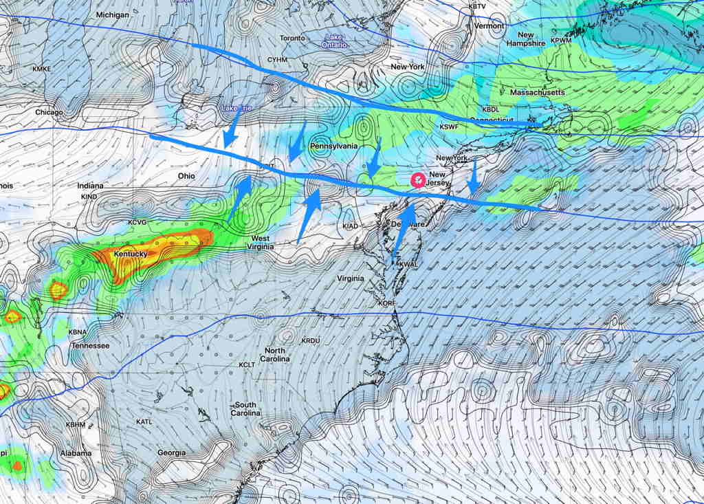
There’s increasing uncertainty about the forecast for Monday through Thursday.  The coastal tropical system may become absorbed by the low pressure system in the Midwest.  The models are having issues resolving where the heaviest rain will fall; some keep the rain substantially away from Philadelphia.

It’s a complex setup which is part of a blocking pattern, a closed upper low/surface low in the Midwest and a semi-tropical low off the SE coast.   Will have to see how it plays out.

WEEKEND WEATHER FORECAST

The surface front moves through about 4AM Saturday morning without upper air support.  A few widely scattered showers are possible before daybreak.

The remnants of the front stalls to our south and the cloudiness breaks for sunshine through high cirrus clouds during the morning Saturday.

Sunday’s weather will depend upon the complex interaction between the developing tropical storm off the southeastern coast and a strong upper and surface low in the Midwest. Much uncertainty for the forecast period late Sunday through Wednesday.

Saturday —

  • Sunny through high cirrus cloudiness, occasional clouds especially in the morning and south of PHL .
  • High temp  77.3° sd 1.5° (NBM)    79.1°   (HRRR)
  • Winds light from the N

Sunday —

  • Sunny in the morning
  • increasing cloudiness after noontime
  • High temp 70.7° sd 3.0° (high spread)
  • Winds light from the SE

SO WHAT HAPPENED TO THE RAIN?

Over many years of being a weather hobbyist and prior to having complete weather data available on the Internet, it was never clear to me what happens when a predicted cold front and its associated thunderstorms “falls apart” before reaching us.

So what happened to today’s cold front and the expected thunderstorms?

Basically, the front lost its “upper air support”.  But what does that mean?

Usually when a strong cold front approaches, the upper air “heights” typically represented by the 500 mb lines  (blue lines on the map below) move southward, meaning a reduction in height and a resulting vertical upward motion in the atmosphere.  This supports rain and thunderstorms.

(500 mb heights are lines of equal height above ground where the pressure is 500 mb.  This is about 18,000 feet or about the “middle of the atmosphere”.    More about this here.)

GFS Saturday 3 AM forecast 500 mb heights  blue lines

That was originally expected to occur.

However, the most recent models today show these 500 mb height lines not moving south but instead, halting and then moving northward after midnight.

This causes sinking motion and downward vertical movement.  Precipitation and thunderstorms can’t form.

That’s what’s happening tonight.

Why did the models get this wrong on previous days?  Nobody knows but there is a strong tropical system off the southeastern coast and it’s been my observation over many years that when tropical systems are present, the models just don’t do that well.