
Over many years of being a weather hobbyist and prior to having complete weather data available on the Internet, it was never clear to me what happens when a predicted cold front and its associated thunderstorms “falls apart” before reaching us.
So what happened to today’s cold front and the expected thunderstorms?
Basically, the front lost its “upper air support”. But what does that mean?
Usually when a strong cold front approaches, the upper air “heights” typically represented by the 500 mb lines (blue lines on the map below) move southward, meaning a reduction in height and a resulting vertical upward motion in the atmosphere. This supports rain and thunderstorms.
(500 mb heights are lines of equal height above ground where the pressure is 500 mb. This is about 18,000 feet or about the “middle of the atmosphere”. More about this here.)
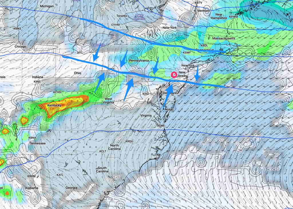
That was originally expected to occur.
However, the most recent models today show these 500 mb height lines not moving south but instead, halting and then moving northward after midnight.
This causes sinking motion and downward vertical movement. Precipitation and thunderstorms can’t form.
That’s what’s happening tonight.
Why did the models get this wrong on previous days? Nobody knows but there is a strong tropical system off the southeastern coast and it’s been my observation over many years that when tropical systems are present, the models just don’t do that well.