WEEKEND WEATHER FORECAST

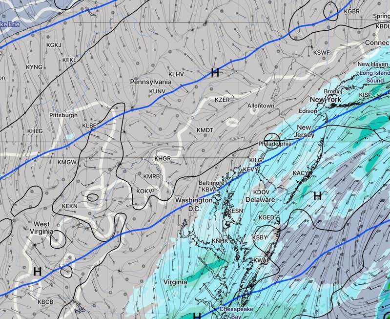
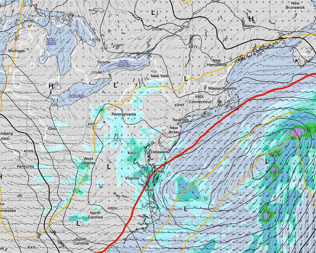
Saturday will not be clear and bright, despite the main low missing us.

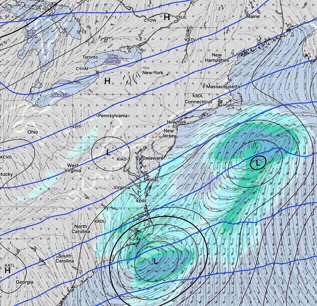
For Saturday,  several weak upper air disturbances along with a strong upper cyclonic flow combined with low level moisture from the main low will bring cloudy conditions and possible spotty light drizzle during the day on Saturday.

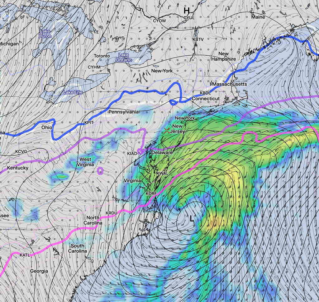
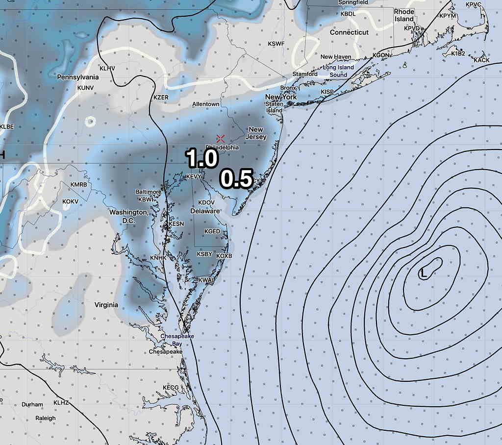
While the models don’t crank out any measurable rain, simulated radar from several models show the possibility of spotty light drizzle.

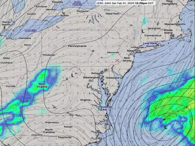
Here’s the latest GFS model Simulated Radar.  Note that the color codes imply a much heavier precipitation than will actually fall.  This drizzle may not be measurable in a rain gauge.)

GFS Simulated Radar for Saturday. (Color coding over-states the amount of rain.)

High 45º on Saturday.

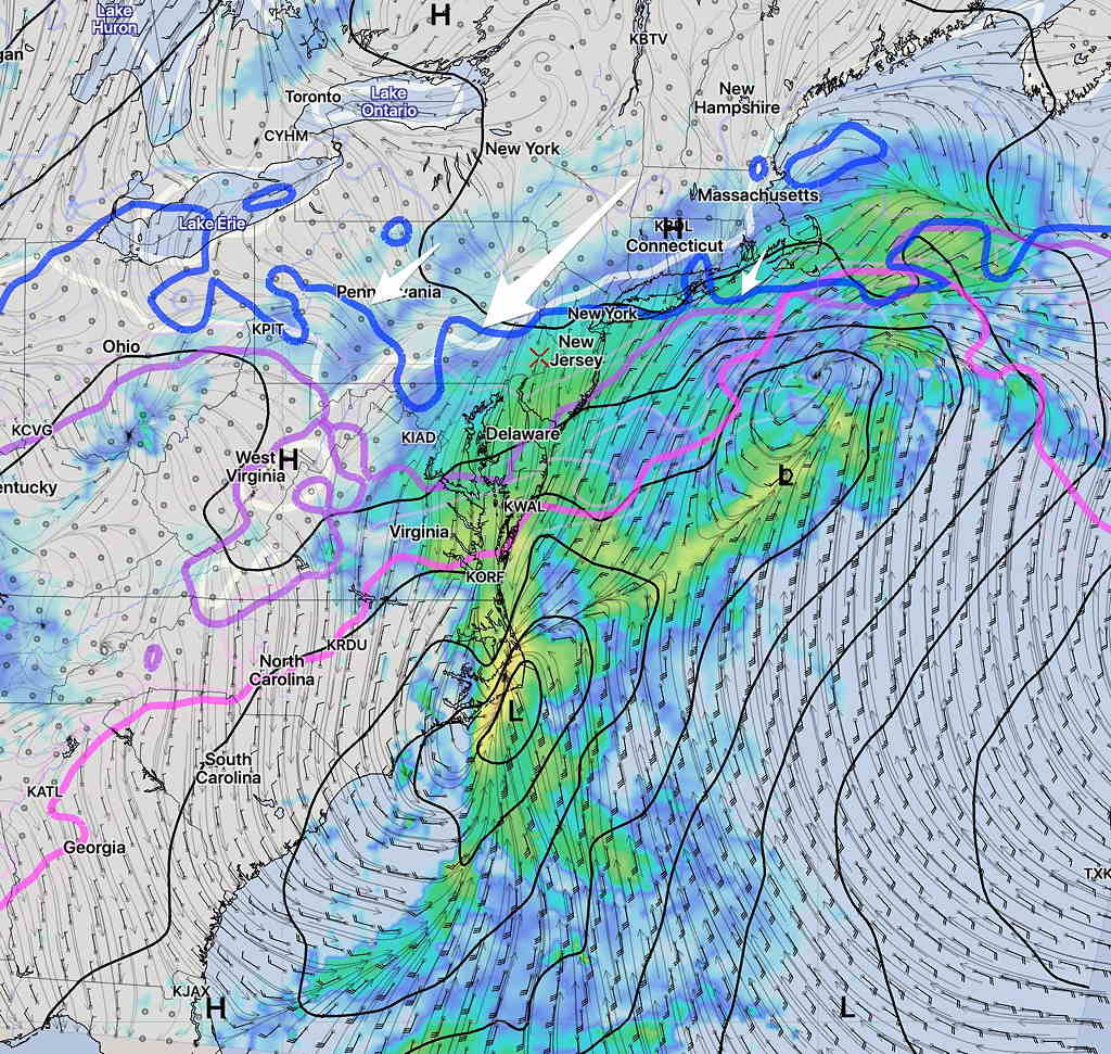
For Sunday:  The models suggest the possibility of a scattered light snow flurry near daybreak Sunday.  Otherwise, a mix of clouds and sun on Sunday.  High 47º.

WEEKEND WEATHER OUTLOOK

Updated Thur 10:40 PM —Adding tonight’s  high resolution model (HIRESW-ARW MEM2) which has light showers 3 AM Saturday:

HIRESW ARW MEM2 precip 3AM Saturday

…earlier Thursday night—
So the Saturday coastal low forecast I’ve been watching this week has become a non-event, as the development is less organized than previously modeled and its track and speed keep it from affecting our area.  Here’s the latest GFS forecast for 6 AM Saturday—

GFS forecast Saturday 6AM

It looks like we’ll have just clouds which may thin during the afternoon. High 48.

Sunday looks to have periods of clouds as well as some sun. High 50.


SATURDAY SNOW (?) UPDATE

Updated Wed 07:40PM — Today’s models continue with the idea that some light rain may graze us early Saturday morning.  No snow.

GFS Simulated Radar 8AM Saturday

The NAM has backed off of last night’s snow forecast and shows only light rain showers possible before daybreak Saturday into Saturday morning.

NAM simulated radar forecast for 3 AM Saturday morning. Critical temp lines (blue) for snow too far north (arrows)

What’s fascinating about this weather event is how far apart different models are with the development and location of the low pressure system at this point in time.  Here’s the Canadian Global model:

Canadian Global Precipitation forecast Saturday 8 AM

…from Wednesday morning—

So, things seemed very clear last night with the forecast for Saturday.  Most of the models had the storm well east and south of us, barely affecting us. The Canadian and ECMWF are still south and east, with no precip here.

That’s also still true of the GFS and GEFS, but not so clear cut with the  higher resolution NAM that has just come into forecast range (84 hours is the max forecast horizon for the NAM).

The NAM runs from last night and early morning have the storm side-swiping our area with a coating to an inch of snow early Saturday morning:

NAM snow depth forecast 10 AM Saturday

The German ICON ensemble model has a somewhat similar snow depth of less than an inch further west:

ICON Ensemble Model snow depth forecast Saturday

The GFS, showing no snow,  has done the best this year.   I’ll keep an eye on it.