
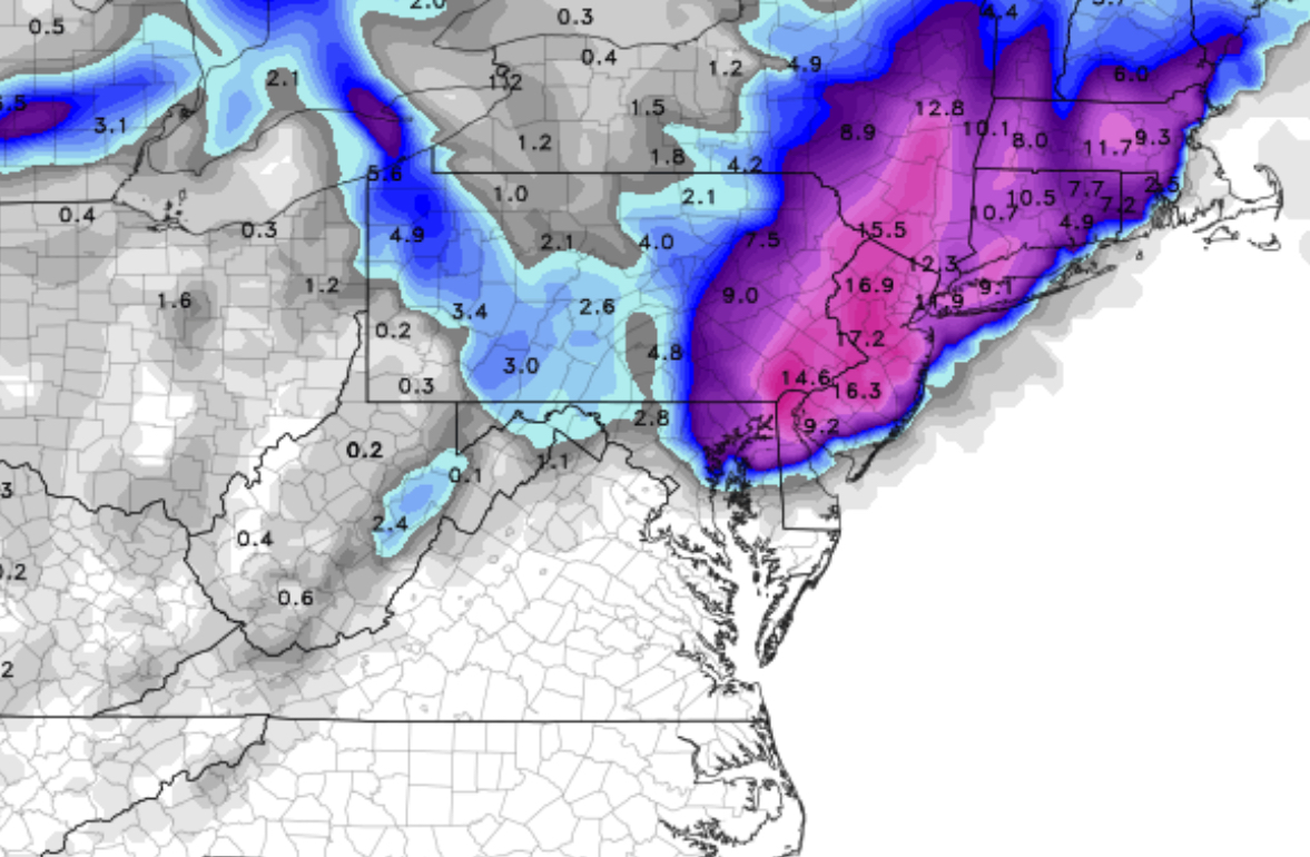
The tonight’s NAM model data is becoming available. Here are the trends:
Higher QPF values- precipitation falling as water has increased significantly to 1.80 inches water, in some areas, over 2.0 inches water!
The predicted vertical thermal profile is much COLDER; indeed, critical “thickness levels” and temperatures now support snow into New Jersey where previously it was thought to be mostly rain or rain mix.
With these changes, there’s been a significant increase in predicted snow totals! Here are the NAM 10:1 snow totals by area:
There are other algorithms that try to take into account other factors such as melting. One is called the Kuchera Snow Algorithm.
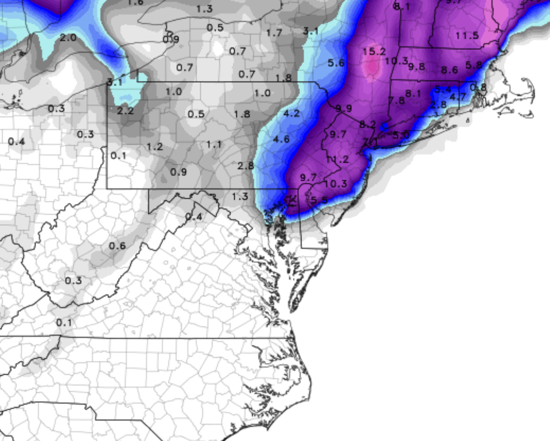
I don’t generally find the predefined snow algorithms that useful or accurate. I believe the 10:1 simple algorithm will do best here and may understate snowfall at times. An average of the two might also prove correct for this storm.
The reason I’m presenting both predefined snow algorithms is to show that significant snowfall is now expected in Philadelphia, NJ as well as in PA.
[su_note note_color=”#ebf2d9″]So we’re looking at 9-17 inches of snow, based on your location, as shown on the above maps.[/su_note]
Timing: Precipitation as rain is starting as scheduled (9PM) and will mix with and turn to snow by 1-2 AM in western sections and a bit later along the I-95 corridor. Heaviest snow during the morning and afternoon hours on Wednesday, ending about 7PM or so.
Temperatures are expected to fall to about 32-33 degrees by 2-3 AM with dynamic cooling that will occur with heavier precipitation on Wednesday
Winds will be 15 to 20 mph with gusts near 25 during the day on Wednesday.
The GFS model data becomes available about 10:45 PM. I expect the GFS QPF values to be less than the NAM values; it always is. I still think we’re talking about a major snowstorm for Philadelphia and the immediate areas. This is a high confidence forecast.
I’ll amend this post with the GFS data if it presents a problem with this forecast.
[su_note note_color=”#ebf2d9″]10:45 PM – Tonight’s GFS model data is similar to the NAM. QPF values 1.43 inches water with distribution of precipitation maximum centered around I95, similar to the NAM. I believe the NAM 10:1 snowfall map above is a good estimate. [/su_note]