PHILLY WEEKEND WEATHER FORECAST

After all the time needed to forecast the past two storms, it’s nice to have a quiet weekend weather-wise.

High pressure builds in for the weekend bringing sunny skies for Saturday and cold temperatures. Still a bit windy. High 46.

The same high pressure will suppress low pressure to our south on Sunday. Sunday will be mostly sunny, but some mid level clouds may move in during the afternoon as a disturbance moves to our south . High 47.

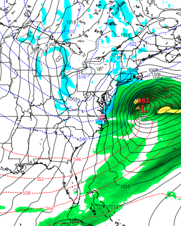
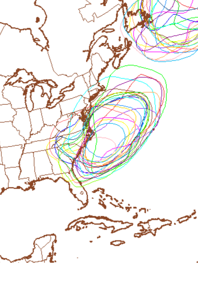
It currently appears that low pressure will remain to our south on Monday, although the GFS is still having difficulty resolving the evolution and path of the low pressure system on Monday.  I’ll keep an eye on it.

[su_note note_color=”#ebf2d9″]Fri 11pm:  Tonight’s GFS is still trying to spin up a deep low pressure system Monday night, that still misses us .  Something is going on. We’ll need to keep an eye on this. [/su_note]

Monday evening GFS


PHILLY WEATHER UPDATE FOR MONDAY

Here’s an update on the storm potential for Monday.  Latest trend continues to keep the storm to our south, missing Philadelphia. Even the GFS has joined in the other models with this trend.  That said, the NAM moves the storm closer to us then last night’s run, still missing us.

There’s still a possibility that things may still change,  The statistical version captures the uncertainty of this forecast —

GFS Ensemble
Spaghetti Diagram 1008 millibar GFS Ensemble Monday— each color represents a possible position and contour of the low pressure system on Monday.  This is quite a “spread”.


What is becoming apparent that for next week, we’re entering a hopefully short period of below average temperatures.

I’ll post my regular Philly weekend weather forecast later this evening.