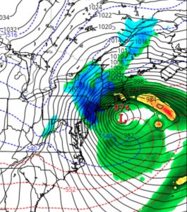
The snow totals exceeded everyone’s expectations, including my own. So what happened?
I can only speak for myself— I was very reluctant to predict snow totals based only on the raw model numbers for a storm in March. Indeed, I felt I over-estimated last night when I said 2-4 inches and reneged this morning.
But if I had gone by the raw model numbers, the forecast would have been more on target. So I can’t say the models got it wrong, except for perhaps surface temperatures, which showed to be colder than forecast. They apparently didn’t get the ‘dynamic cooling’ factored in at the surface.
Indeed, as said in my blog post yesterday, if this had been a storm in January, I would have predicted 7+ inches. But, I felt that warm surface temperatures and radiant energy through clouds would severely reduce accumulations and over-ride the raw numbers.
But the raw model numbers (at least based on the NAM FOUS) had enough QPF and low enough temperatures to account for what we have received. So the models did well, based on my usual criteria. I just didn’t trust it explicitly for the forecast.
I use the NAM FOUS data, an odd, tabular set of numbers that often provides everything I need for a good snow forecast; I rarely use the preconfigured snow totals of some of the model outputs.
BTW, the NAM from this afternoon shows snow ending shortly after 7PM, although current radar would suggest otherwise. We’ll see.

