#weather #paweather #wx #pawx #philadelphia #phillywx
Thunderstorm Update
Update Sun 7/02 11:05 PM — A quick late update. Tonight’s NAM-NEST and HRRR have some thunderstorms moving through Philadelphia about 1-2 AM. This is a change from earlier models.
Additionally, storms expected Monday afternoon and evening. Another change — Tuesday may also have storms, as the cold front hangs up near here. Updates tomorrow.
Thunderstorm Update
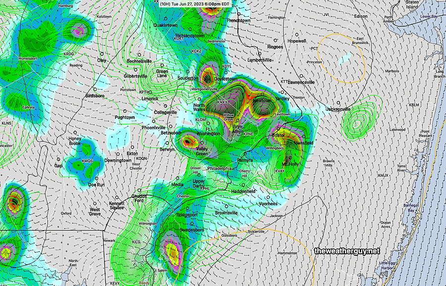
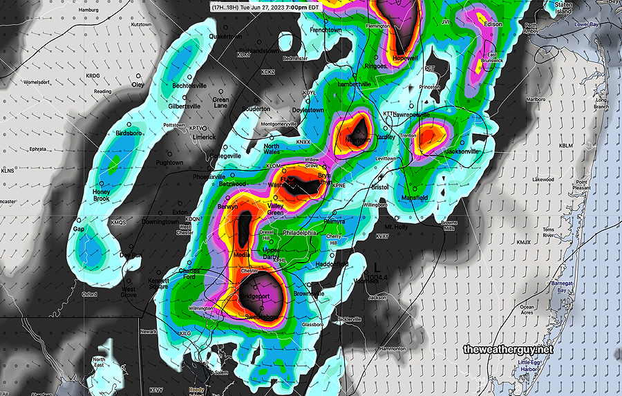
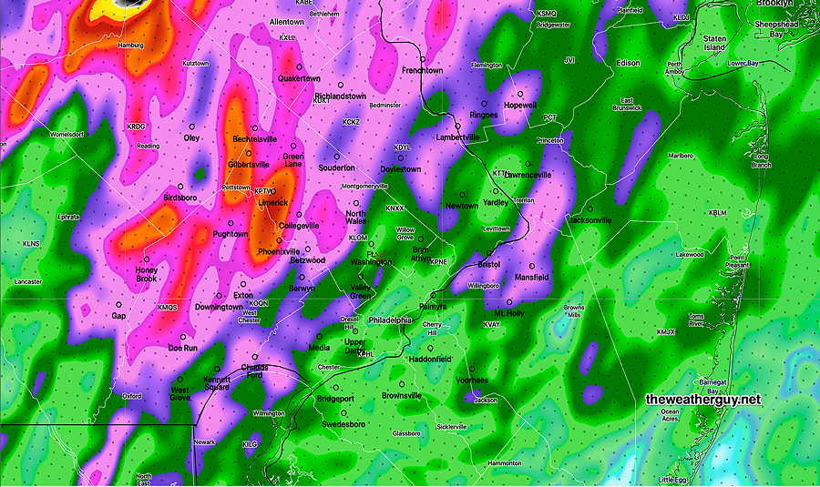
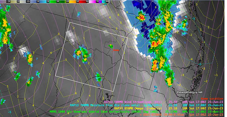
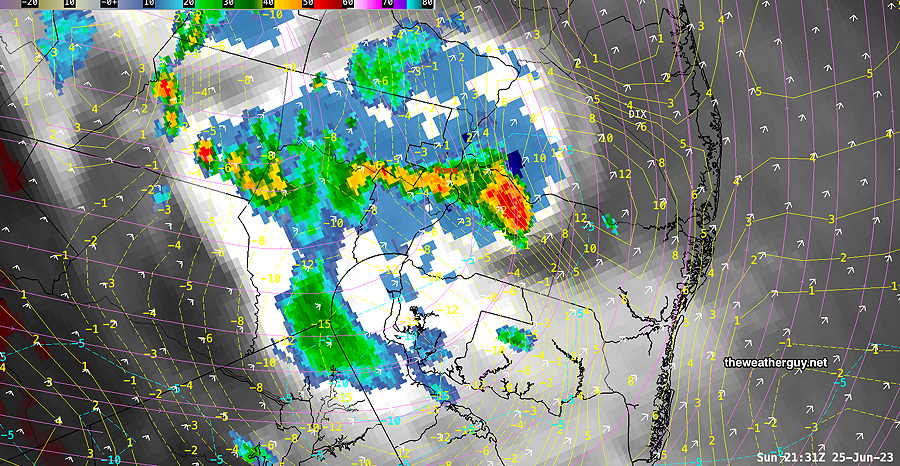
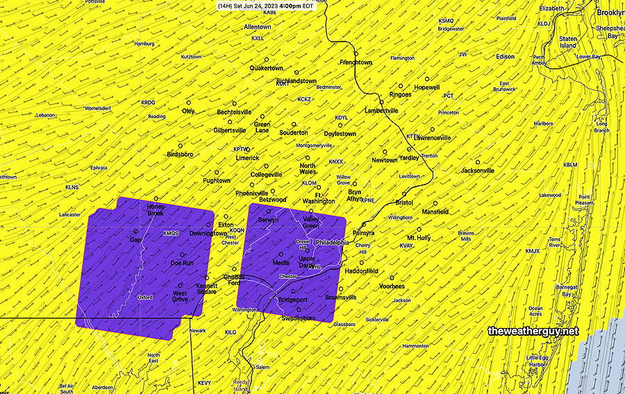
Updated Sun 07/02 @ 7:42 PM — The TV meteorologists are doing a fine job this evening covering the severe weather outbreak in far western suburbs. Here’s a recent radar with the few severe storms that have developed—
As has been the case both last night and again this afternoon, the models do not have the storms above coalescing into a line that will enter Philadelphia.
On the contrary, the HRRR model runs, supported by the Canadian models, have forecast that these storms will move to our north and to our south this evening, largely missing the immediate Philadelphia area.
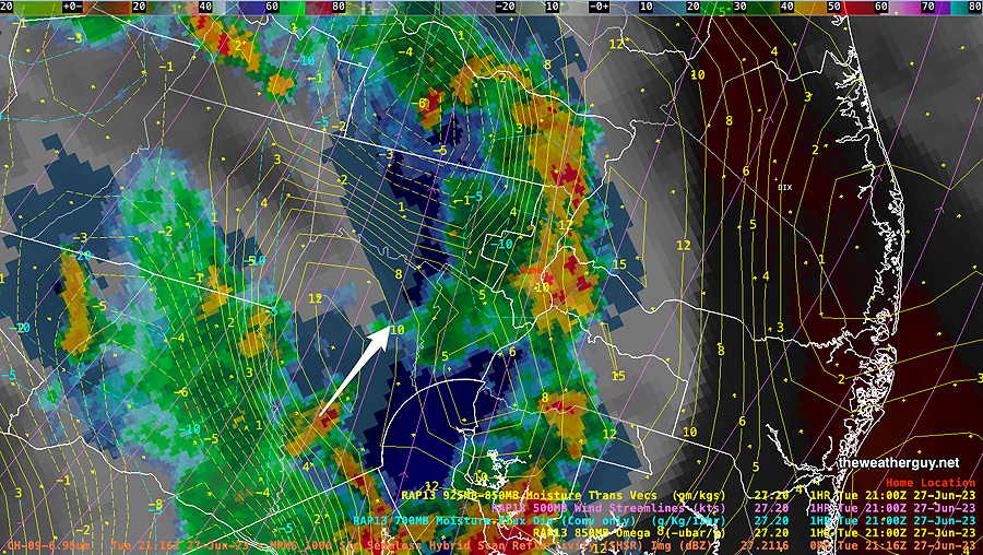
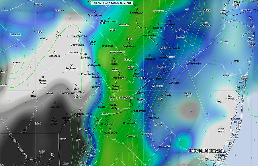
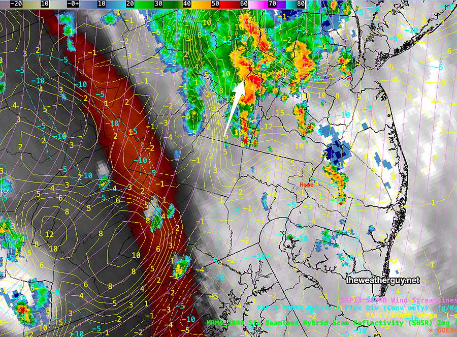
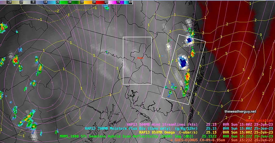
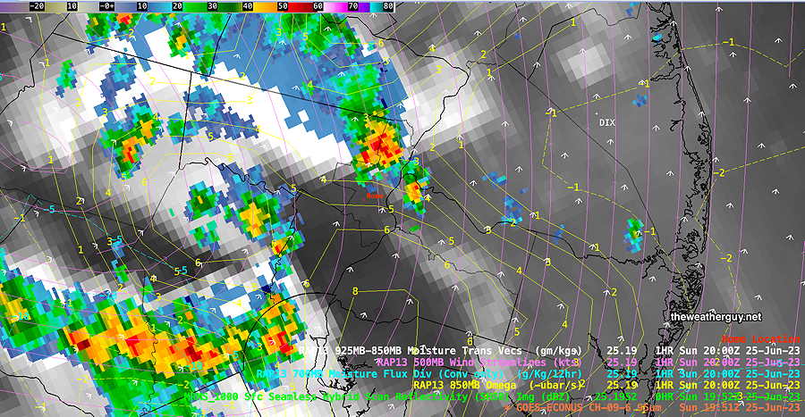
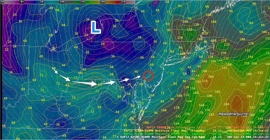
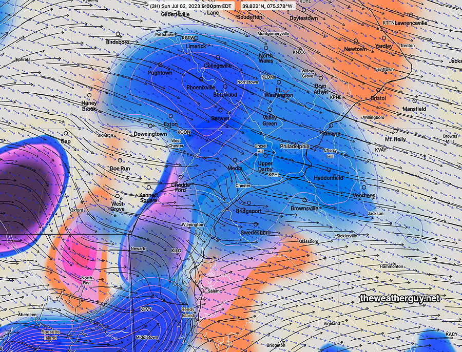
The reason for the storms not entering Philadelphia— a strong area of negative vorticity (sinking motion) will be over Philadelphia, dampening out the storms—
We never know in advance if the models are correct about exact placement of severe weather, but that’s the current model forecast. And I imagine that’s why you visit this blog.
Live Thunderstorm Blog 07-02-23
Sunday Thunderstorm Outlook
Updated Sun 07/02 @ 9:26 AM — As forecast last night, the heavy showers and thunderstorms last night stayed far northwest of the city, with most areas in the Delaware Valley getting 0-0.02″ of sprinkles.
Last night’s early models had today’s potential storms strangely bypassing the immediate Philadelphia area, but the 06z models now show Philadelphia in the path of some strong storms today.
The latest HRRR and RAP model runs have just become available (12z runs) and show thunderstorms developing in place and moving in between 4:30 PM and 8 PM. Peak is 6-7 PM.
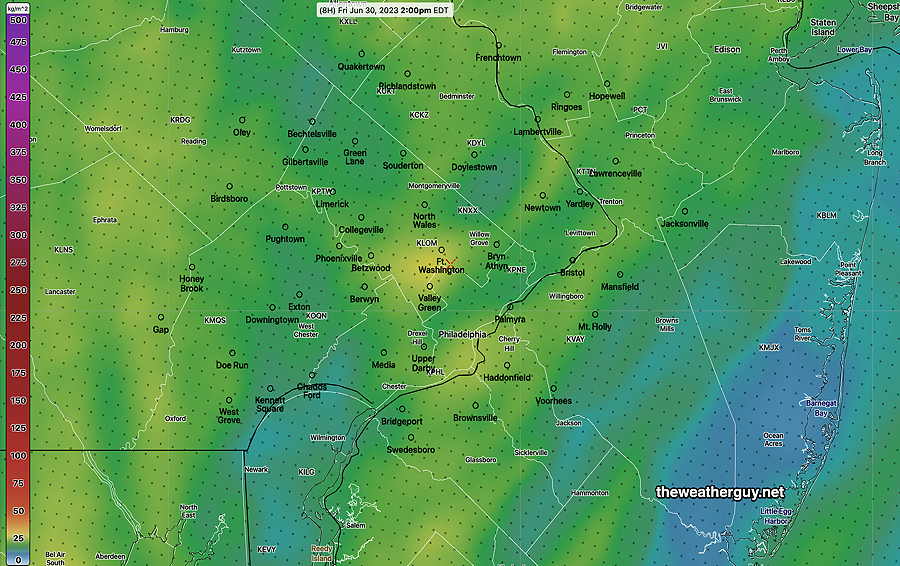
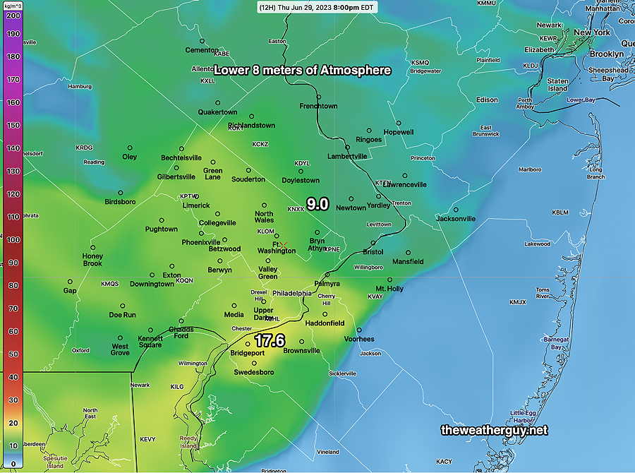
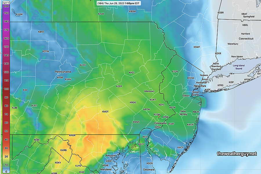
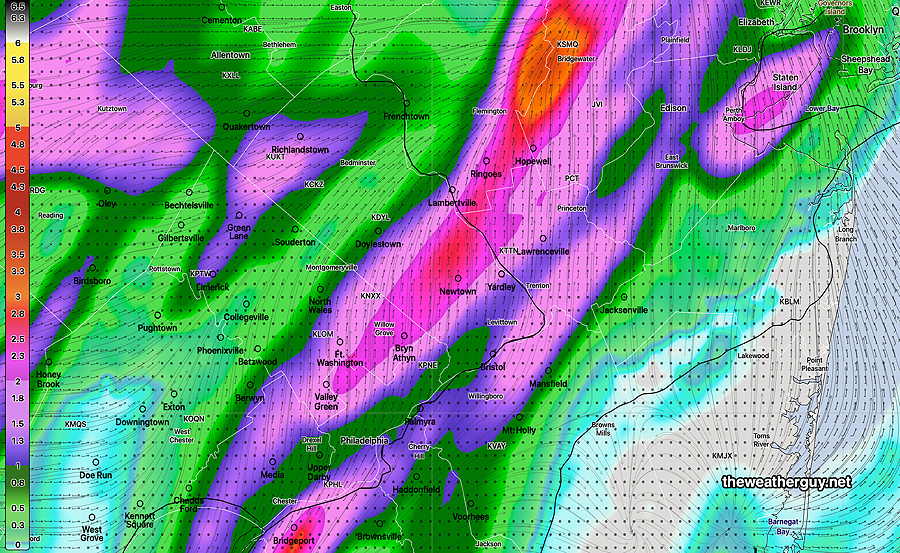
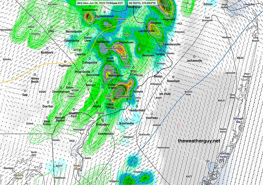
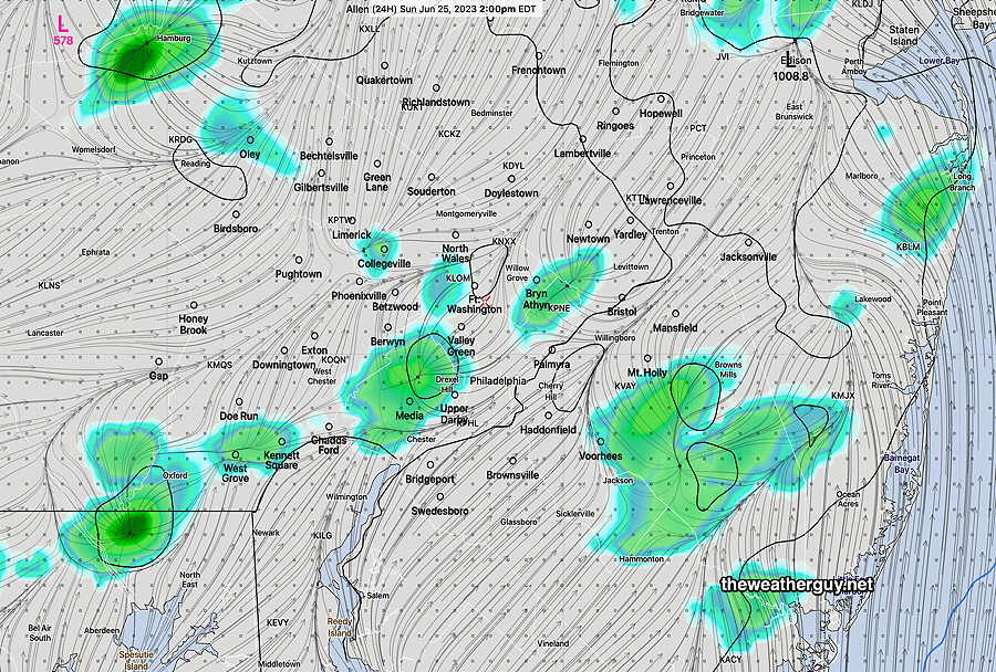
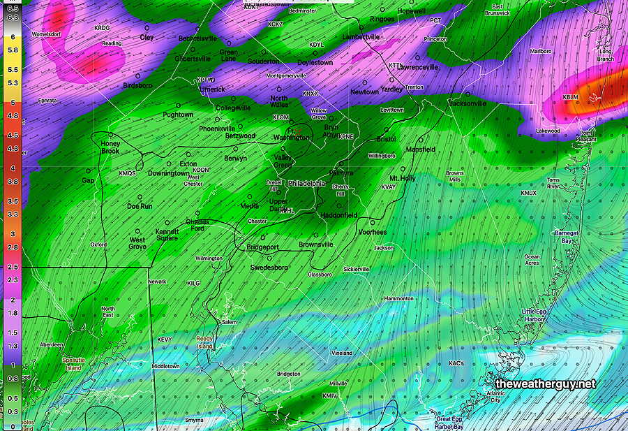
Despite very high “precipitable water” (PWAT ) of over 2 inches, the models are placing heavy rain accumulation north of the city. Here’s the forecast total precipitation, which is low considering the PWAT, suggesting that the storms won’t linger—
Comparing today’s forecast severity parameters to recent severe events, the potential severe storms with damaging winds today is high—
Today’s HRRR Forecast Severity Table—
| Sept 1 , 2021 Tornado Outbreak (example of highly severe) | Recent April 1st 2023 Tornadoes (Example of severe) | Today’s 12z HRRR Forecast | Today’s Impact | Today‘s Notes | |
| CAPE Joules/kg | 3500-4200 | 2100 | 2500-3204 | ⚑⚑ | |
| Helicity m^2/s^2 (tornados) | 1350 | 655 | 208 (420) | ↔ ⚐ | High southern Chester County |
| Vertical Shear 1/sec | 40-46 | 40-45 | 18 | ↓ ↓ | |
| Precipitable Water | 2.7″ | 0.83” | 2.1″ | ⚑⚑ | |
| Lifted Index º K | minus 6º | minus 9.3º | minus 6.2º | ⚐ | average |
| HRRR Hail inches | 1.9 | 1.4 | 1.6 | ⚑⚑ | |
| Thunderstorm Echo Tops | 46,000 ft | 32,000 ft | 45,000 ft | ⚑⚑ | very high |
| Peak Wind Gusts mph | 40-50 | 40-50 | 55 | ⚑⚑ | |
| Storm Motion Shear Vector Alignment | Aligned – ~ 90º | Almost aligned | aligned-curved direction | ⚑ | |
| 250 mb Jet Stream Wind mph | 63 | 135 | 46 | ↓ |
↓ indicates works against Severity ⇩ Significant, but less impact
Sunday Update
Updated Sat 7/01 10:40 PM — With the backdrop of having had a cluster of storms move through Cape May County this morning, unpredicted by any model, I’m going to attempt to forecast the showers and storms expected on Sunday.
A warm front will move through the area tonight into Sunday morning with showers and thunderstorms. Most likely time is from 2 AM to 5 AM. The models are keeping the storms mostly far northwest of the city, although some may make it in here.
Sunday morning will start cloudy, but sunshine should break through high thin clouds by noon.
The warm front hangs near us on Sunday. High moisture and instability will cause more storms to develop late afternoon and evening, with increased chances between 4 PM – 10 PM. Strangely, tonight’s models have most of the activity moving northwest and south of the city, somewhat missing the immediate Philadelphia area.
It’s always difficult to know if the model placement of the storms will be accurate.
Updated Sat 07/01 @ 9:25 AM — According to models, the clouds over us this morning should dissipate by noon. The slowly approaching warm front seems to be moving a bit faster than forecast yesterday. Some thunderstorm activity expected moving into Philadelphia as early as 8 PM this evening (HRDPS) but the latest HRRR keeps it moving in until after midnight.
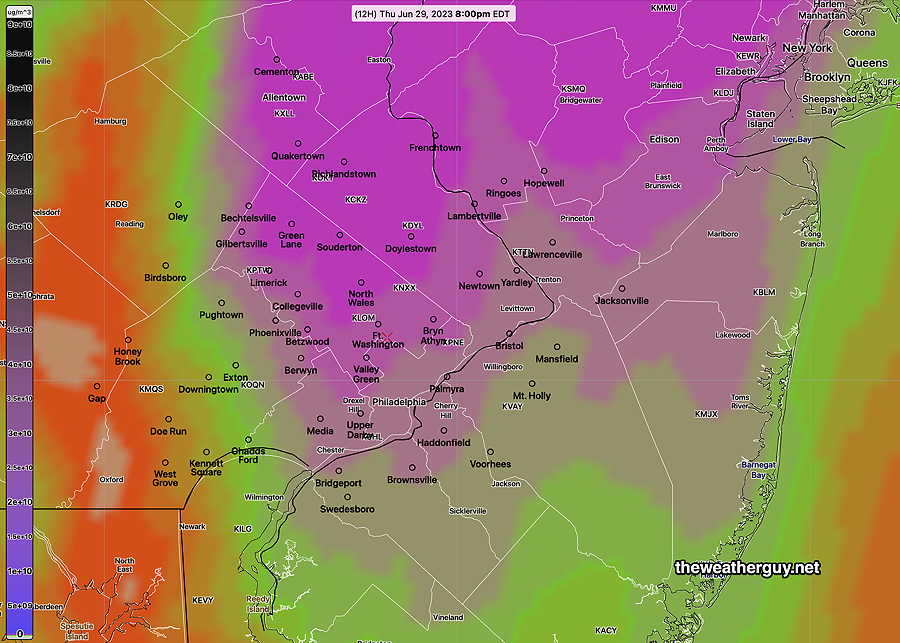
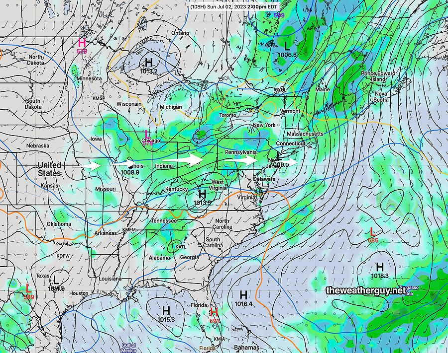
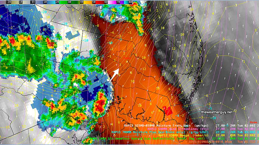
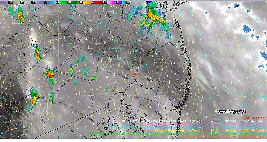
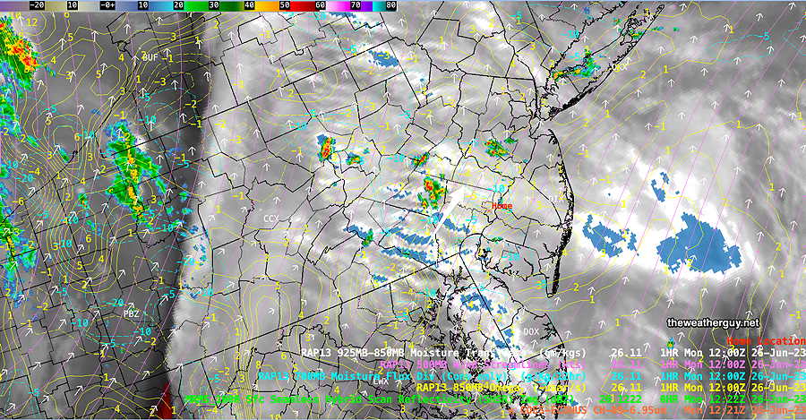
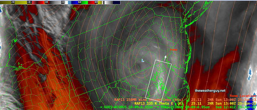
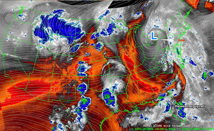
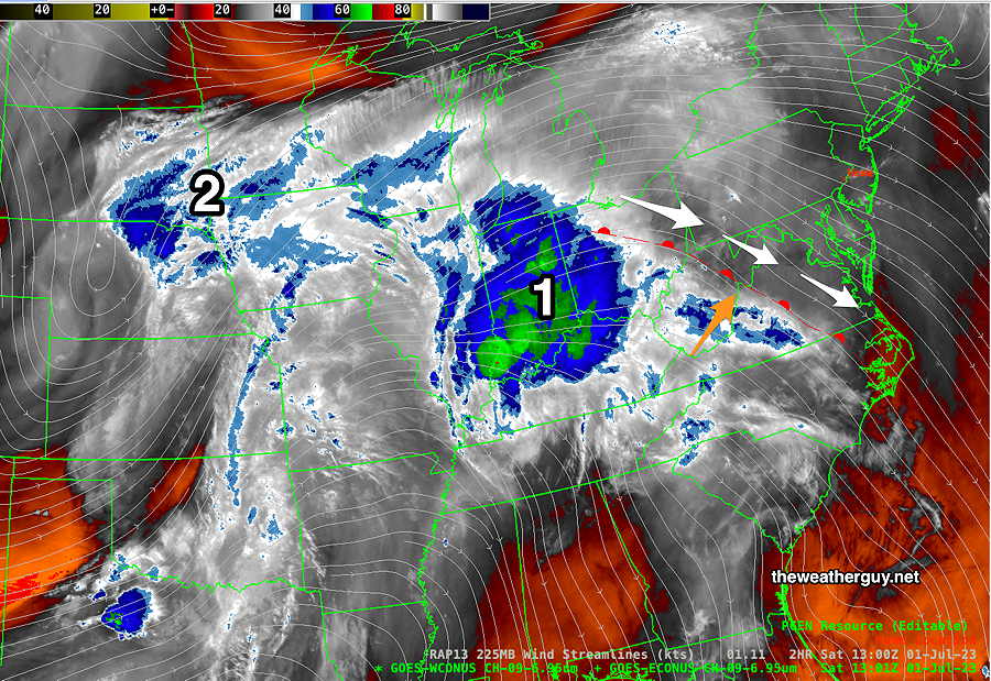
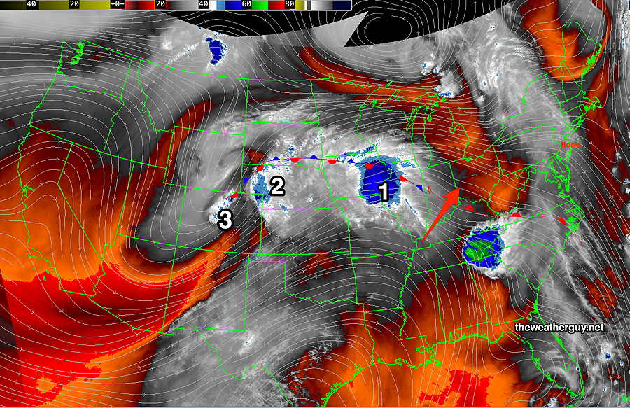
This morning’s water vapor image with superimposed RAP model jet stream level wind streamlines. I’ve drawn the warm front in —
Some “interesting” weather expected Sunday.
Updated Fri 6/30 @9:41 PM — I’ve revised the Sunday forecast below
Previously Posted Fri 8:19 PM —
A stationary boundary running generally west-east to our south will move north as a warm front Saturday night into Sunday morning. The exact timing varies from model to model, but somewhere between daybreak and noon on Sunday is the general trend, although some models have it hanging up in our area. —
Before the warm front, showers develop, but all the models keep the showers and thunderstorms from moving eastward during the daytime on Saturday . Western Chester county and areas west may see some showers and thunderstorms Saturday evening.
Saturday
Partly to mostly sunny through mostly high clouds most of the day but a few hours of cloudiness possible early afternoon in some locations. Becoming windy during the afternoon.
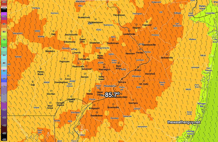
High temperature 85 – 86º ( NBM model— location Blue Bell, PA )
Showers and thunderstorms develop near Philadelphia after midnight Saturday into Sunday morning.
Sunday
Showers and some thunderstorms before daybreak and into the morning, depending upon the movement of the warm front. Some models have the warm front stalling near us. The NAM-NEST has the warm front stalling with a line of thunderstorms, possibly strong, moving through midafternoon.
The latest NBM has showers and thunderstorms in the afternoon as well, so there’s higher than usual uncertainty with the Sunday forecast.
High temperature 83 -85 º ( NBM model— location Blue Bell, PA)
A cold front comes through later Monday with showers and thunderstorms.
Tuesday, the 4th of July, looks very nice.