#weather #paweather #wx #pawx #philadelphia #phillywx
Sunday Forecast Update
Update Sun 06/18 @ 9:42 AM — Last night’s models have sunny skies for today, so I’m going to drop the cloud forecast for the 3-6 PM time frame.
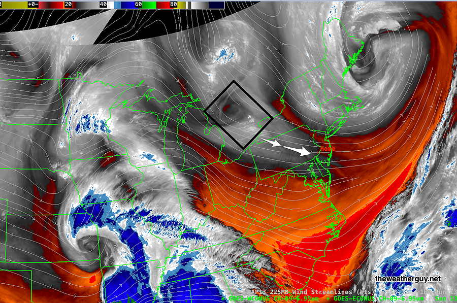
There is an upper air disturbance just northwest of Pennsylvania that doesn’t appear to be captured by last night’s models—

Some cloudiness with this disturbance is expected this evening after 6 PM, mostly north of the city.
Sunday Forecast Update
Update Sat 6/17 10:36 PM — Tonight’s high resolution models show some similarity to today’s which correctly predicted the periods of cloudiness and the few pop up showers we had. (One missing ingredient tomorrow is a strong jet streak.)
So despite the model cloud algorithms again have little to no clouds for us on Sunday, I’m thinking that an increase in cloudiness with some isolated showers is a possibility, especially areas north of Philadelphia. Most likely time frame is 3-6 PM. Not a high confidence forecast with this change.
Update Sat 6/17 10:56 AM — Mobile quick update. This morning’s high resolution models show more clouds and pop up showers today than previously forecast.
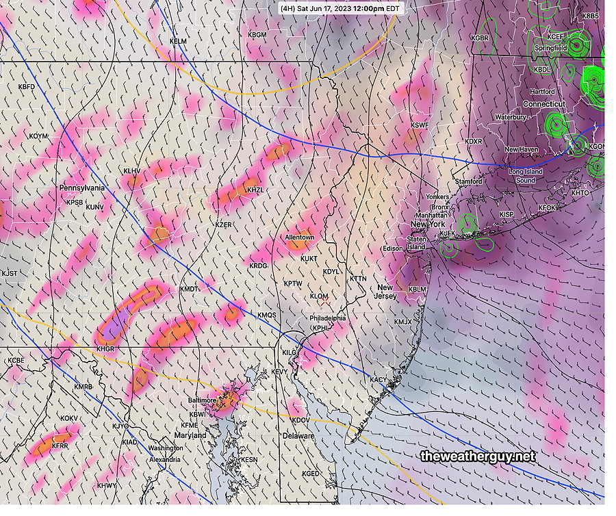
Update Sat 06/17 @ 9:27 AM — There’s a bit more hazy/sunshine cloudiness than forecast by the models right now. A new download of the HRRR shows some potential hazy sunshine/cloudiness through the day. Not captured by the models’ built-in cloud algorithms—

Here’s the same with superimposed vertical motion—

Ordinarily, the built-in cloud algorithms for the HRRR and RAP tend to overstate cloudiness. Interestingly, when there’s strong cyclonic upper flow, they tend to understate it. The above shows relative humidity fields at different levels of the atmosphere above 50-60%. Combined with areas of vertical motion, we get some cloudiness and maybe some sprinkles.
Update Sat 6/17 8:42 AM — Looking at last night’s models, I’m returning to a modified original forecast for Saturday: Some instability cloudiness possible, but mostly sunny. An isolated sprinkle possible, mainly north of our area, remains a possibility. Becoming WINDY around noontime.
Update Fri 6/16 10:52 PM — Tonight’s models show no clouds or showers on Saturday. Sunny, but windy.
Previously Posted Fri 5:14 PM —
Rainfall totals for Friday were posted here.
Some showers now in central PA may make it into the western suburbs later this evening, but are forecast to dissipate before reaching the city.
High pressure builds in for the weekend, but the upper air cyclonic flow will be with us on Saturday and significantly less on Sunday. (The re-established Omega block across the continent will keep us in some degree of upper air cyclonic flow until Wednesday or Thursday.)
Saturday
The upper air cyclonic flow keep things somewhat cooler than an average June day. Some instability cloudiness possible, but mostly sunny. A widely scattered sprinkle after 4 PM, mainly far north of our area, remains a possibility. Few areas will see them.
It it will be breezy to almost WINDY.

High temperature 79.6º sd 1.7º ( NBM model— location Blue Bell, PA)
Sunday
High pressure at the surface. Mostly sunny
High temperature 82.6º sd 0.7º ( NBM model— location Blue Bell, PA)
