#weather #paweather #wx #pawx #philadelphia #phillywx
Friday Forecast Update
Updated Fri 08/04 @ 2:11 PM — I’ve delayed this update to allow time for clarification regarding the line of storms expected with the cold front passage this evening.
There’s still a wide range of forecasts, with some models having the line of showers/storms move through between 6 and 9 PM while other forecast guidance has the storms closer to 9 PM to midnight.
Most, but not all, models have the storms losing upper level support causing them to weaken considerably as they approach Philadelphia.
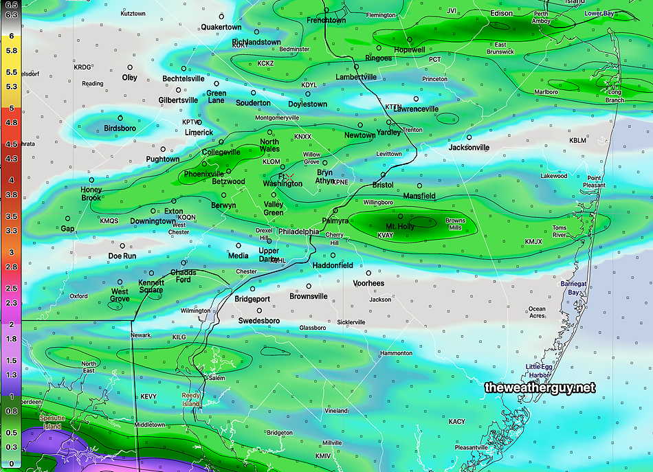
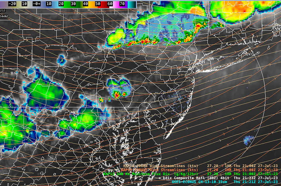
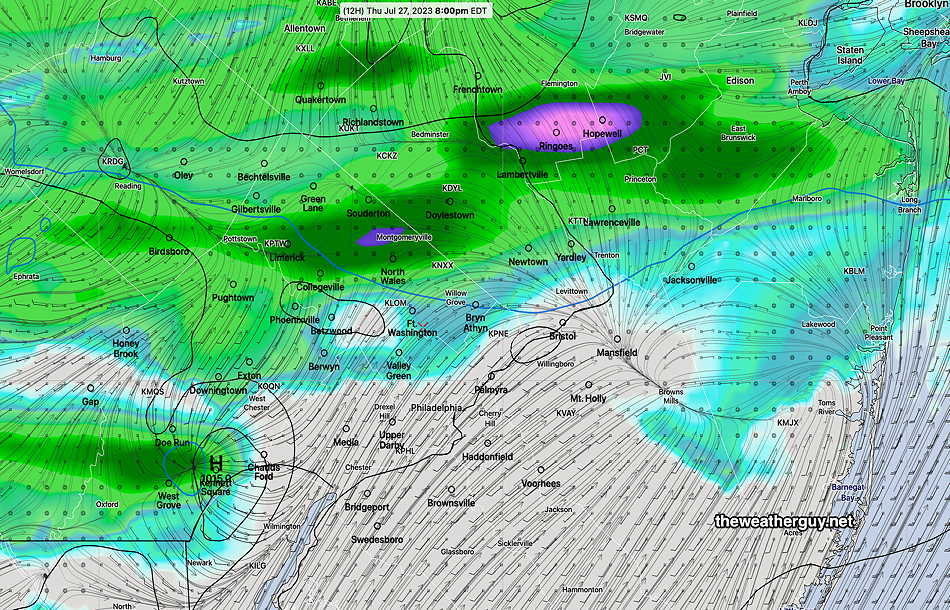
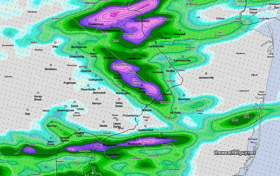
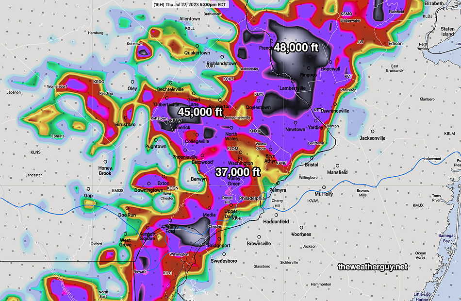
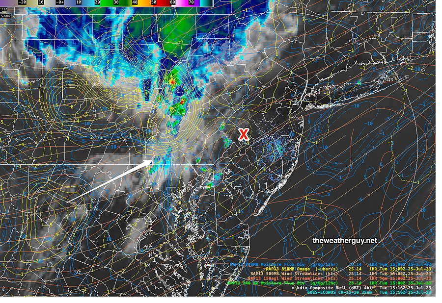
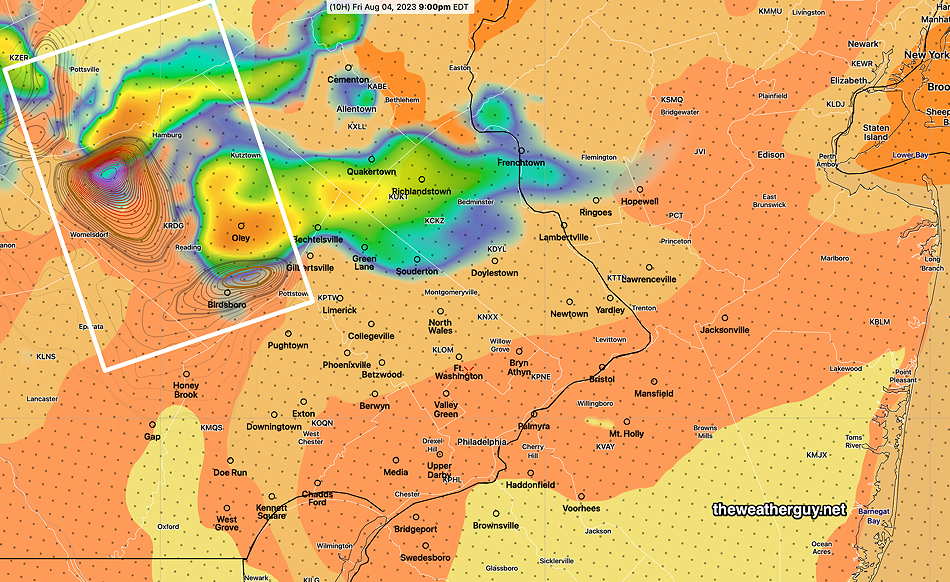
The latest HRRR continues with that scenario, but does have some potentially severe storms in Lehigh Berks counties and upper Bucks/Montgomery counties. Those storms weaken considerably as they move southeastward towards Philadelphia.
Here’s the 15z HRRR showing elevated CAPE and highly elevated helicity in Berks county.
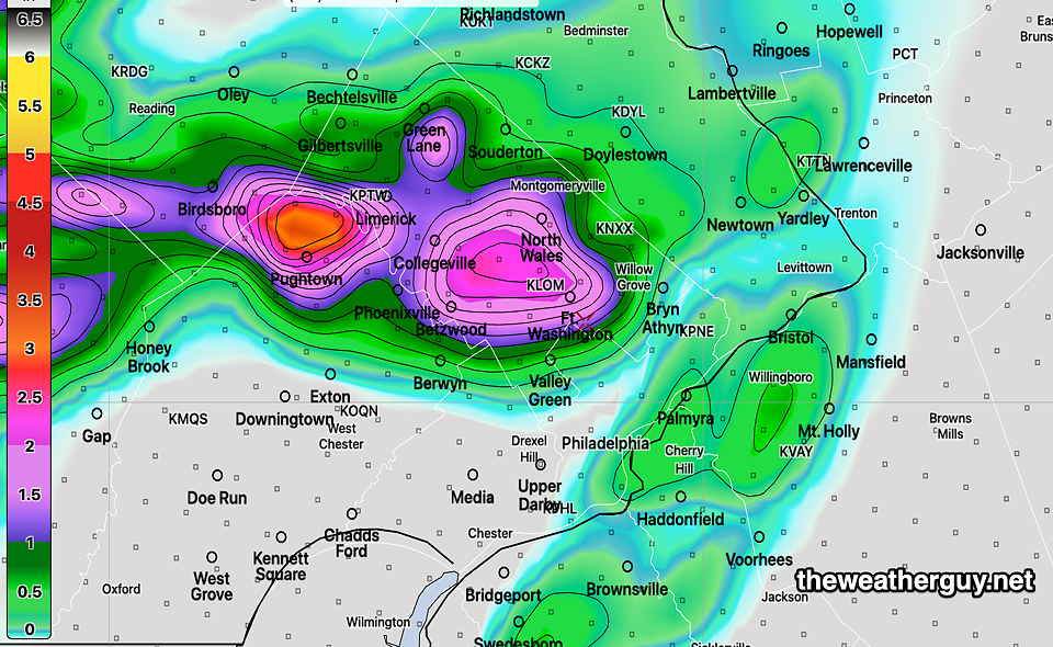
The latest HRRR has a later arrival of any showers/storms here, between 9 PM and midnight—
We’ll see some sunshine break through this afternoon. The more sunshine, the more energy for storms.
As for Saturday, the forecast promise of a perfect weekend is not all that clear. Several models are showing considerable cloudiness lingering on Saturday as low pressure develops on the stalled front near Virginia. More details later this evening.
Friday Forecast
Update Thu 8/03 10:01 PM — Tonight’s models show any shower or thunderstorm activity tomorrow to be unimpressive, especially as they approach Philadelphia tomorrow evening. It appears they will lose their upper air support and weaken as they approach the city.
Updated Thu 08/03 @ 5:47 PM — There’s some uncertainty around the forecast for tonight and Friday. The HRRR and HRDPS both show clouds early Friday morning breaking for sunshine by noon. Then a fast moving cold front moves through between 7 and 10 PM Friday evening with showers and thunderstorms, some strong.
On the far other end of the spectrum is the latest NAM-NEST which shows considerable shower activity this evening and tonight into Friday morning. The NAM-NEST continues with the showers into the afternoon and has little in the way of sunshine. I’m going to downplay this NAM-NEST forecast for now and go with the drier HRRR/HRDPS forecast for the daytime Friday.
Some strong storms possible Friday evening with the cold front. Stay tuned.
Thursday Update
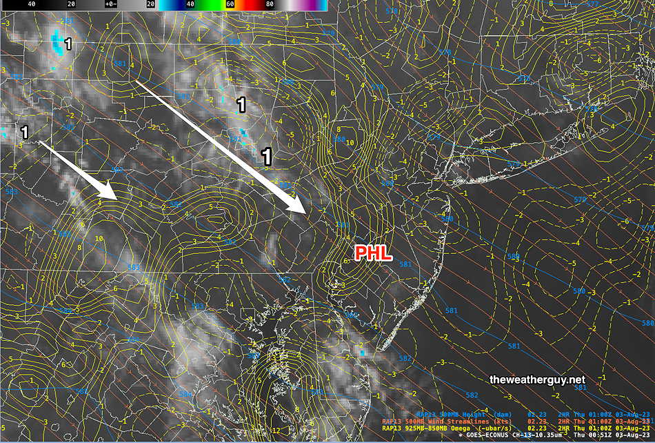
Updated Thu 08/03 @ 9:31 AM — Most of our NCEP models continue to keep us dry during the daytime today (Thursday). but notably, the ECMWF, RGEM and HRDPS forecast some light scattered shower activity in the afternoon. To try to determine which is correct, let’s see if there’s any satellite imagery that supports showers—
I’m now leaning towards some widely scattered shower activity in the early afternoon. Most areas won’t have any showers.
Thursday Outlook
Update Wed 8/02 10:59 PM — After reviewing tonight’s early models, my earlier forecast still holds.
So mostly sunny, a few periods of cloudiness. During the afternoon, a few isolated showers west of the city, but most areas dry. More scattered showers possible in the evening, again mainly west of the city.
Updated Wed 08/02 @ 5:23 PM — The previously forecast warm front isn’t looking that impressive for Thursday, yet some models are cranking out periods of sun and clouds and very widely scattered showers on Thursday afternoon and evening. Most of the showers are forecast to be light and west of Philadelphia, but we’ve seen that forecast accuracy of location of precip is less than stellar.
So mostly sunny, a few periods of cloudiness. During the afternoon, a few isolated showers mostly west of the city, but most areas dry. More scattered showers possible in the evening, again mainly west of the city.
A weak warm front will cause some of these showers, but it will be enhanced by a rather strong jet streak.
Read more: THIS WEEK’S WEATHER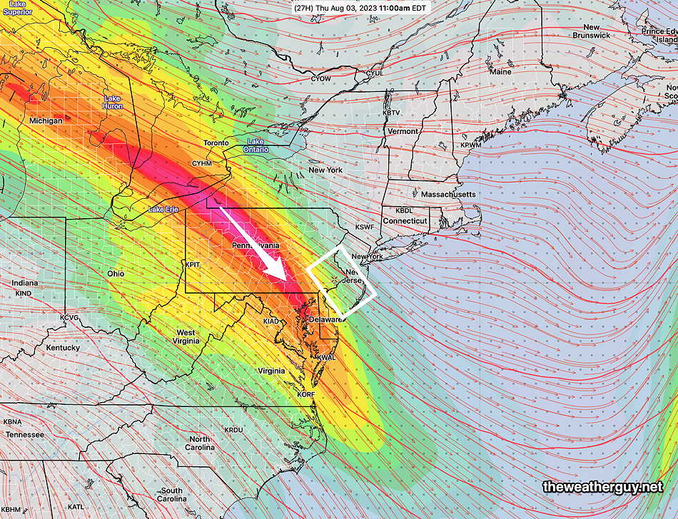
The forecast for tomorrow will be interesting. The latest NAM-NEST and HIRESW and RGEM models have scattered shower activity in the afternoon and evening. The latest HRRR and HRDPS show virtually no shower activity in the afternoon.
I’m leaning towards the sunnier and drier forecast for tomorrow, but it’s a bit lower confidence than average.
So mostly sunny, a few periods of cloudiness. During the afternoon, a few isolated showers mostly west of the city, but most areas dry. More scattered showers possible in the evening, again mainly west of the city.So mostly sunny, a few periods of cloudiness. During the afternoon, a few isolated showers mostly west of the city, but most areas dry. More scattered showers possible in the evening, again mainly west of the city.
Wednesday -Friday Update
Updated Tue 08/01 @ 7:49 PM — Not much happening weather-wise. Another beautiful day on Wednesday.
On Thursday, a warm front approaches with an increase in cloudiness, but the showers and clouds appear to be unimpressive.
Friday looks to be the most unsettled with periods of light showers, but the models aren’t showing any severe weather at this time. A cold front moves through Friday night with some showers and thunderstorms.
The weekend looks good!
Previously Posted Mon 10:47 AM —
Overview
There isn’t much to talk about weather-wise for the next three or so days. We’re in an upper level trough, with associated cooler weather, while the Midwestern US will be very hot, although not to levels seen for much of earlier July.
Expect clear and sunny weather through Wednesday, with low humidity.
On Mondays, I usually begin This Week’s Weather with a jet stream level map (250 mb level in summer). I’ll mix it up this week with a 500mb map (mid level atmosphere ~ 18,000 feet) this week, (which looks similar jet stream level map)—
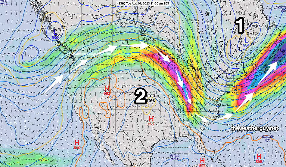
Notice the orange contour that snakes across Florida and extends up the Canada in the central US. South of this 5476 “500-1000 mb thickness” contour, it’s extremely hot and humid. (Notice it’s just south of the jet flow winds.)
In this setup, impulses move along and near this thickness level with rain and unsettled weather in most cases. By Thursday, the mid level flow flattens out and the orange contour will be closer to our area, bringing increased chances of showers and thunderstorms.
Enjoy the good weather!
[/read]