Update Sun 09/18 @ 10:30 AM — Today’s high temp 83.5º with an unusually low sd of 0.7º
Outlook
Generally warm weather for the first half of this coming week. A rather potent cold front may move through late Wednesday night with showers and thunderstorms.
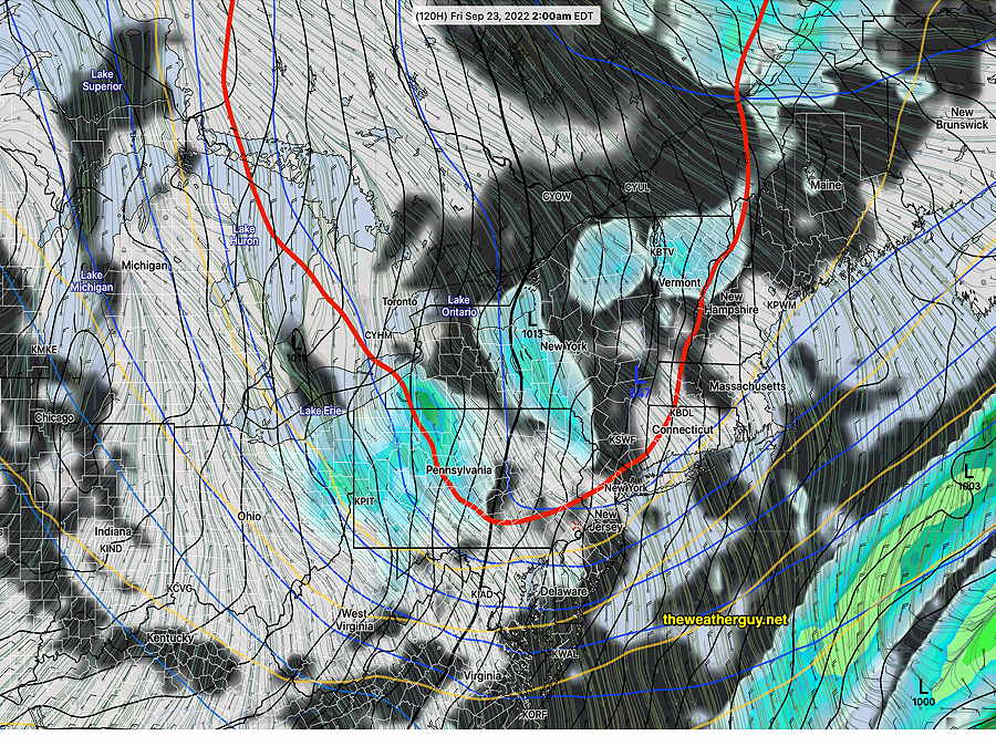
The GFS is advertising a brief, unusually chilly outbreak for late Thursday into Friday. On the weather map, we see the appearance of the 540 thickness line (red), a parameter usually associated with the snow-rain line (in winter).
Today’s 06z GFS forecast for Friday 2 AM with 540 thickness line (red) making an usually early appearance. A brief period of chilly weather next Friday expected. (Click on image for a larger view.)
This dip in the jet flow should assure us that tropical system Fiona stays out to sea.
Updated Fri 9/16 10:01 PM — minor update, highlighted
A fairly straightforward forecast for this weekend as high pressure over us will provide mostly sunny skies for Saturday and Sunday.
Saturday
For Saturday, there will be some considerable high, thin cirrus at times as a result of some moisture streaming over an upper level ridge covering the center of the country. Otherwise, sunny.
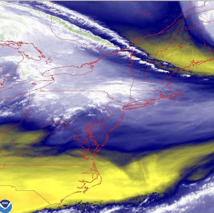
Water vapor showing northern moisture flow
High temperature 82.7º sd 1.2º NBM model Blue Bell, PA
Sunday
Sunny.
High temperature 37.0º sd 1.8º NBM model – for location Blue Bell, PA
Next week shows temperatures trending towards very warm for mid September. A weak front will also move through Monday night. A hurricane developing near Puerto Rico is expected to stay out to sea but it’s not a sure bet, according to the Canadian model. Hurricanes, in general, seem to affect forecast accuracy.
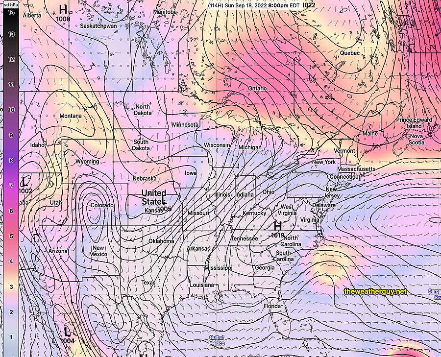
The rest of the week as well as the weekend continues to look good. There’s little spread among the models for this forecast—
GEFS sea level pressure forecast with amount statistical spread (shading) for Sunday at 8 PM. Colors show only 0-2 mb of spread in the GFS ensemble pressure forecast, indicating high confidence, low uncertainty. Bermuda high with additional high pressure in the Virginias will provide fair skies. (Click on image for a larger view.)
Long Period of Warm and Dry Weather
Update Tue 09/13 @ 8:21 PM —An extended period of dry and increasingly warm weather will be with us through the weekend and well into next week.
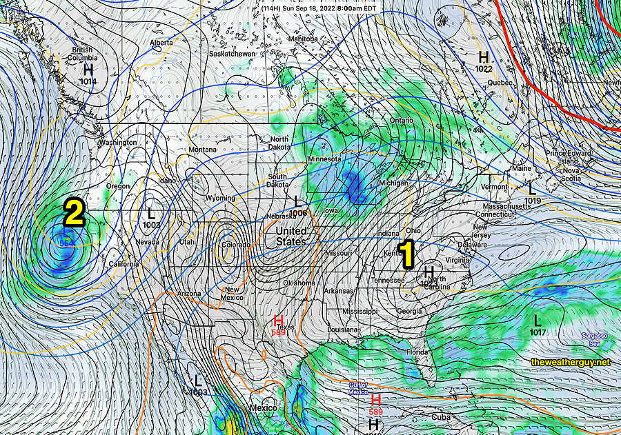
GEFS forecast for Sunday at 8 AM Surface high pressure (1) and a building upper level high, with fixed low pressure (2) in the North West. (Click on image for a larger view.)
A building upper level ridge in the center of the country and a large area of high pressure at the surface will become somewhat stationary. No rain expected and high temperatures will be moving into the low 80s by the weekend and into the upper 80s by next Wednesday. Great weather to be in the outdoors; not much action for weather enthusiasts. Enjoy!
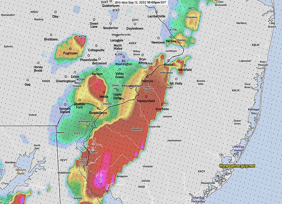
Updated Mon 9/12 9:54 PM —Tonight’s early models continue to show an expanding area of showers and some embedded storms developing. The area expands westward from NJ back into the Philadelphia area and moves northward. Timing is between now and 1 AM.
Radar 10 PM
Updated Mon 9/12 8:53 PM —So with all the models I access daily indicating rain with some strong embedded storms this evening, I just saw the forecast from this morning’s LAMDAX experimental model.
It has exactly what we’re seeing now: weak rain here with most of the stronger storms moving through Baltimore and Washington. A second line of storms will shear off to our northwest, according to the LAMDAX
Heavy Rain, Storms Monday Evening
Update Mon 09/12 @ 4:14 PM — Rain and thunderstorms are already developing to our southwest and will move into the area as early as 5:30 PM in western suburbs and the immediate Philadelphia area between 7 PM and 10 PM. Some activity may linger as late as 1 AM.
The latest HRRR seems to show the rain and storms intensifying as it moves into NJ with peak intensity there between 9:30 and 1 AM.
Today’s 18z HRRR shows high thunderstorm cloud tops as it enters New Jersey at 10 PM (cloud tops 32,000-35,000 feet) (Click on image for a larger view.)
Previously Posted Mon 9:46 AM —
A deep upper low is over the Great Lakes area and will move east. A cold front will move through this evening at a time of moderately high instability and strong upper air dynamics. Some heavy rain and thunderstorms are forecast as the result of high CAPE and high PWAT.
Only low to moderate vertical shear and helicity, so strong storms possible, but severe storms not as likely.
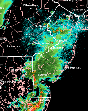
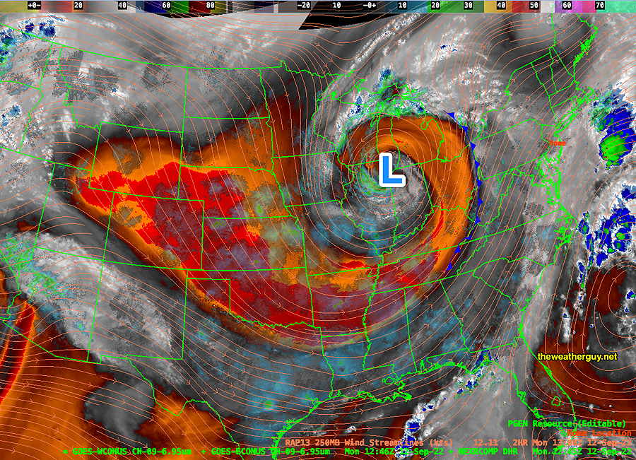
Current situation as shown on water vapor image—
Water Vapor image Monday morning shows deep upper low (L) and cold front drawn. (Click on image for a larger view.)
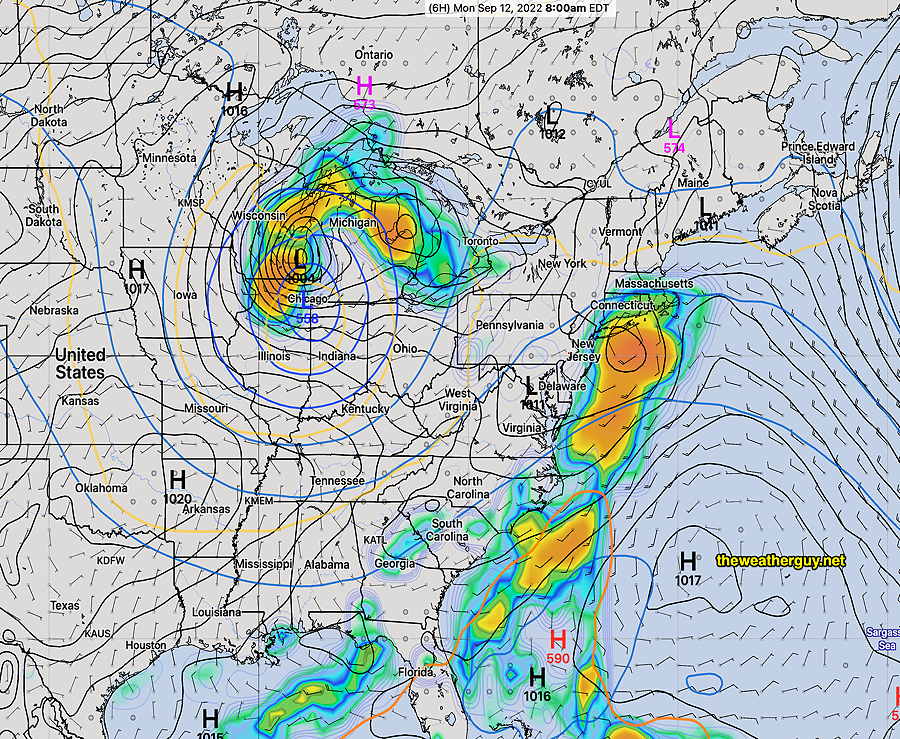
Weather Map corresponding to above image —
NAEFS current forecast map corresponding to above water vapor image. (Click on image for a larger view.)
Current forecast shows some very widely scattered showers/storms this afternoon, but the main event will likely be between 7 PM and 11 PM this evening.
I’ll update later this afternoon about 4:30 PM with the latest HRRR and NAM-NEST model data.