Updated Wed 8/31 9:19 PM — A year ago tomorrow (Thursday) we were dealing with storm IDA, tornadoes, and 5-6 inch rains. What a difference a year makes!
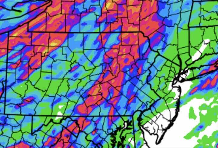
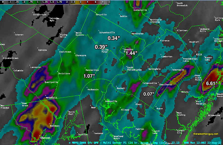
Update Tue 08/30 @ 10:11 PM — How much rain did we get?
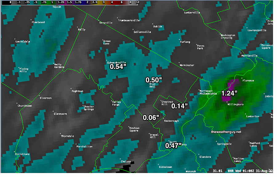
I’m waiting for an MRMS summary to become available to see if any areas got substantial rain. I know that my neck of the woods got very little.
Show More
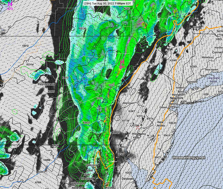
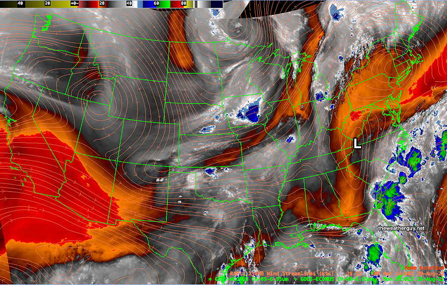
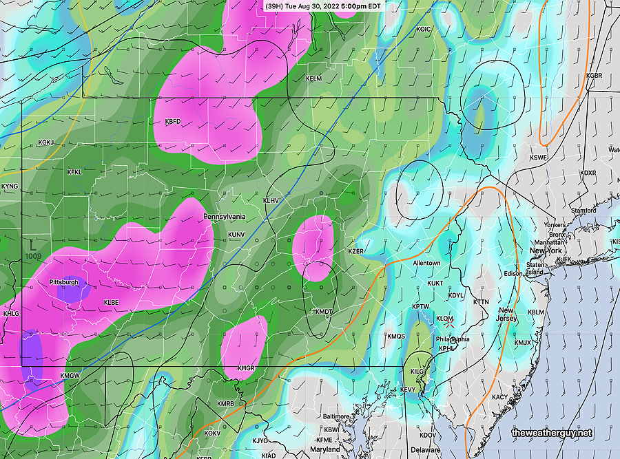
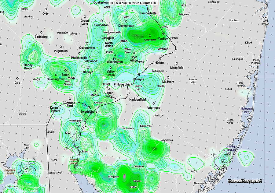
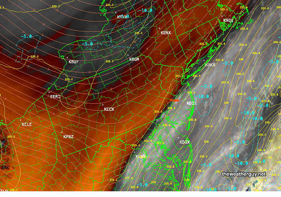
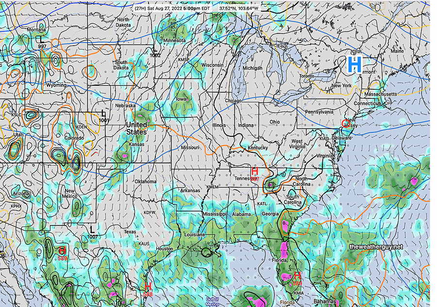
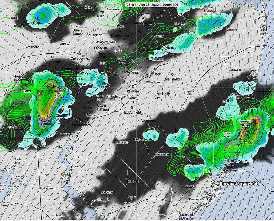
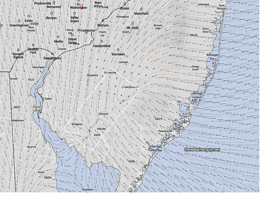
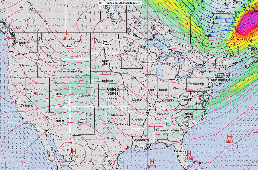
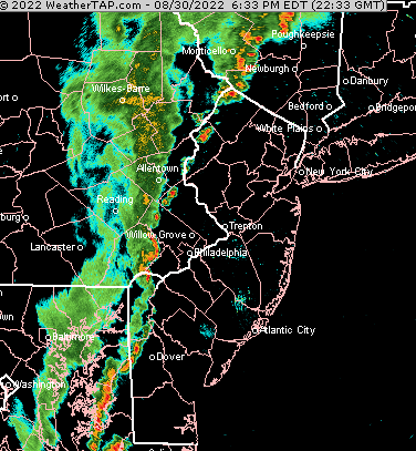
Update Tue 08/30 @ 2:38 PM —What’s working against heavy rain storms for us today? As described in an earlier update below, the storms will be moving into a wall of more stable air, as demarcated by the 576 thickness contour Another way of viewing this, instead of pressure related, is using equivalent potential thermal energy as a guide. In physics/meteorology, a thermal quantifier of instability is a calculated parameter called “Theta-E or Equivalent Potential Energy”. On weather maps, lines of equal Theta-E can be calculated and drawn. Here’s the current water vapor image with lines of equal Theta-E drawn at the energy level of 335ºK (measured as temperature, Kelvin scale) — So, based on current water vapor and calculated Equivalent Potential Energy, I’m expecting any strong storms in far western suburbs to diminish in intensity as they move eastward. Updated Tue 8/30 8:15 AM —Last night’s models show showers and storms as early as 5:30 PM tonight but the main activity moves through between 7 and 9 PM. The NAM-NEST shows some of the heaviest rain, approaching 1 inch, but the majority of models are in the 0.3-0.5 inch range. We’ll take any rain we can get. I continue to lean towards the lower range forecast. Updated Mon 8/29 10:53 PM —Tonight’s 00z high resolution model runs (HRRR, NAM-NEST, HIRESW-ARW, HIRESW-FV3) show similar timing for the rain to move in (8 PM -11 PM Tuesday evening) but vary widely with the amounts of rainfall from 0.2 to 1.0 inch in the immediate Philadelphia area. All show the heaviest rain to our far north and west. I’m leaning towards lighter amounts here, but we could use the rain. The experimental LAMDAX model also keeps rainfall light here. Update Mon 08/29 @ 8:25 PM — This afternoon’s models continue with the forecast of a cold front moving through Tuesday evening and night time, departing early Wednesday morning. For those hoping we’d get some significant rain with this system, I’m afraid we’re going to be disappointed. Most models only crank out 0.2-0.5 inches of rain in the immediate Philadelphia area. As one heads north, northwest, and far west, areas may receive as much as 0.9 inches. Areas in NJ will receive even less. Of course, there’s always a localized area that may receive much more (or much less). Most of the dynamics will lift off to the north. Additionally, the front is moving into a very warm ‘tongue’ of air, as depicted by the ‘576 thickness line’, which I have suggested in past posts has been part of the signature for this season’s disappointing rainfall. We’ll get such low rainfall despite high PWAT values greater than 2.2″ and high CAPE values near 2000 joules/kg . I believe that most of the current drought is the result of human created climate change, but some of the current drought is likely resulting from the current ascent phase of the Hale Solar Cycle superimposed on climate change. Previously Posted Mon 10:20 AM — This week’s weather will be marked by a cold front moving through Tuesday night and a large dip in the jet flow with cooler and nice weather for the end of the week and lasting into the Labor Day Weekend. For Tuesday evenings’ cold frontal passage— Most of the dynamics are forecast to be north of our area with this front on Tuesday, reducing the amount of rain we get here. Also note the ‘576 thickness line’ protruding into our area which may also reduce rainfall (as I’ve suggested it had done several times in previous weeks). Current NBM forecast is for only 0.3 inches of rain for most of our area. The dip in the jet flow on Thursday will bring much cooler temperatures— As for hurricanes and or tropical storms, there’s some indication that a hurricane may develop and affect the Carolinas next week.
Showers and Storms as early as 5:30 PM
Rainfall may be disappointing Tuesday evening