For snow lovers, it looks like there’s disappointment in the forecast. Those several disturbances mentioned to move along the flat jet stream are still coming through, but not with much if any snow. Here’s the latest–
The Saturday disturbance still looks like it will miss us to our south.
The Sunday evening disturbance looks to be less organized with a mix of rain and maybe some wintery mix.
The Wednesday disturbance currently appears to move slightly to our north, giving us mostly rain.
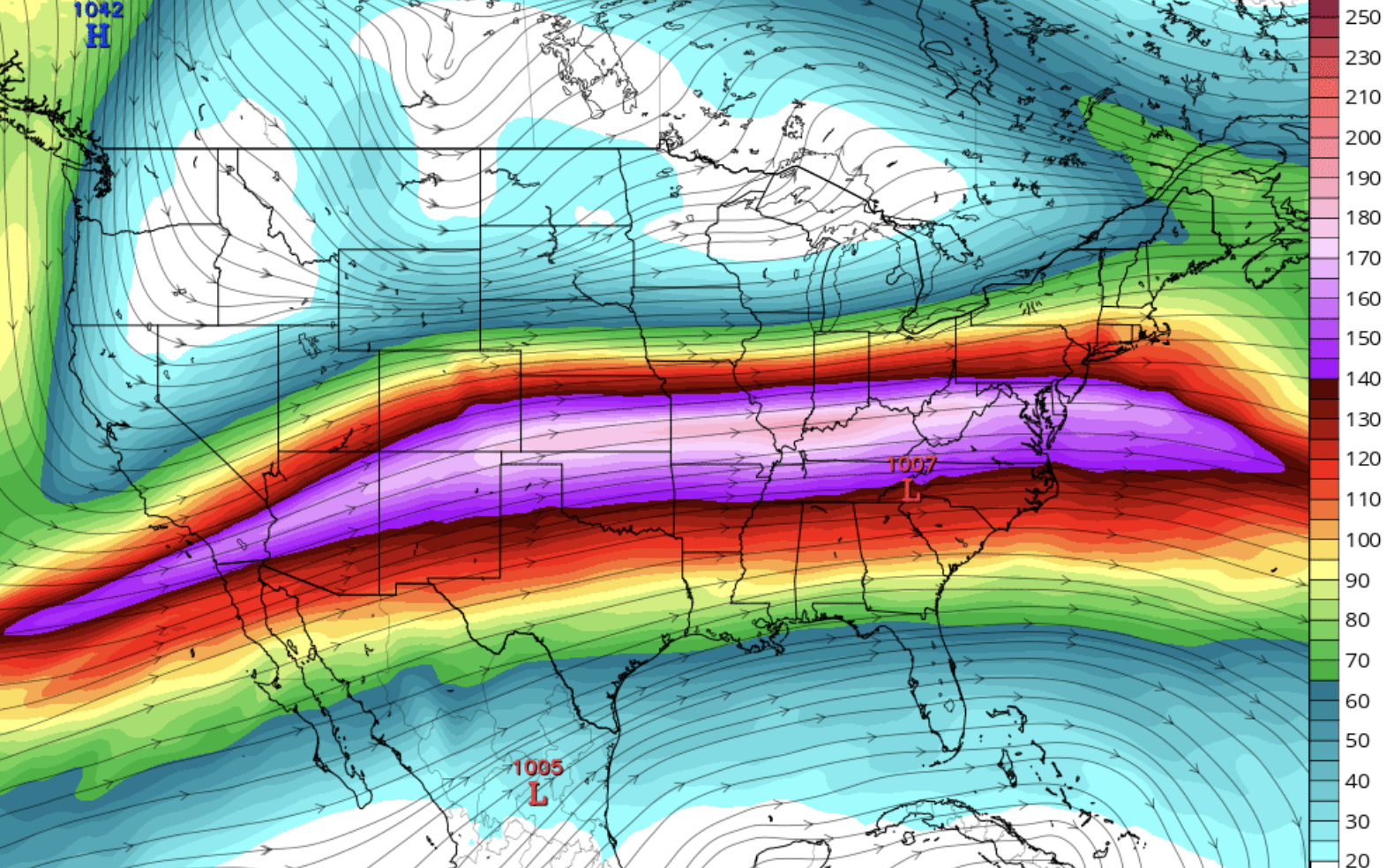
 Previous prediction of 200 mb winds

The flat jet usually doesn’t allow much if any development and shape of the jet is now anticyclonic vs cyclonic. Furthermore, it moved from a position to our south (cold for us) to a more northern position which allows warmer air to move in.