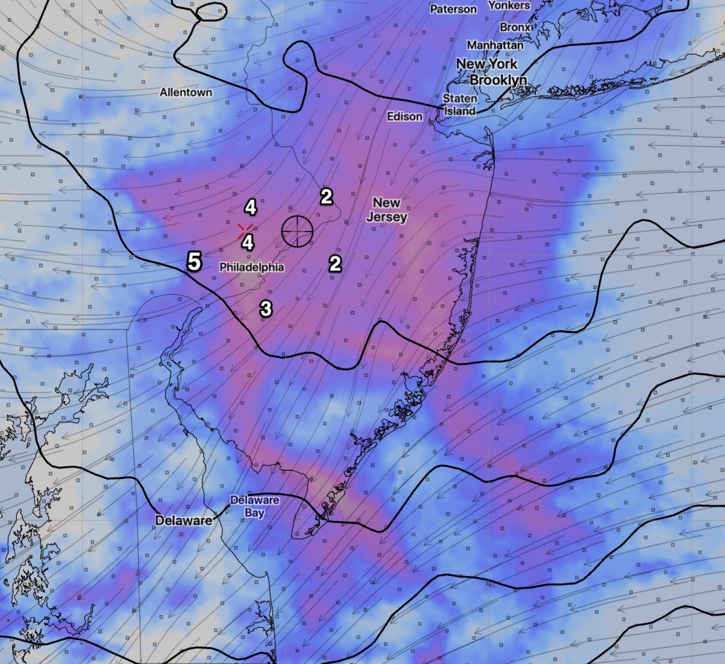
[su_note note_color=”#defcdc”]Look for an update on tonight’s snow about 9-9:15 PM with the new NAM data.[/su_note]
[su_box title=” Forecast Update Thurs 4 PM” box_color=”#defcdc” title_color=”#000000″]A quick update- Latest NAM shows a higher QPF- 0.23 inches water. Raising the snow total tonight to 2, possibly 3 inches of snow.
The larger storm on Sunday into Monday is looking too warm for snow at critical levels of the atmosphere. [/su_box]
[su_box title=” Forecast Update Thurs 12 PM” box_color=”#defcdc” title_color=”#000000″]This morning’s NAM maintains a QPF of 0.15 inches water falling as snow late tonight into early morning Friday. 1-2 inches possible, more towards the Delaware border.
Additional over-running of moisture over the stalled front and colder air may allow continuation of a light mix of non-accumulating rain mixed with sleet or snow through the day Friday.
The same process, somewhat more enhanced, will continue Friday night into Saturday with a change back to sleet and snow overnight Friday. Additional light accumulation by morning Saturday. This is a complex, poorly defined moisture over-running colder air event. Stay tuned. [/su_box]
from earlier this morning…
A very active and somewhat complex weather pattern is developing for the Philadelphia area through the weekend into Monday.
A stalled frontal boundary exists to our south. Waves of low pressure are expected to develop along the boundary and move rapidly west to east, on a track just to our south.
We had a surprise snow flurry last night that left a small accumulation in some areas from a weak unpredicted wave that developed.
[su_note note_color=”#d9f2da”]A similar setup will allow a more enhanced wave of low pressure tonight, late Thursday night into Friday morning. The NAM has been predicting this for several days; Last night’s GFS finally joined the NAM with a QPF of ~ 0.10 inches water, more towards Delaware and South Jersey. About an inch of snow is expected.[/su_note]
This complex setup looks like another round of light precipitation Friday night into Saturday. Indeed, several waves may move through over the weekend, the timing is unclear right now. The largest wave is expected late Sunday into Monday.
A range of precipitation types from snow to sleet or a mix is possible with each wave, somewhat dependent upon whether the wave moves through at night when it is coldest, or during the daytime hours.
Stay tuned for clarification… This is an evolving and complex forecast.

