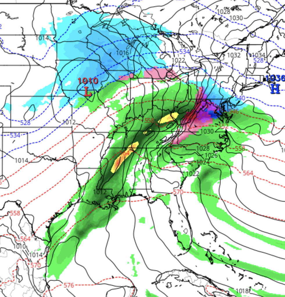
[su_box title=”Winter Weather Update: Monday Evening ” box_color=”#defcdc” title_color=”#000000″]Tonight’s NAM has become available. The NAM has snow starting about 9-10 AM Wednesday and continues as snow until 4-6 pm, when it starts mixing and changing to all sleet by 7pm. Temperatures remain at or below freezing until early evening.
Based on QPF, 4-6 inches of snow may accumulate before the changeover. A further changeover to rain will occur later in the evening. Heavier rain about midnight.
This is a preliminary forecast. Expect changes with future model runs. [/su_box]
From earlier..
Here’s the latest on the snow that’s expected for Wednesday. As usual, there’s a fair amount of model disagreement.
This morning’s GFS had the snow starting as late as noon, however this morning’s run of the new FV3-GFS had the snow starting about 8 AM. This afternoon’s high resolution NAM NEST has the snow starting about 10 AM.
This will be a storm where the total QPF will be divided into snow, sleet and rain components. Most of the models are in general agreement that there will be about 3-6 inches of snow, with a lean towards the lower end, before a changeover to sleet and then eventually to rain. BTW, the European (ECMWF) has 4-6 inches for our area.
Models have the changeover from snow to sleet anytime from 3PM to 7 PM. Sleet will likely fall for several hours as it mixes with rain. The heaviest precip will occur as rain towards midnight and after.
As discussed earlier, this will be another “warm air aloft over-runnng cold air at the surface” type system, actually a warm frontal-type system.
The forecast accuracy for this type of system has little to do with the “track of the storm” as they say on TV, but rather with the three dimensional thermal profile of the atmosphere and the eventual placement of the moisture plumes and dynamics. There’s no storm center “to track” here; it’s more subtle than that.
Getting the forecast even close to correct probably won’t be possible until Tuesday night’s model runs.

