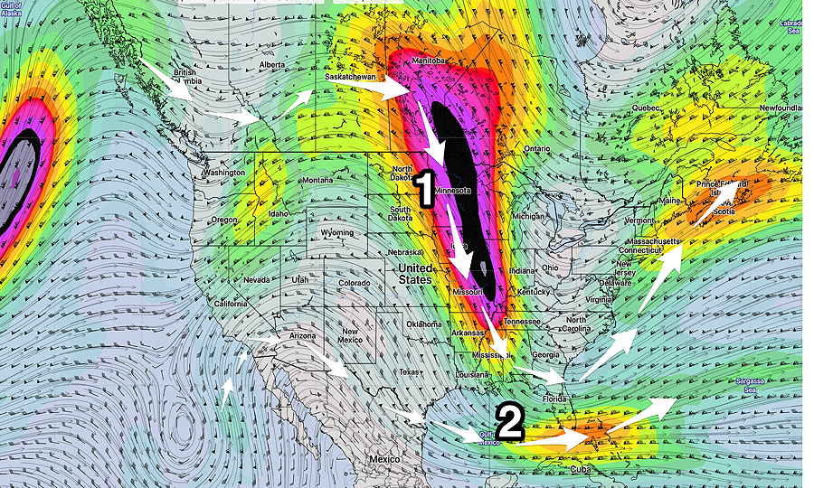
Update Tue @ 9:15 AM— One of the issues with looking far ahead at the forecast for the weekend is that there are very few (good) models that forecast out to that time frame — the GFS, Canadian GDPS, European ECMWF and the German ICON.
Show More
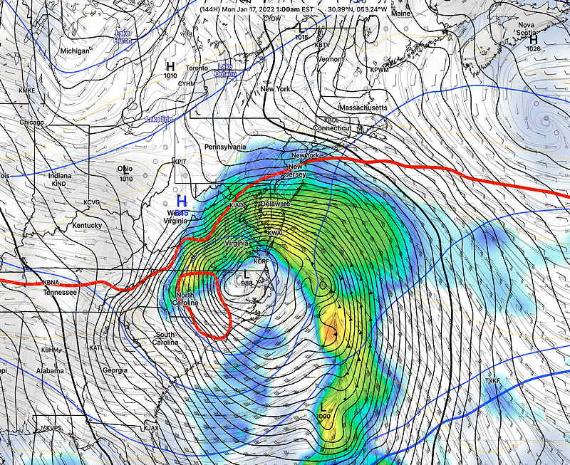
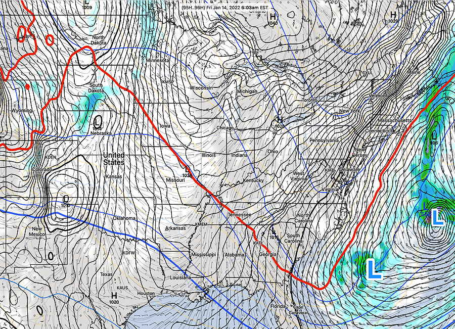
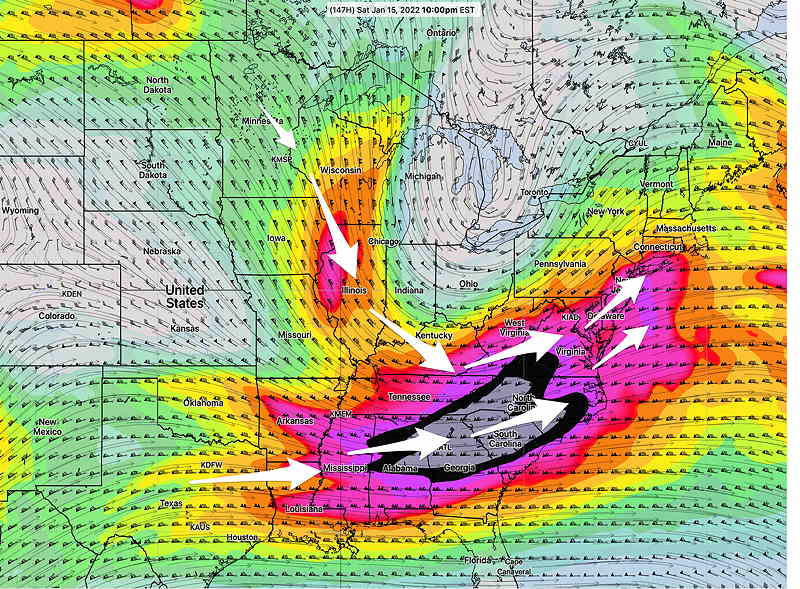
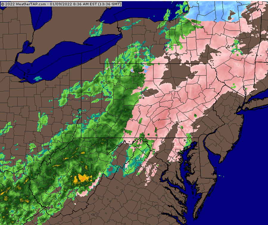
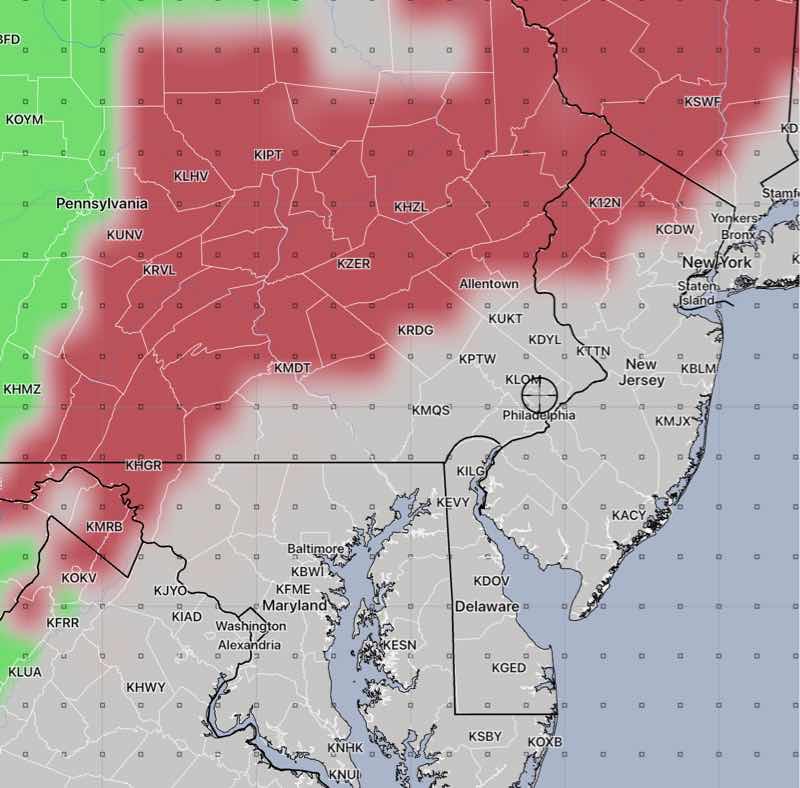
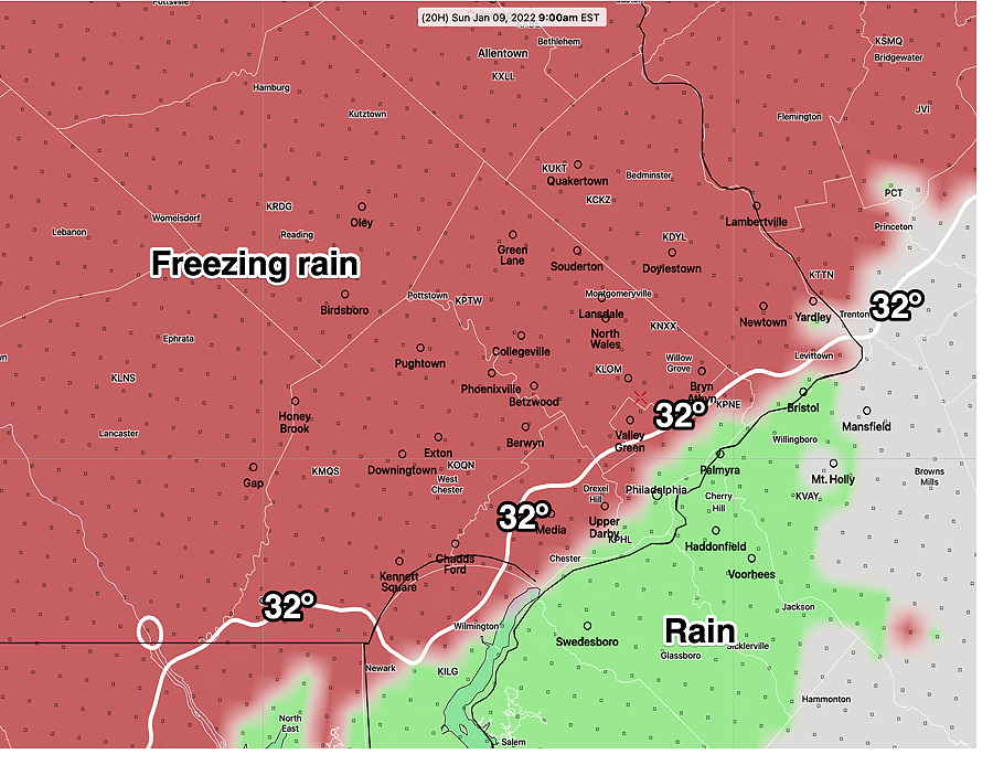
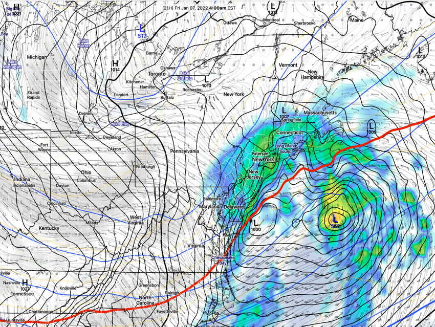
Each of those ‘deterministic’ models have a corresponding statistical “ensemble” version —the GEFS, Canadian GEPS, European ECMWF Ensemble, and the German ICON Ensemble. So basically there are four extended range forecast models and four corresponding ensemble versions. Evaluating a forecast for this weekend time frame really means: 1. comparing each deterministic model to its own previous model run (continuity). 5. To be complete, some ensembles have “mean” (average) values and “mode” values. To get an idea of “center tendency” and normal distribution of the ensembles, comparison of the mean vs the mode gives additional insight. 6. Looking at each ensemble, the degree of spread (standard deviation) gives an idea of uncertainty in the forecast. So what about this weekend’s possible storm? Well, there’s fair continuity within each ensemble version, and somewhat close forecasts between the ensemble versions. Most ensemble and deterministic models have a storm developing from a clipper system to our south intensifying in the western Atlantic and moving south and away from us. This happens in the Saturday night to Sunday time frame. At most, we might get the very northern fringe of the snow shield. The latest GFS has a new wrinkle, with yet another storm developing late Sunday into Monday. The GFS predicts this storm as a significant nor’easter with a mix of precip for our area. The latest GFS (below) is a statistical outlier, and NOT supported by the other models or its own ensemble. But it’s something to watch. Stay tuned. Update Mon @ 6:30 PM— Tonight’s predicted low temperatures below. We may go below these temperatures this coming Saturday night Today’s models have trended with a possible weekend storm (Saturday night-Sunday?) moving to our south, not up the coast. Models still show some snow here, as we might be on the northern edge. Previously Posted Mon 11:48 AM — An upper air trough created by cold air descending into the northeast will bring very cold weather early this week and possible coastal storm development next weekend. The GFS develops a deep low pressure system, far to our east, not affecting us. The trend has been for this to occur further slightly more westward, but the eastward track is currently favored. Other than windy conditions, we shouldn’t have any precipitation from this storm. Of interest is another amplified trough develops next Saturday, with likely phasing of the two jet streams. The Canadian Global shows a coastal (snow) storm developing late Saturday. The GFS has a coastal storm on Monday. This is a long ways off, with disagreement in the models, but it’s something I’ll be watching over this week. Stay tuned.
2. comparing each deterministic model solution to the other three deterministic models.
3. comparing each ensemble to its own previous ensemble run (continuity).
4. comparing each deterministic model to their own corresponding ensemble version.