THIS WEEK’S WEATHER

Update Thu @ 5:11 PM — A slight change to the weekend forecast, as today’s models are forecasting a weak low pressure system to develop south and east of us early Saturday, along the stalled cold front that has moved through today, Thursday.

This looks to bring some light sprinkles around daybreak Saturday mostly near Allentown, then periods of cloudiness with periods of sunshine. The morning looks to be cloudier than the afternoon.

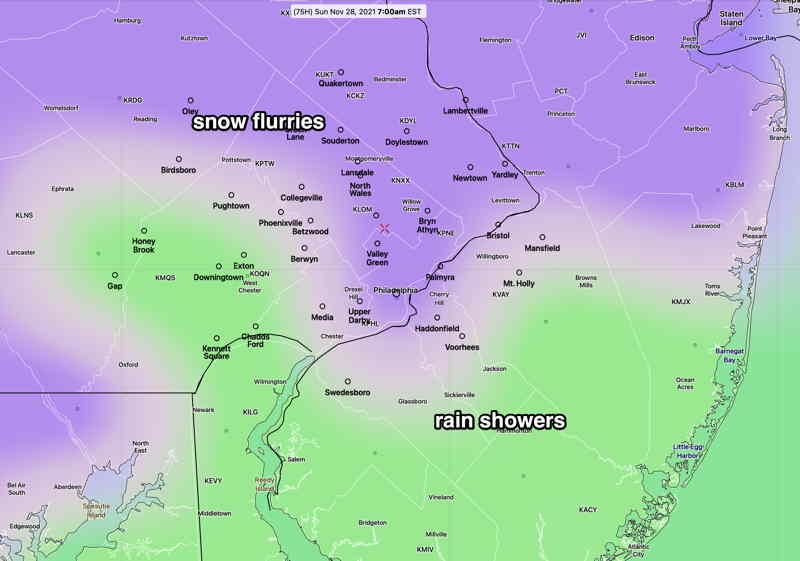
Sunday starts sunny, but increasing cloudiness is forecast by the GFS and NBM in the afternoon. Average seasonal high temperatures are in the 47º-48º range for the weekend. We’ll be close to that.

Interestingly, the Canadian Meteorological Center (CMC) just completed and released major updates to their models this week. The CMC GEM model has forecast much more sun for Sunday, but the new statistical CMC GEPS has a similar forecast to the GFS of increasing clouds Sunday afternoon. We’ll see.

My regular weekend weather forecast will be out tomorrow.


Update Wed @ 8:00 PM — A warm front moves through tonight (Wed) with some showers into early Thursday.

The uneventful pattern continues through the weekend as a cold front moves through Thursday night and stalls near us, allowing disturbances in the jet flow to bring clouds.

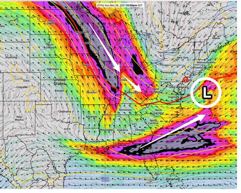
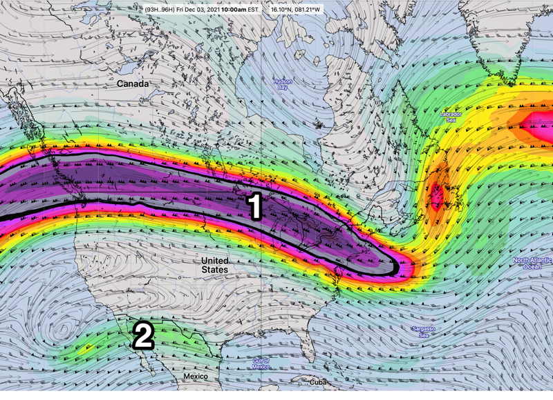
Disturbances (1) and (2) in the upper flow will bring moisture and vorticity both Friday and again Sunday with increased cloudiness. Saturday looks to be the best day with periods of sunshine.

GEFS Friday 300 mb wind (jet-stream level) forecast. Generally flat flow continues over us with some embedded disturbances (1) and (2). Southern jet flow (3) is beginning to show some signs of life.

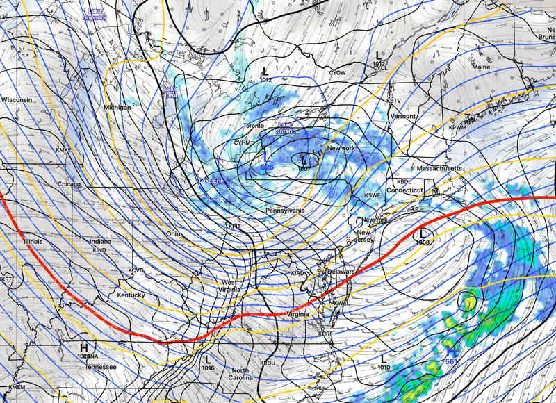
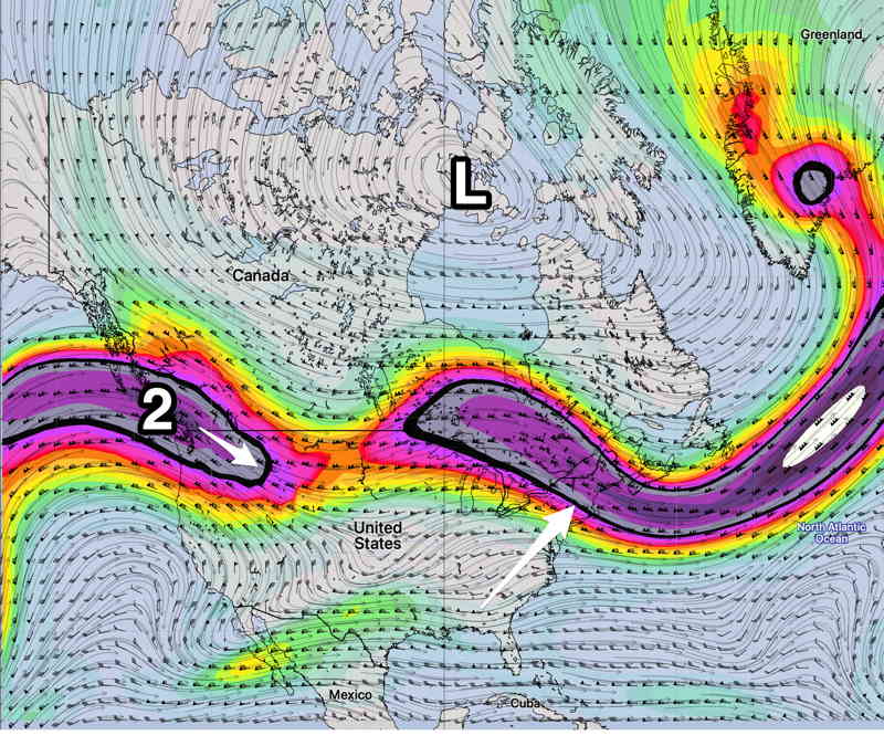
The pattern changes (at least for a few days) late Sunday as additional jet stream energy carves a higher amplitude trough over us. What remains unchanged is the upper low near Hudson Bay. It just hasn’t move much—

GEFS jet level wind forecast Sunday. Existing jet flow moves a bit north while an impulse (2) will cause a dip in the jet for Monday-Wednesday. Upper level low (L) has been stuck in this general position for several weeks. We won’t see a major pattern change until this moves.

Initial Post Discussion—[post_published]

An uneventful weather pattern has evolved for this week, as a flat jet flow will not lend itself to any great storm development. A warm front followed by a cold front will affect our weather later in the week.

GEFS 300 mb wind flow for Friday. Flat jet stream flow (1) will not lend itself to storm development. Some southern jet stream moisture (2) may work its way into our region by Sunday.

  • Some cloudiness on Tuesday.
  • A warm front moves through slowly on Wednesday with clouds.
  • Milder air on Thursday will be pushed out by a cold front late Thursday into Friday.
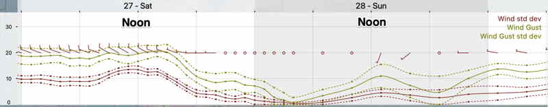
  • Windy late Thursday and on Friday.
  • Saturday looks to be cold and dry as does much of Sunday.
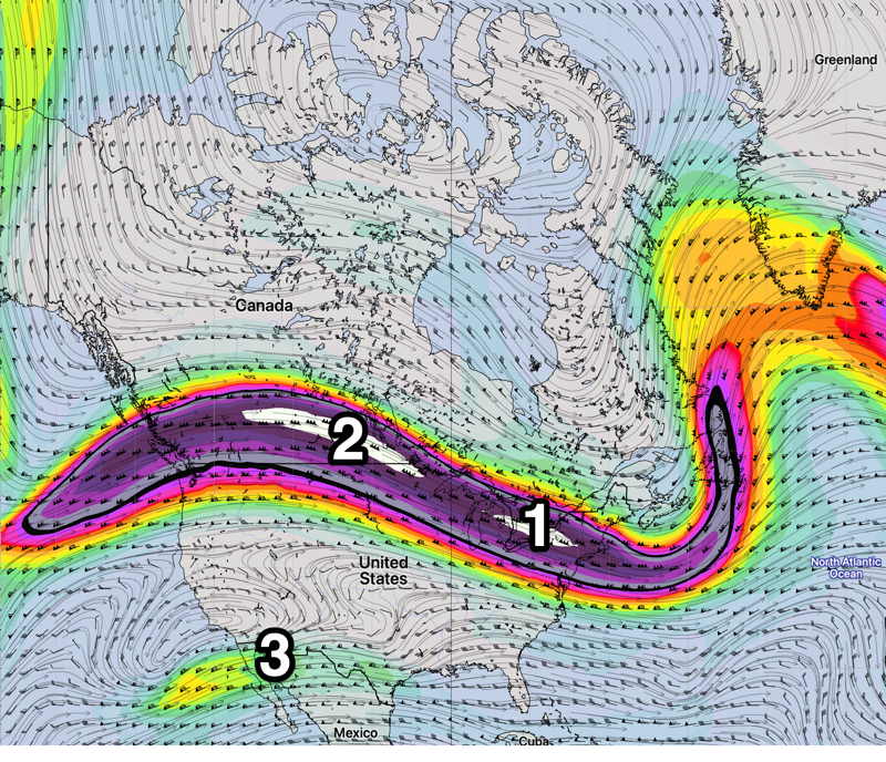
  • Moisture from the Gulf (2) may work its way towards us late Sunday.

WEEKEND WEATHER FORECAST

Sun @ 7:53 AM— My home security camera showed a dusting of snow on cars about 2 AM.

Here’s an update to my original Sunday forecast

For today, Sunday, clouds should break for a period of sunshine about mid-day. As has been the case recently, there’s quite a bit of model statistical spread regarding the amount of cloudiness, but I’ll go with the optimistic NBM mean cloud cover. Clouds return later in the afternoon and winds pick up and become gusty. High 49 (Blue Bell) 51 (PHL)

Another series of windy, cold days the beginning of this upcoming week.


Sat @ 6:50 PM— Tonight’s GFS has no snow falling tonight in the immediate PHL area. However there are several models (SREF, HRRR, NBM, Canadian GEM) that have light snow flurries/snow showers moving through around midnight through 3 AM.

Temperatures today did not warm up to levels predicted by last night’s models and current temperatures are a few degrees colder than current models are forecasting.

Assuming temps are a bit colder tonight, areas just north of the city may see a dusting/coating of snow at daybreak. These are the areas with possible accumulation—

Canadian GEM Regional snow accumulation forecast. (White area just north of Philadelphia is a dusting or less.) (Click on image for larger view.)

Sat @ 9:51 AM — This morning’s models show snow flurries between midnight and 3 AM, but without a dusting accumulation in the immediate PHL area. Minimal precip and temperatures at the surface have trended warmer in the models.

NAM-NEST forecast for 4 AM Sunday showing 32º line (white line) is north of PHL and dusting accumulation possible north of Quakertown and west of HoneyBrook. (Click on image for a larger view.)

Fri 10:03 PM— Tonight’s short range models have snow flurries after midnight Saturday into predawn Sunday. A dusting of snow is possible.


Initial Post Discussion—[post_published]

The strong pressure gradient that gave us the blustery winds today will gradually reduce as low pressure moves off to the northeast and high pressure builds in for Saturday.

Another low in the Great Lakes area will transfer its energy to a low pressure system that develops near Long Island on Sunday.

GFS forecast for Sunday 6 AM. (Click on image for a larger view.)

Most models have the main Great Lakes low weakening so as to have no precipitation for us. Some statistical model members show just enough lift and moisture for some light snow flurries after midnight Saturday.

It will be colder than season averages. (Seasonal average high temps are 49º-50º)

Saturday

It will be sunny and windy. Less windy than Friday. The pressure gradient causing the winds will lessen and the gusty winds will diminish during the afternoon. High Temps 41.8º ± 1.7º (NBM model Blue Bell)

After midnight Saturday into the predawn hours of Sunday, there’s a chance of light snow flurries.

Cloudy early. Sunday will become partly sunny/partly cloudy. Light winds early, but increase in the afternoon. Temperatures reach their highs late in the day. High temps 46.0º ± 1.5º (NBM model Blue Bell)

A cold front moves through Sunday night with winds increasing for Monday.

Winds
NBM (Click on image for a larger view.)