
As mentioned earlier this week, a coastal system will form in the western Atlantic but the upper air flow will move it east of our area over the weekend.
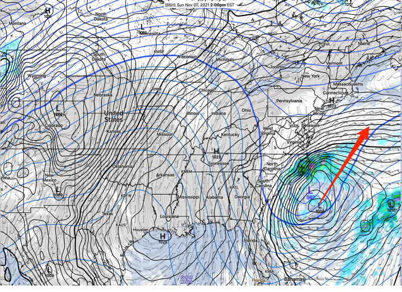
In a forecast change, today’s GFS has the low pressure system lingerirng off of the North Carolina coast. It still should not affect us. Every model has the storm eventually moving east of us.
For the Philadelphia area, high pressure extending down along the east coast will both block the northern movement of the coastal low and provide continued somewhat colder than seasonal average temperatures for the weekend. Average seasonal high temperatures are in the 57-58º range.
Saturday
Update Sat 8:35 AM — The model trend is for even less cirrus cloudiness today.
The coastal low will throw some upper level moisture towards us, resulting in sunshine through cirrus type clouds. High temp 53.7º sd 0.8º NBM model Blue Bell. (Higher than average confidence)
Update Sat 8:35 AM — The model trend is for even less cirrus cloudiness on Sunday.
The models have some mid-level clouds early Sunday morning, then sunshine through high cirrus clouds. High temp 54.9º sd 2.3º NBM model Blue Bell.
And, of course, it’s the end of Daylight Saving Time on Sunday. The only good thing I can think of about the change back to Standard Time is that the new weather models, particularly the GFS, are available before bedtime. (On Sunday, about 10:45 PM EST instead of 11:45 PM DST for the first 24 hours forecast). For new visitors to this site, here’s some background about Daylight Saving Time and Weather Model Availability with Eastern time.