THANKSGIVING & WEEKEND WEATHER OUTLOOK

Update Fri @ 10:27 AM — This morning’s early models continue with last night’s updated forecast: not much happening weatherwise on Sunday. The coastal low will form too far to our northeast.

NAM Forecast for Sunday 10 PM. Coastal low near Long Island. (Click on image for a larger view.)

Another cold front moves through Sunday evening with gusty winds.

I’ll post my regular Weekend Weather Forecast later today/this evening.


Update Thu @ 9:52 PM — Thursday’s afternoon models have moved away from any coating of snow Sunday. Not much happening here according to this afternoon’s GFS, ICON and tonight’s NAM. The Canadian GEM still has a coating, as does the NBM. Coastal low pressure develops too late to affect us. The NAM has temperatures above freezing by early Sunday morning.


Update Thu @ 12:18 PM —

Friday: Showers end by 7-9 AM. Very windy in the afternoon. Winds approaching 35-40 mph.

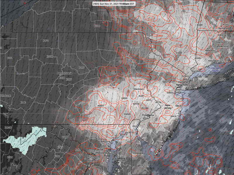
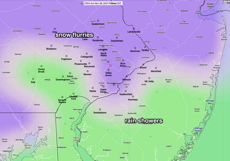
Sunday: light snow early morning. A very light coating possible, according to the latest models.


Update Thu @ 9:46 AM — For today, a mix of high clouds and some mid level clouds will break for full sunshine during the afternoon today. A cold front with showers after midnight into early Friday morning.

Regarding the coastal low for Sunday into Monday, last night’s models have less development with this potential system and any development appears to occur nearer New England. Perhaps a snow flurry for us early and light rain showers. Snow flurries at night.

SREF Conditional Precipitation Type forecast Sunday 7 AM. The SREF has any light precip changing to rain during the morning. A chance of a change back to snow flurries after 6 PM. No accumulation expected at this time. (Click on image for a larger view.)

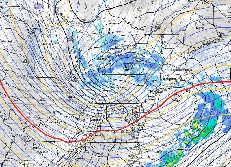
Update Wed @ 3:45 PM — A quiet weather weekend weather outlook has become more interesting today. The outlook for Sunday has changed.

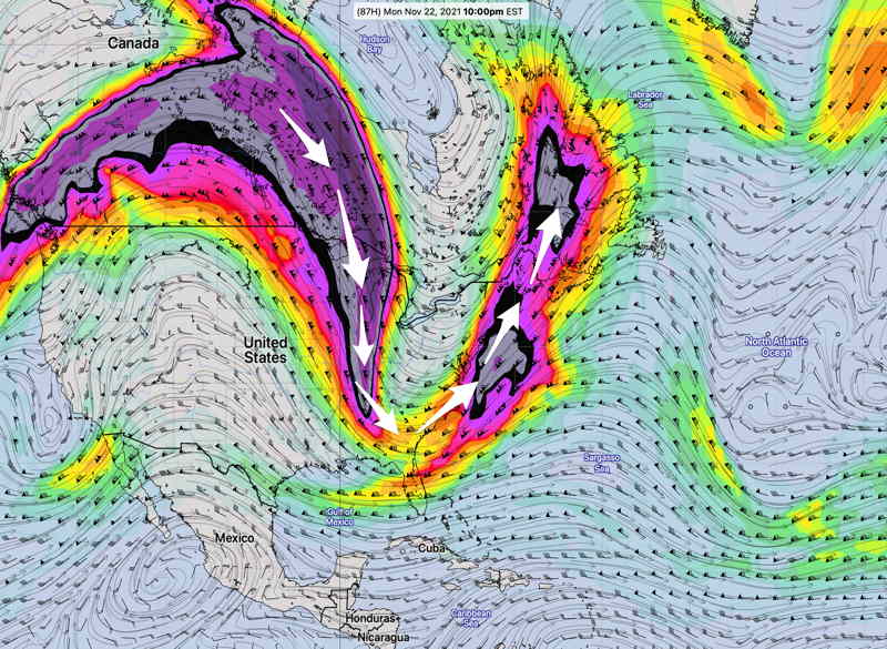
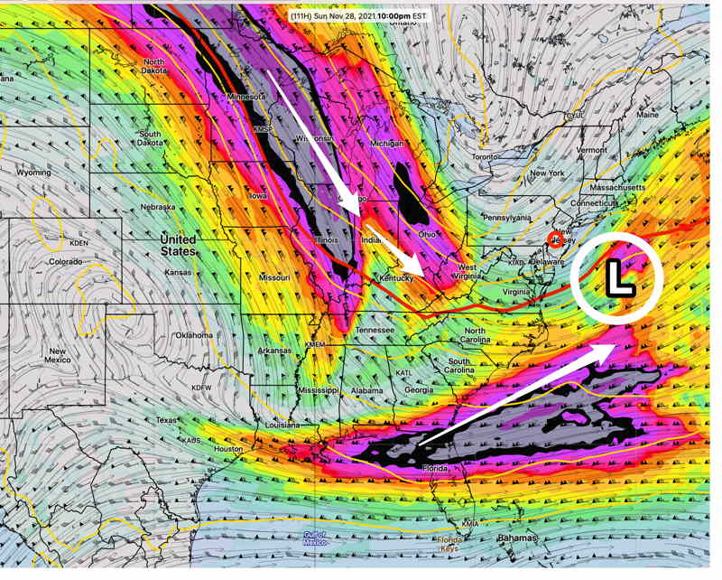
The two jet streams (shown in the graphic from yesterday) are forecast by the GFS, Canadian Global and ICON to phase somewhat and spawn low pressure somewhere off the NJ coast—

GFS Forecast 300 mb (winter jet level) for Sunday evening. Low pressure develops somewhere near coastal NJ. The timing and development has the possibility of some snow flakes falling, especially north and west of Philadelphia. (Click on image for a larger view.)

Some snow may be the result especially north and west of the city. Accumulations currently near zero.


Initial Post Discussion—[post_published]

The cold air will be loosening its grip on Thursday as a southwesterly flow of milder air moves in. (1 in graphic below)

Thursday will be sunny in the morning, partly to mostly sunny in the afternoon. Clouds late. The model blend (NBM) high temp forecast on Thursday is 54.5º± 1.5º but it wouldn’t surprise me if high temps got into the upper 50s.

Another plunge of cold air will occur with a dip in the jet stream flow late Thursday into Friday. A cold front will move through early Friday morning with some light rain before daybreak on Friday.

Cold air with this upper trough (2) will be with us for the weekend. Several impulses in the upper flow will bring some cloudiness at times and reinforce the cold air.

ICON model jet stream winds (300 mb) forecast for Thursday 7 PM. The warmer upper flow on Thursday (1 above ) will be replaced by an upper trough (2) (Click on image for a larger view.)

WEEKEND WEATHER FORECAST

Update Sun @ 9:05 AM — Simple But Interesting— Following yesterday’s poor model cloud forecast, I wanted to get some better model data indicating the uncertainty in the model’s cloud forecast. The HREF model includes “statistical spread” data as a download parameter option. Here’s this morning’s HREF total cloud cover forecast for 11 AM Sunday—

HREF 06z model total cloud forecast for 11 AM Sunday. Dark is mean cloud cover, red contours are areas of high statistical spread, green/blue is rain. Notice that the red contours (high statistical spread) are centered over the PHL area at 11 AM, indicating that the group of models that make up the HREF have a wide range of cloud forecasts. While the mean (average) cloud cover is low (~ 40%) in PHL at 11 AM, the uncertainty in the cloud cover (spread) at 11 AM is is ± 35%!

I’m staying with the forecast update below from 9:21 PM last night.


Update Sat @ 9:21 PM — Reviewing this afternoon’s models and the early models available this evening,  Sunday morning and the early afternoon is looking sunnier than previously forecast.  As a result, the high temp will be about 54º.  

Increasingly cloudy between 2 and 4 PM.  The NAM-NEST has some light showers as early as 6-7 PM.


Sat 03:52 PM Forecast Review — Saturday was a beautiful day with more much more sunshine than forecast.

Most of this morning’s models showed 100% mid-level clouds by noon; clearly not correct.

I usually prefer the GFS for cloud cover, especially when the humidity parameters back up the cloud cover forecast.  But the GFS didn’t come through for today.

Looking back at last night’s models, the NAM-NEST had the best forecast, but it’s not a model I would have chosen to predict today’s cloud cover. 

With Saturday’s forecast incorrect, I will be checking tonight’s models to update Sunday’s forecast later.

Initial Post Discussion—[post_published]

A cold front went through Thursday night and high pressure moved in for Friday and expected to linger for some of Saturday. The high pressure system will move off the coast Saturday. A warm front will move in Saturday and another strong cold front moves in late Sunday. Windy Sunday evening ahead of this jet dip.

The cold front later Sunday will be propelled by an outbreak of cold air, pushing the jet stream into a highly amplified pattern for Monday and Tuesday—

GFS forecast jet stream level (300 mb) for Monday at 10 PM showing a highly amplified pattern. . The mulit-colored areas are 300 mb wind speeds and the highest winds are the ‘jet streaks’. (Click on image for a larger view.)

This upper air configuration causes low pressure development. This development will occur east of our area. A similar type of configuration, slightly west in winter, might cause a significant snow storm for the coast. Not this time.

Saturday

As high pressure departs, winds will shift to southeasterly as a warm front approaches. After some sunshine in the morning, considerable mid-level (altocumulus/altostratus) cloudiness develops by noontime and continues through the rest of the afternoon.

Update Fri @ 11:06 PM — Tonight’s high resolution models show a few more breaks of sunshine on Saturday than the earlier GFS that the above forecast is based on.

High temperature 48º ± 1.1º NBM (model blend) Blue Bell, PA

The warm front attempts to move north while a very strong cold front approaches from the west ahead of the dip of the jet stream (in the above graphic).

Clouds early, then many models show some late morning to early afternoon sunny breaks, but clouds return to become cloudy as showers approach from the west for later in the day.

Update Fri @ 5:36 PM — Friday afternoon’s GFS shows significant cloudiness, very little sunshine for Sunday.

Windy conditions develop during the evening and nighttime.

High temperature 50.1º ± 2.0º NBM (model blend) Blue Bell, PA

GFS mid-level cloud (maroon shading) AND simulated radar forecast for Sunday, 4 PM. (Click on image for a larger view.)

The GFS has some light showers/sprinkles by early evening in western suburbs. HIGH WINDS. Windy SUNDAY EVENING AND NIGHT ahead of the front.