
Forecast Updated Fri @ 9:09 AM — Some changes to Saturday’s forecast. An the easterly flow expected to give us mostly low clouds for Saturday may bring in some sporadic light drizzle at times as well. The GFS began showing this last night.
As for Sunday, there’s still a dichotomy between the cloudy but dry GFS forecast for Philadelphia on Sunday and somewhat wetter forecasts from the other models. This forecast dilemma has persisted for days and still remains, although there are signs that the NAM is moving towards the GFS forecast. The ICON has already joined the drier GFS forecast.
The ensemble/statistical version of the GFS, called the GEFS, which averages 31 variations (referred to as ‘pertubations’) of the GFS model still has a wetter forecast.
I’m staying with the forecast for cloudy but dry for Philadelphia, north and west, for Sunday, but I think waiting for tonight’s models might be required.
Forecast Updated Thu @ 8:04 PM —Friday will likely be the best day of the next three. Considerable cloudiness will break for a mix of sunshine and clouds.
Saturday looks to be mostly cloudy. Most areas dry. A few isolated light ‘spits’ in some areas possible.
Sunday remains a forecast dilemma regarding any rain. We know it will be cloudy.
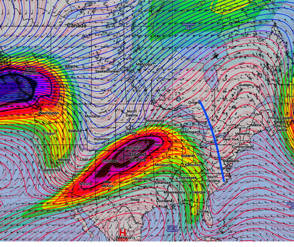
The GFS continues to keep Philadelphia and areas north and west dry due to blocking high pressure. The latest ICON has joined that camp.
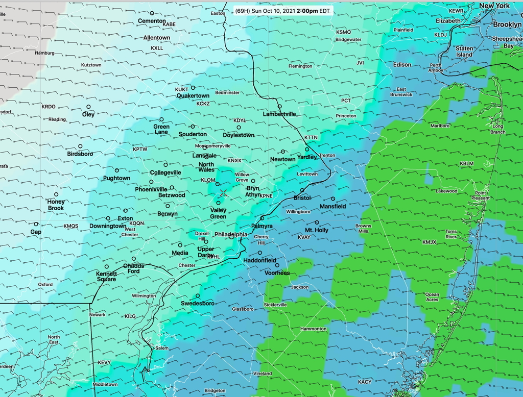
The NBM (model blend) shows some rain for most of the area Sunday, reflecting the fact that most models are forecasting some rain. (The latest GEFS also shows some rain. )
So the dry GFS (for Philadelphia north and west) is still the outlier. But I’m leaning towards the GFS. I’ll try to nail it down with my regular Weekend Weather Forecast later on Friday.
Forecast Updated Thu @ 8:36 AM — The forecast for blocking high pressure to prevent northern movement of the coastal low, as consistently predicted by the GFS, continues to be the likely scenario for Sunday. The basic depiction from last night’s GEFS still holds. This means that Philadelphia, north and west, will get little, if any rain, on Sunday. Mostly a mix of low clouds, widely scattered sprinkles possible. (Greater chance of rain in South Jersey.)
Moving backwards in time to Saturday, the upper trough will bring mostly cloudy skies with widely scattered sprinkles possible.
The Canadian GEM and the NAM continue to have wetter forecasts for Sunday. I don’t think they’re correct.
Stay tuned.
Forecast Updated Wed @ 7:17 PM— Things haven’t changed much over the past day (see original post below).
For the remainder of the week, we’ll continue to be under the influence of a closed low pressure system that finally opens up into an upper trough, (as described in the original post below).
We may have some decreased cloudiness on Thursday and Friday.
There’s major forecast uncertainty for the weekend, especially Sunday. A significant degree of cloudiness may still be with us on Saturday, the result of an upper trough over the area.
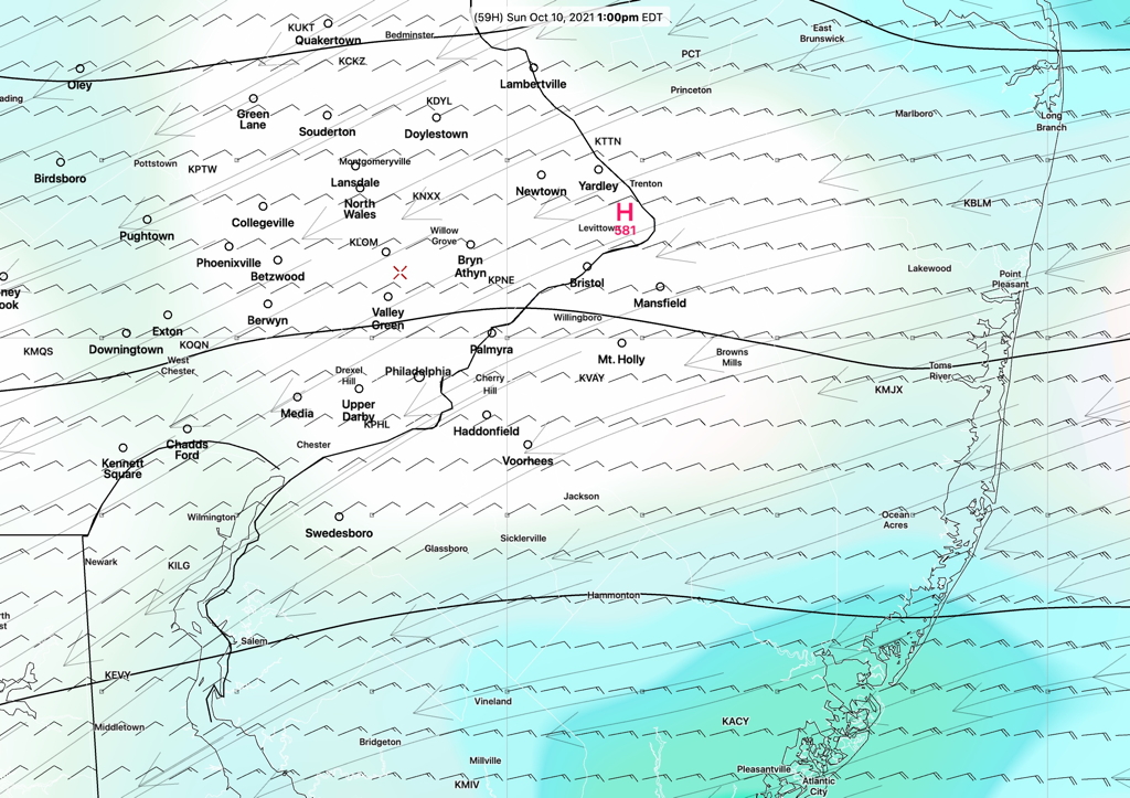
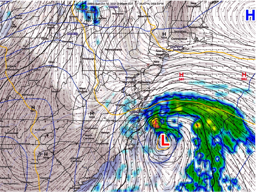
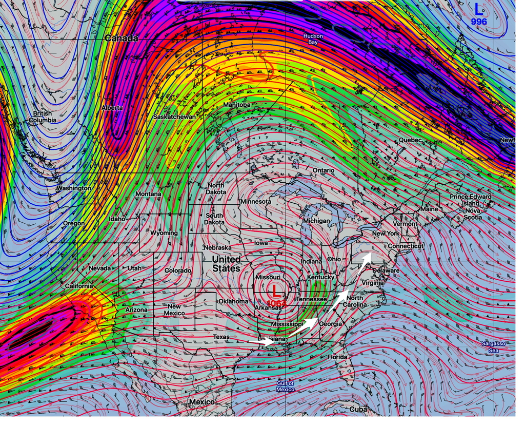
For Sunday, a semi-tropical system is expected to form along the southeastern coast. The GFS has high pressure blocking this system from much northern movement on Sunday, sparing the Philadelphia area from heavy rain (in fact from just about all the rain)—
Most models have a bit more rain/showers for Sunday. especially east into NJ.
The statistical “ensemble” version of the GFS (the GEFS) has a chance of light showers on Sunday extending into Philadelphia—
The latest ICON model shows accumulated rain for Sunday for NJ—
While the GFS is somewhat of an outlier with its forecast compared to the few other current models that forecast out beyond 84 hours, I currently favor the GFS. So I’m leaning towards a much drier forecast for Sunday.
(The GFS did better overall with several storms last winter and its track of IDA was overall better as well.)
Stay tuned.
Original post from Tuesday—
As forecast last week, a closed upper low formed in the mid section of the country and we’ve been under the influence of a cyclonic upper air flow. Moisture is being brought up from the south around this upper low—
The models are forecasting this closed upper low to lift out into an upper trough by the weekend.
Unsettled weather will continue here until the the upper low lifts out and the residual trough disappears.
The upper low lifting out represents another short term pattern change. The speed that the upper low lifts out and the timing of the trough will determine the weather for the weekend.
Saturday still looks a bit unsettled with this upper trough. Sunday looks better. But even that general forecast is lower than average confidence.
Updated Tues 9:30 PM— To be watched is a tropical type system that may move partially up the coast over the weekend, brought northward along the upper trough.