WEEKEND WEATHER FORECAST

Updated Sat 8:18 AM – highlighted below
Updated Sat 7:20 PM- Some changes in the Sunday forecast below

Departing low pressure that brought the very windy conditions on Friday will slowly move off to the northeast for the start of the weekend and high pressure should build in.

A closed upper air low in Arkansas and a somewhat stalled frontal boundary will rotate moisture and upper air disturbances towards our area Saturday night and into Sunday. These disturbances will cause some cloudiness and possibly light sprinkles.
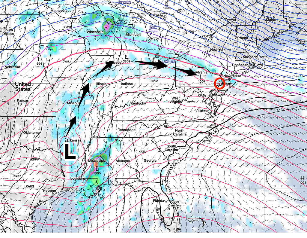
upper air low
GFS Sunday forecast showing upper low in Arkansas and surface low in Mississippi. Upper flow with embedded areas of vorticity will bring clouds and the chance of light showers on Sunday.  (Click on image for a larger view.)

High pressure will be in control on Saturday with mostly sunny skies. Winds will be diminishing as the day goes on. (see wind meteogram at end of post) High temperature 64.3º sd 1.3º (NBM Blue Bell)

Embedded jet stream disturbances will be passing through to our north or through Philadelphia, depending upon the model.

The model blend (NBM) keeps us dry while the GFS has some very light scattered shower activity to the north of us. The Canadian regional GEM keeps us dry.

The new HIRESW-FV3 has scattered, very light intermittent shower activity moving through our area in the morning, with a chance persisting throughout the day.

The latest ICON model is in the middle of the pack and leans towards the HREF model.

The ICON has backed off on the light sprinkles here.

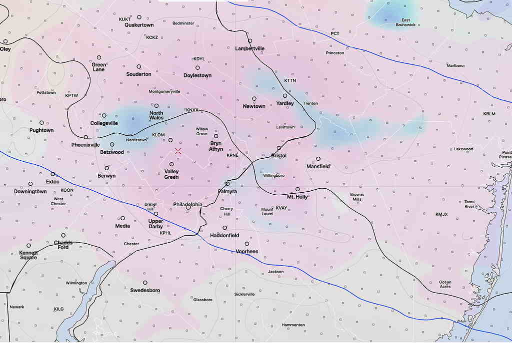
The HREF only shows sprinkles before 8-9 AM Sunday.

I’m going to lean towards the new HREF. Some cloudiness and possible light, widely scattered sprinkles before 9 AM, then mostly sunny skies in the late morning and afternoon.

High temp 80.7º sd 3.1º (High Spread!). More sun has the NBM high temperatures 83.6º sd 2.8º.

HREF partial cloud (pink), light sprinkles (blue) Sunday AM (Click on image for a larger view.)

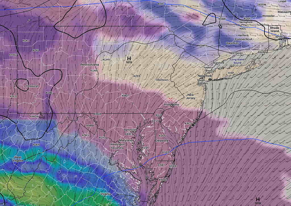
Winds
NBM Wind meteorgram Forecast Saturday and Sunday (Blue Bell, PA) (Click on image for a larger view.)

MIDWEEK FORECAST SHIFT

Fri 11:37 AM Forecast Review — While I hadn’t covered Thursday evening’s rain in depth, the new HIRESW (specifically, it was the new “HIRESW-ARW-MEM2”)  did nice job in predicting Thursday’s evenings rain 24 hours in advance.  Last year,  I thought the HIRESW did very well with thunderstorm prediction.  NOAA is making the newest version of the HIRESW model “operational” this coming May 11th 2021.  

The HIRESW “High RESolution Window is a relatively new model that is being actively developed by NOAA.  There are actually several versions. Beginning May 11th, these new models will become operational:  the HIRESW, the HIRESW-ARW-MEM2 and the HIRESW-FV3.    

The HIRESW forecasts out to 48 hours.  The new HIRESW-FV3  forecasts out to 60 hours.    The are run twice a day.

Additionally, there will be a new, updated statistical “ensemble” version,  the HREF   (HIgh Resolution Ensemble Forecast model).  The HREF is a model based on statistical averages/means of several different models, the RAP, HRRR, and the HIRESW versions combined with some time-lagged versions to even out model run variances.  The HREF is run 4x daily  

Update Wed 10:08 PM – The weak cold front never made it south this evening. Nor did any thunderstorms. Thursday’s high will likely be near 80°. Currently, the main cold front will move through late Thursday. Most models are keeping the main storm activity to our north and through central Pennsylvania on Thursday. However, tonight’s HIRESW-ARW shows some thunderstorm activity mid morning and again about 5pm Thursday in our area.

While this is primarily a “weekend weather” site, looking at the weather models is my daily crossword puzzle.

I couldn’t help but notice that there’s been a major shift in the model forecast over this past day and some of the TV media forecasts have not updated their forecasts.

Originally, Wednesday and Thursday were to be very warm days, with many of the on-air forecasts talking about record high temperatures, especially Thursday.

The models forecasts have shifted this afternoon – a cold front will slide down during the day Wednesday, a day earlier than previously expected. Showers and thunderstorms will break out, especially Wednesday evening. The models have most of the energy to our north and to our south, so right now, any thunderstorms are not expected to be severe in the immediate PHL area.

High temperatures in the 80’s Wednesday may not make it out of the low 70’s on Thursday (a huge change in the forecast). (The latest GFS model has high temperatures in the 60s Thursday!)

The front may get hung up just south of our area, causing showers on Thursday.

We now return you to your regularly scheduled programming…