Updated Wed 8 AM highlighted.
A cold front will move through Wednesday between 12:30 and 4 PM. Thunderstorms were originally forecast to develop with this front although the forecast has been for less than 1/4 of an inch of rain to fall.
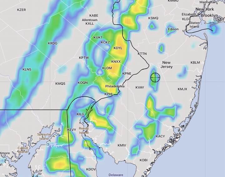
Fast moving system. Moving through Philadelphia closer to 12:30 to 2 PM (per HIRESW-FV3 shown in 2nd graphic below.) Cloudiness ahead will limit available energy. Strong wind gusts with system. Total rain about 0.25 inches water.
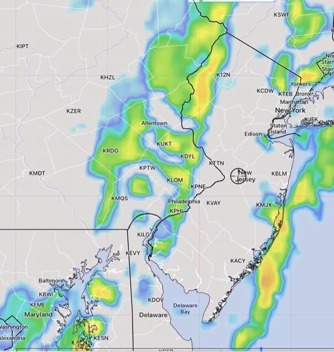
Tonight’s models are just becoming available and the RAP, HRRR and NAM are very unimpressive with the line of storms.
Also just available is the high resolution HIRESW-ARW. It maintains a line of storms about 2 PM with somewhat higher rainfall and higher winds.
The HIRESW-ARW did well last year with thunderstorm forecasts and we’ll see how it does tomorrow.
Another model of interest is the new, soon to be released HIRESW–FV3. It has the showers and thunderstorms coming through an hour earlier, at 1 PM—