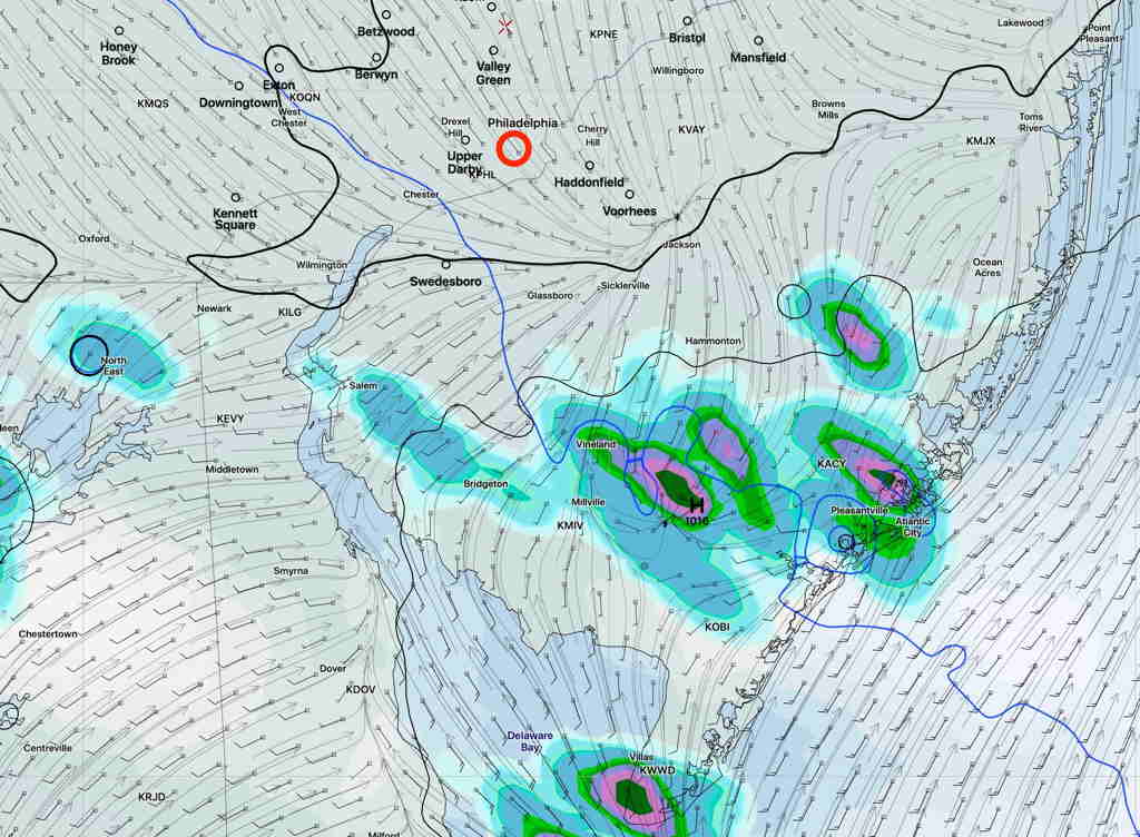
Updated Sun 07:29 AM — The latest NAM NEST keeps the showers south of the immediate PHL area. High temperature 93.6° sd 1.3º (Blue Bell), 94.9º sd 1.3º (Phila Airport)
NAM NEST 1 hour precip forecast 3 PM Sunday. (Click on image for a larger view.)
Updated Sat 10:42 PM — Tonight’s models keep the scattered showers south of Philadelphia. The position in the GFS graphic below remains unchanged. High temperatures 94°.
The focus of this weekend’s weather has been the very warm (hot) temperatures expected. But there’s a forecast change regarding showers.
The frontal boundary that passed through Friday night had been expected to ‘wash out’. Instead, it has stalled to our south and is now expected to become an area of weak moisture convergence for this evening and Sunday.
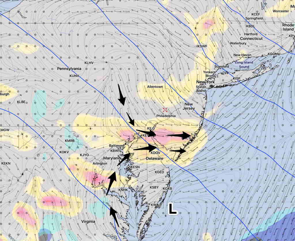
GFS Forecast vertical velocity (yellow/pink) and lower wind flow. (Click on image for a larger view.)
With daytime heating and the vertical motion from the wind flow convergence, scattered showers and thunderstorms are possible in the area shown in pink above. (South of the Philadelphia area.)
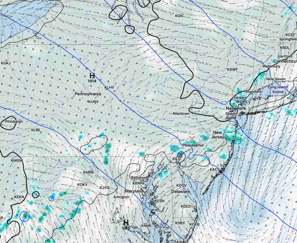
This afternoon’s NAM NEST has this area of convergence a little further north, and a ripple ( vorticity disturbance) in the upper air flow with showers developing closer to Philadelphia area tomorrow afternoon—
NAM NEST 2 PM Sunday precipitation forecast (Click on image for a larger view.)
So there’s some uncertainty about the exact location of these possible showers. Also timing uncertainty, with the GFS having these showers as early as late morning and NAM NEST as early as 2PM Sunday.
The cloudiness this morning had been predicted last night.
Cloudiness should dissipate from west to east.
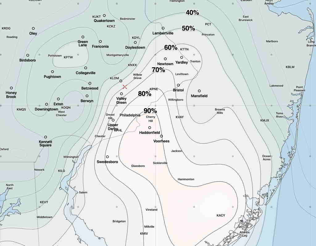
Last night’s 2 AM (06 UTC) run of the major models show varying times for the cloudiness to break for sunshine. Most of the short range models (RAP, HRRR) have sunshine by 10AM-12 noon.
However, NAM, NAM-NEST and the GFS are a bit slower with the cloud clearing, having some cloudiness lingering until 1-2 PM here in the Philadelphia area.
GFS percentage cloud cover forecast 1 PM Saturday. (Click on image for a larger view.)