Sat 07:42 AM Update — The models are more optimistic about sunshine for Saturday. Still a good chance of showers and thunderstorms about 4-7 PM, but they will be scattered and not every area will get one.
Following a very rainy Friday from tropical storm Fay, we could all use some sunshine for the weekend. It appears we may have to wait for Sunday for that really nice weather.
The models show an extremely moist and unstable air mass remaining over the Philadelphia area for much of Saturday before a weak ‘cold’ front moves through later in the afternoon.
Considerable low level moisture will produce low clouds Saturday morning. Any breaks of sunshine around noontime may result in widely scattered showers and thunderstorms. More organized shower and thunderstorm activity is likely between 4 and 7 PM on Saturday as the weak front moves through. Highest chances north and west. There are model differences regarding the amount of cloudiness/sun and also temperatures.
Saturday—
Mostly cloudy in the morning some sprinkles possible, a mix of sun and clouds in the afternoon. Low confidence on the cloud cover
Widely scattered showers/thunderstorms during the afternoon, especially 3-6 PM.
High temps 88.9º sd 2.2º. Very humid, dew points above 70º
Winds SW–> W 10-15 mph with gusts to 25 in the afternoon.
Sunday—
Mostly sunny
High temp 89.8º sd 3.0º (high spread, uncertainty)
Updated Fri 05:14 PM — Philadelphia Airport has had over 4 inches of rain so far! The NBM forecast from this morning was pretty good. The NAM NEST had the rain tapering around 2 PM; obviously a wrong call.
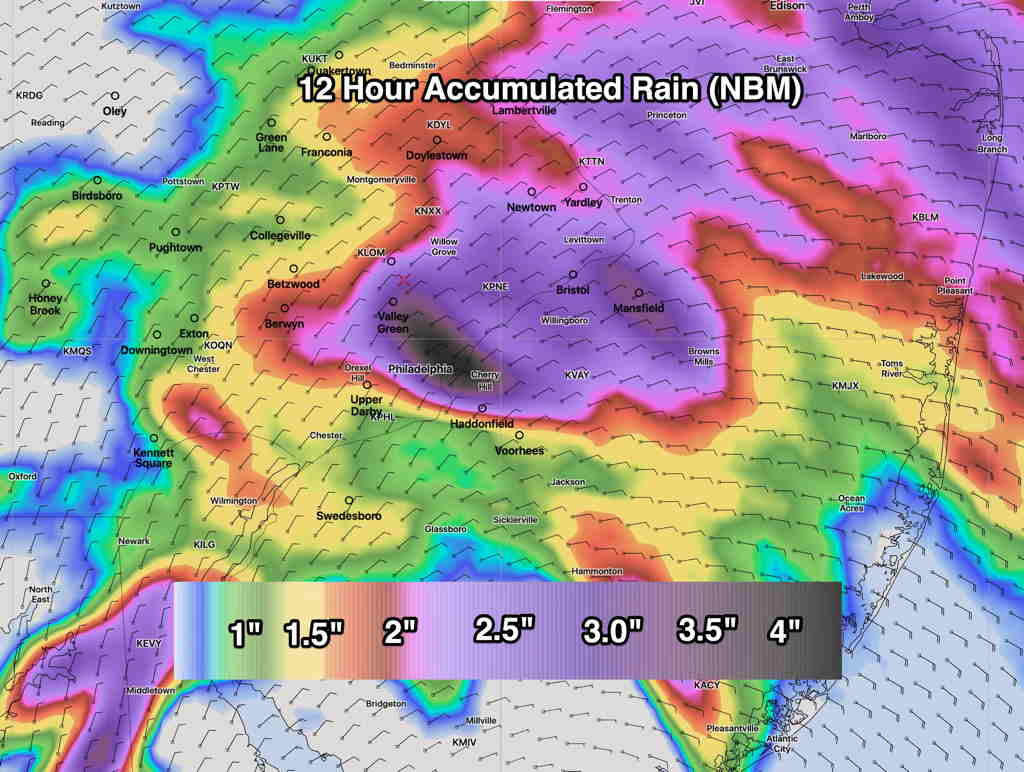
Updated Fri 09:49 AM —Updated with latest Model Blend (NBM) from 8 AM this morning.
Updated NBM (8 AM run) accumulated rain forecast. (Click on image for a larger view.)
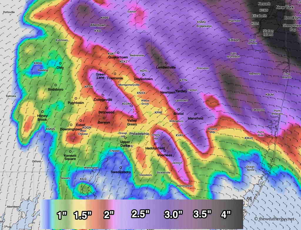
Updated with latest model blend (NBM) accumulated rain graphic.
The models that are run at 2 AM EDT (06z) continue with a similar forecast as last night. Rain will be starting shortly, if it hasn’t already started in your area. Precipitation amounts look to be a generalized 1.25-2 “ of rain with some local areas having 3-4”.(I’ll post a graphic shortly.)
Latest Model Blend (NBM) Accumulated Rain Friday. (Click on image for a larger view.)
The only change noted in the latest models is a tapering in the rain about 2 PM around here, vs the previous forecasts which had the moderate rain going into the early evening hours. It appears that the main slug of precipitation shifts northward into northern NJ and northeastern PA.
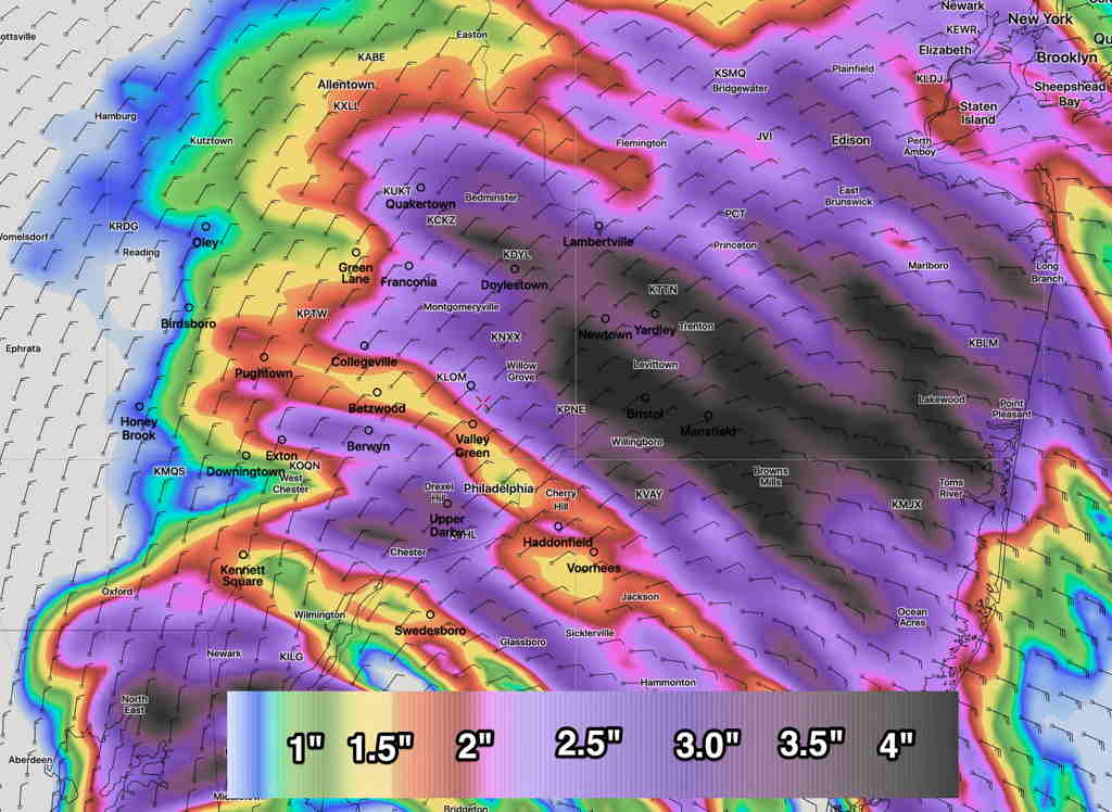
Here’s the most recent (06z) NAM NEST (High resolution) accumulated rain forecast with a somewhat different area of precip maximum:
NAM NEST Accumulated Rain forecast (Click on image for a larger view.)