Low pressure moving south of us Sunday night may bring some light showers, especially south of Philadelphia. That system departs around daybreak Monday and clouds break early for sunshine.
Monday will be mostly sunny. A small upper air disturbance brings some cloudiness early to mid afternoon, but sun returns after it passes through.
The model forecasts for Sunday have changed a bit since I posted yesterday.
Originally Sunday was expected to become sunny early in the morning. Today’s models are suggesting that considerable mid and high level cloudiness lingers into early afternoon as a weak trough moves through. Then some sun and partial clearing.
Some of today’s models had light, very widely scattered sprinkles around noon, and tonight’s early RAP model just becoming available shows that possibility too. Most of the models do not or keep the POP very very low. So, some uncertainty with tomorrow’s forecast regarding this.
High pressure builds in for Saturday as moisture ahead of the next weak disturbance moves in aloft around an upper ridge.
Saturday will be mostly sunny, although it appears that there may be a period of high cloudiness (cirrus) during the mid-day hours. Light winds about 10mph. High temp 70.8º sd 1.6º
The moisture moving in aloft around the upper ridge may result in some showers later Saturday night.
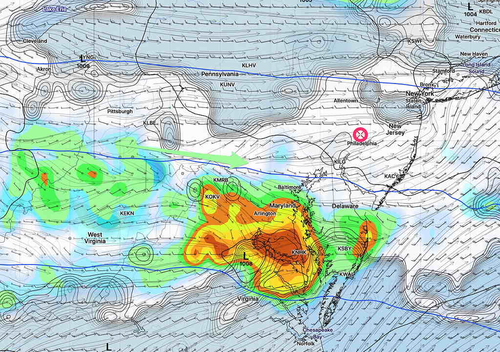
On Sunday, some sunshine expected by the late morning as the showers are expected to become suppressed to our south. It will become increasingly cloudy during the afternoon, as the upper flow becomes a bit more cyclonic and surface low pressure develops to our south. Winds 10 mph but a bit more gusty. High temp 76.0º sd 3.0º
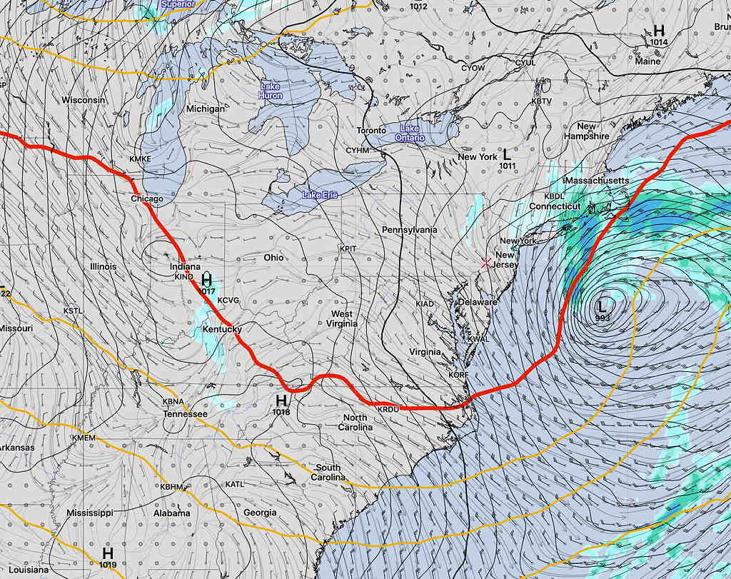
GFS Forecast 3 PM Sunday: Clouds, rain, wind. (Click image for a larger view.)