WEEKEND FORECAST UPDATE

[su_note note_color=”#ffffff”]Updated Sun 11:49 AM — This morning’s GFS data, just available, continues to show the convective precipitation to our south at 7 PM. (See the main forecast  update below.)

GFS Convective Precipitation forecast 7PM Sunday

[/su_note]

[su_note note_color=”#ffffff”]Updated Sun 10:34 AM — The newer high resolution models becoming available this morning continues with my forecast update just below.  The somewhat older NAM model just available still shows some convective activity possible in the afternoon—

Latest NAM model with convective activity shown in the brighter green/orange/yellow at 2 PM

[/su_note]

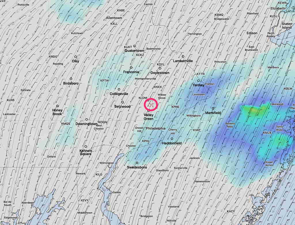
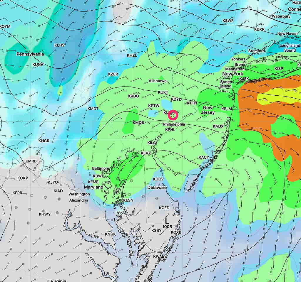
Last night’s models have backed away from the heavy rains expected in the Philadelphia area this morning.  However, light intermittent rain will continue through today.   Total QPF predictions of 1 + inches of rain have been reduced down into the 0.3-0.6 range.

High temp 53.0º sd 4.1º. (High spread uncertainty)

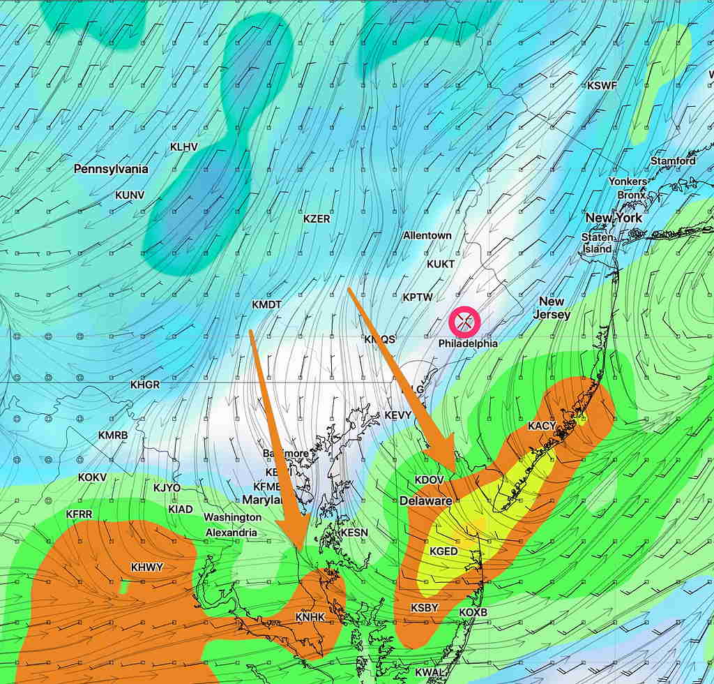
Additionally, there had been expected to be some convective activity (thunderstorms) in the late afternoon.  That activity is now predicted to be diminished and, if it occurs, will break out south of Philadelphia, closer to far south Jersey and Wilmington during the early evening.

The vertically stacked low pressure system causing this will be slow to depart and will likely affect our weather into Monday.

WEEKEND WEATHER FORECAST

[su_note note_color=”#ffffff”]Updated Sat 08:59 AM — The pre-dawn model runs are a little more optimistic about the sunshine today.   The GFS has only high level (cirrus) cloudiness until lower clouds move in later in the afternoon; the high resolution models have thicker mid-level cloudiness as early  as 2 PM.  More clouds far north and west, less cloudiness in NJ.   High temp 63.8º sd 1.5º.  Very light winds [/su_note]

Today’s rain lasted longer than forecast.

Tonight’s models suggest a change in the forecast for Saturday.  Saturday was originally expected to be mostly sunny for a good part of the day.

Tonight’s models are forecasting increasing cloudiness much earlier in the day.  Saturday may start sunny, but it appears that high and then mid-level cloudiness will start moving as early as 12 noon.  There may be some bright spots in the cloud cover mid-afternoon, but overall cloudy.  (New Jersey may have more sun.)

High temperature 63.5º sd 2.3º. Light winds.

Sunday will be cloudy with rain, heavy at times, especially mid-day.  High 55.5º sd 4.5º (high spread in possible highs)


FRIDAY FORECAST

[su_note note_color=”#ffffff”]Updated Fri 12:51 PM — Quick Saturday Outlook: The models becoming available now show a rather short period of sunshine for Saturday.  Some cloudiness Saturday morning  will break for sunshine, but clouds move back in from the west as early as 2-3 PM.  Light showers possible by evening. [/su_note]

[su_note note_color=”#ffffff”]Updated Fri 10:51 AM — Latest HIRESW has the showers continuing through 4 PM.[/su_note]

Low pressure will gradually move away today. The heavier rain tapers off from southwest to northeast about 1 PM but the latest HRRR still shows some light scattered showers as late as 2 PM.

Otherwise, cloudy.  High temp 51.1º sd 1.2º

HRRR 2PM Simulated Radar forecast. Click on image for larger view.