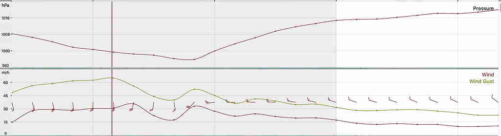
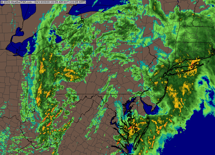
[su_note note_color=”#ffffff”]With the exception of the wind gust forecast which was a bit overdone for southeastern PA, the models did pretty good with the forecast, including the heavy rain, the lull in activity about 11 AM, and the frontal passage with thunderstorms in the afternoon. Highest wind gusts were in NJ.[/su_note]
For Tuesday, the front that had moved through here about 3-4 PM will stall to our south, while multiple impulses will move along the front during the week.
Tuesday will have periods of sun and clouds in the morning, but with increasing cloudiness in the mid to late afternoon. High 55º.
Revised Tue 09:30 AM —removed mention of snow for Wed morning.
Looking ahead to Wednesday, the first of several impulses moves along the stalled front. Some high resolution models have it cold enough for light, wet, (non-accumulating) snow early morning, with temps near 33-34º about 7 AM. Several other models have the upper atmosphere cold enough for snow, but suppress the precip to our south.
The latest NBM has temps closer to 40, likely eliminating that wet snow possibility. I’ll keep an eye on it.