
[su_note note_color=”#ffffff”]Today, Sunday, we had more clouds than most models had predicted. The warm front moved through on schedule, but clouds lingered on its heels from the advancing storm to our west. We had high temps of only 68-69º as a result.[/su_note]
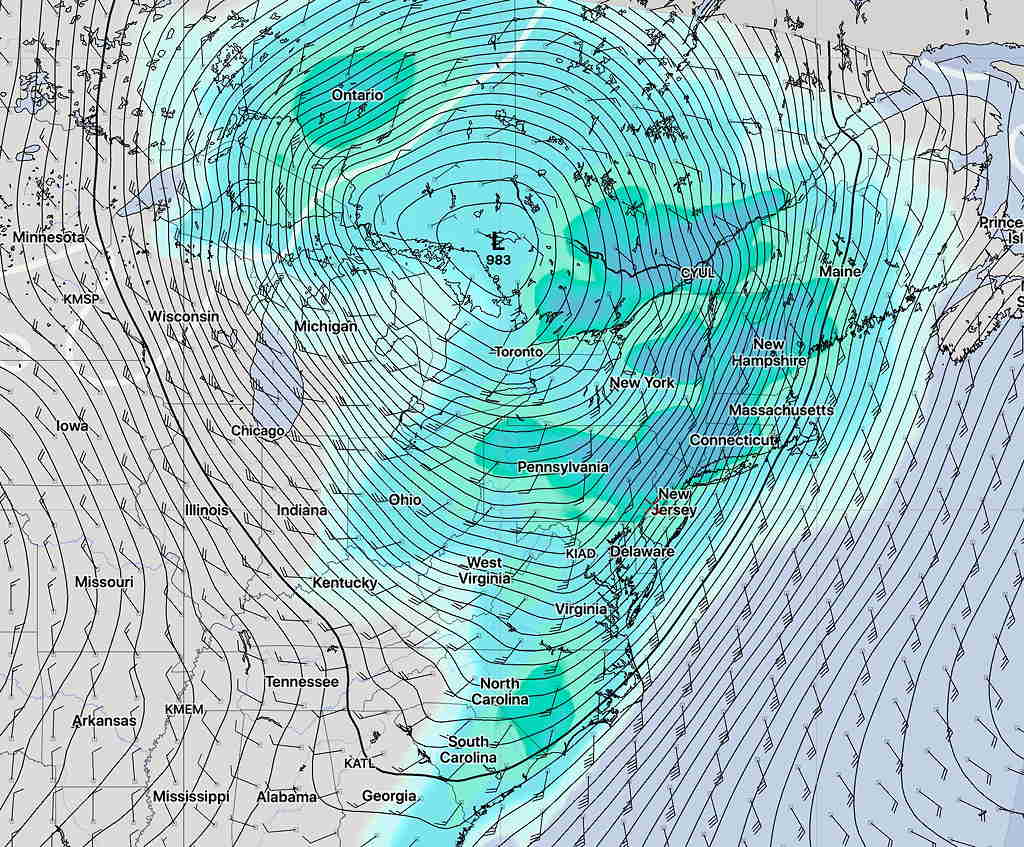
The models have been consistent in predicting a significant storm for Monday, starting this evening. A very tight pressure gradient between strong high pressure in the Atlantic and the advancing deep storm over the Great Lakes will bring very high winds and wind gusts to our area. These winds will likely cause damage.
Winds are expected to start increasing this evening and will hit maximums during the morning and early afternoon Monday.
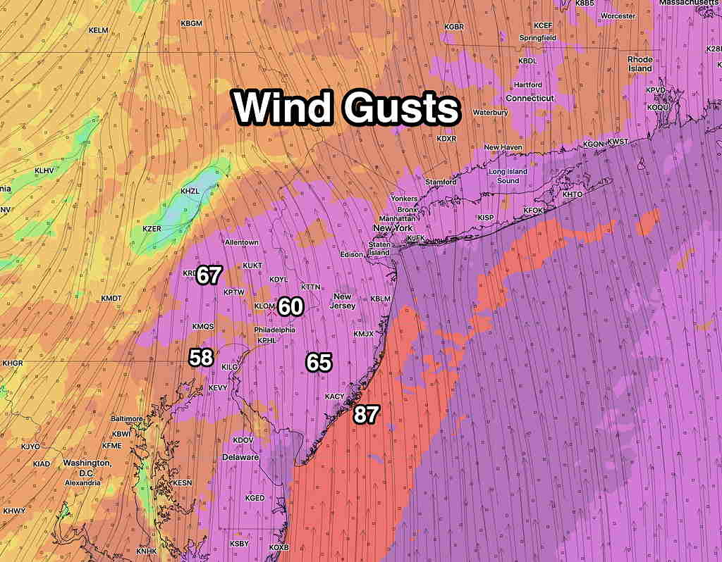
Wind gusts are predicted by various models to be in the 60 mph to 87 mph range!
The other aspect of this storm will be heavy rain and thunderstorms. Total precipitation is forecast to be in 1.5 -2 inch range, possibly localized higher amounts.
The tight packing of the pressure lines (isobars) is an indication of the steep pressure gradient, especially on the eastern side of the low.
The day will start stormy and rain with high winds will continue through most of the day.
Wild weather! Stay tuned.