This morning’s surface temperatures are already running 6-8ºbelow last night’s model forecasts.
Add some dynamic cooling if we get high precipitation rates and the rain forecast may be off. We’ll have to watch if a mix with or a change to snow occurs earlier than previously forecast.
It looks like the rain moves in about 10AM to noon on Friday. There’s still a good chance that wet snow mixes in (non-accumulating) between 4 and 6 PM and tapers off during the evening hours.
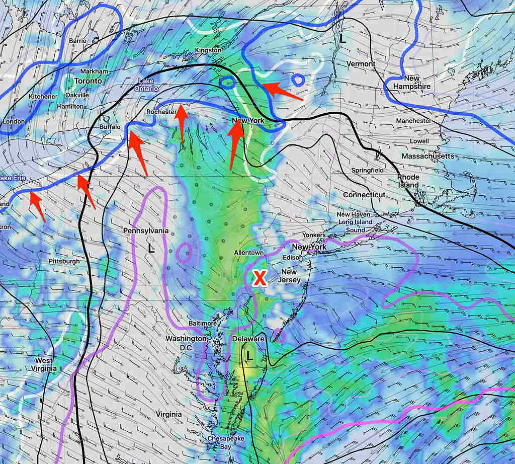
Here’s the latest High Resolution Ensemble Model (the version I lately prefer): the HIRESW-ARW MEM2. The arrows point to the lowest critical temperature line for snow moving through at 4 PM- 6PM—
HIRESW ARW-MEM2 Simulated radar Forecast for 4 PM Friday with arrows pointing to 975mb freezing line.
Last night’s models continue with the premise that the lowest layer of the atmosphere (from 1500-2000 feet above ground level) will be above freezing during the day tomorrow, preventing us from getting snow or having any snow that forms above melt before we see it.
All models have us getting rain rather than snow from Allentown south and east due to this shallow warm layer.
However, temperatures above this lower shallow layer drop off rapidly, to well below freezing at 3000 feet and above. This may be important.
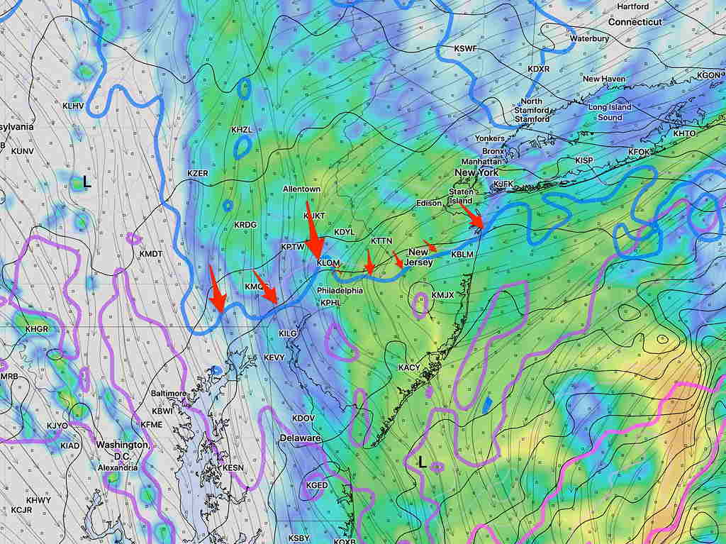
Latest NAM model Simulated Radar 1 PM Friday. Critical temperature at 1500 feet is the blue line with the red arrows.
A notable model change is a forecast increase in amount of total accumulated precipitation (0.4 -0.6 inches water) and the rate of precipitation (PRATE). .
With the higher PRATE, dynamic cooling may bring the cold air aloft down to the lower layer. The models don’t seem to account well for dynamic cooling.
We’ve all seen forecasts where rain in predicted, but we get rain mixed with snow or even non-accumulating snow. This is a possibility tomorrow, especially later in the afternoon and evening.
I’m always reluctant to go against the models. But you people read this blog to get another perspective. So expect rain, but if we get rain mixed with snow or even non-accumulating snow, it won’t be a surprise.