For Monday, a low pressure system moving in from the west will spawn development of a coastal low.
Light precipitation arriving before daybreak Monday will fall when surface temperatures (actually temps are measured 2 meters above ground) will be above freezing in our area, but areas north and west will have temperatures aloft cold enough for some snow.
NO SNOW near Philadelphia or the immediate suburbs expected.
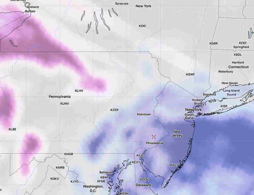
Here’s the snow “critical thickness” lines (red, purple) for 5 AM Monday morning —
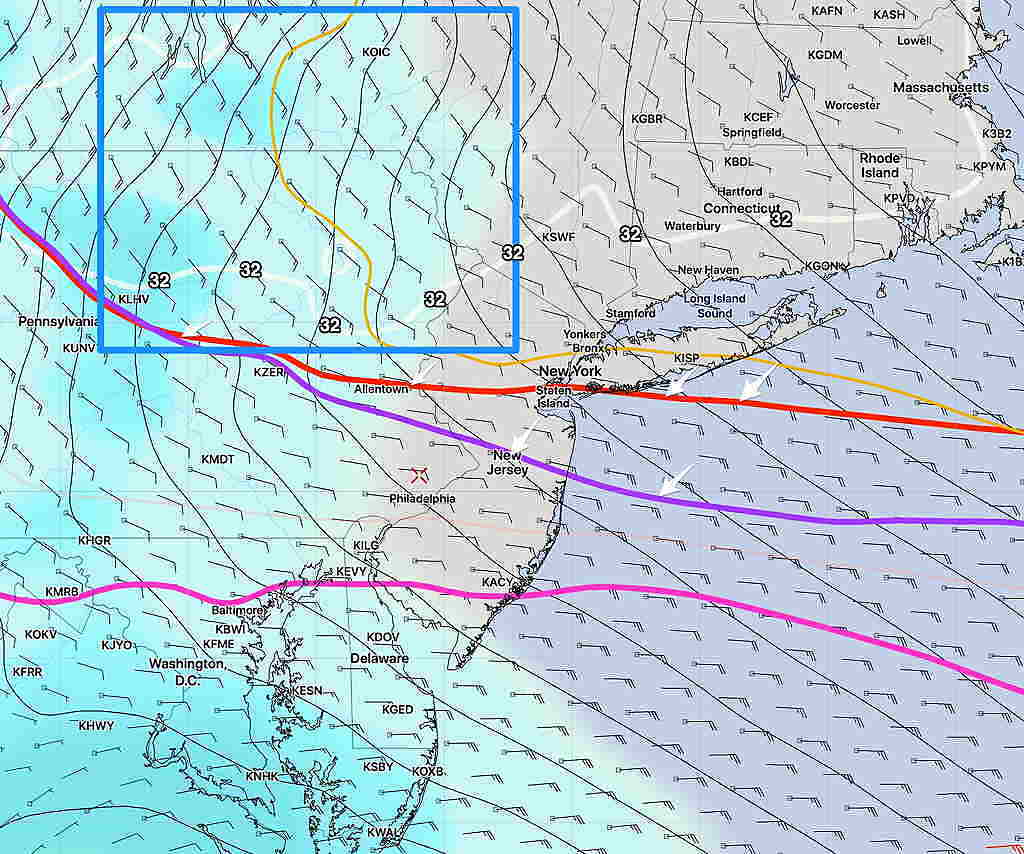
Short Range Ensemble forecast- Snow “critical thickness” lines (arrows) are north of our area. Too warm for snow. Notice the 32º temperature line (white) is well north of our area. The blue box is the general area for any snow.
National Blend of Models snow accumulation forecast 6 AM —
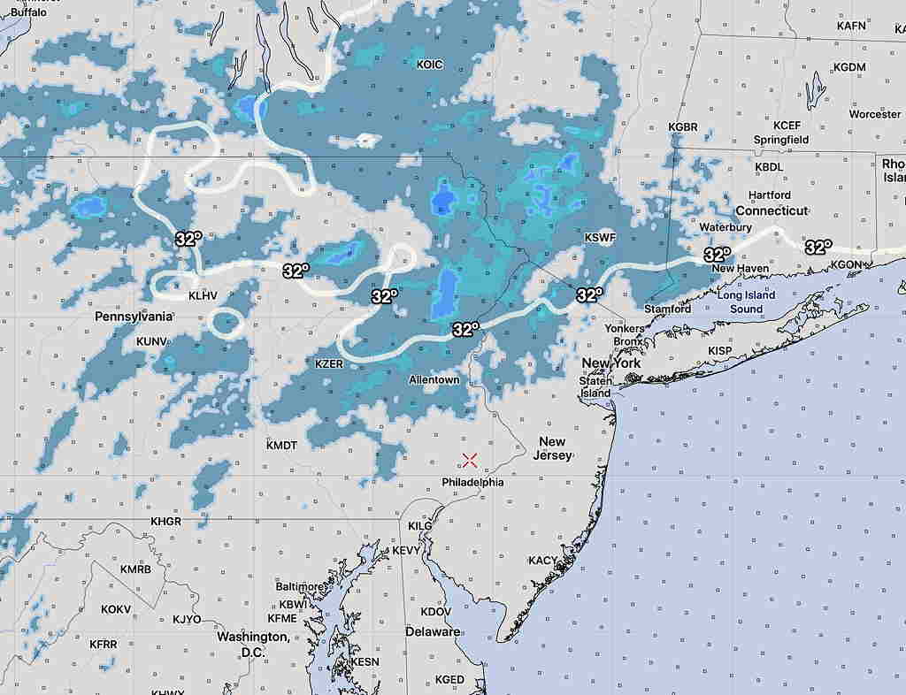
National Blend of Models (NBM) showing light snow (less than 1 inch) shaded with 32º temp line at 6 AM Monday.
Brief update— Clouds are breaking for sun, about 2 hours later than had been forecast. Sun today with highs temps 50-52º.
This morning’s models are coming available and it looks like the easterly wind flow for Sunday may result (as mentioned) in more low-level cloudiness on Sunday than previously thought. So periods of cloudiness and some sun for Sunday. High temps 48-50º.
Monday is looking to be a very rain day. Total QPF 1.5- 2.0 inches of rain.