RAIN ENDS EARLIER ON SATURDAY- STILL MILD SUNDAY

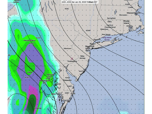
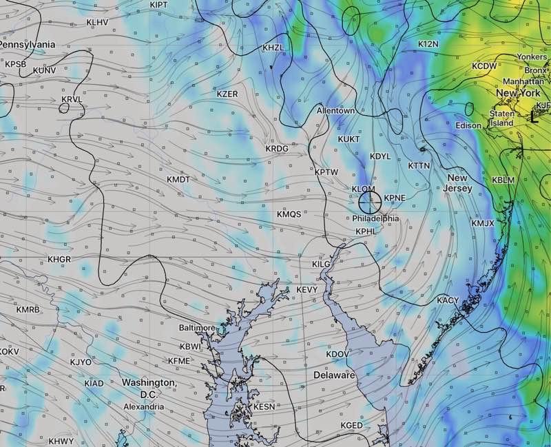
Updated Fri 11:15 PM — Forecast from earlier still holds.  Here’s the latest simulated radar depiction from the HIRESW NMMB2 showing rain exiting at 2 pm Saturday:

HIRESW NMMB2 model Simulated  Radar 2PM  Saturday 

The latest models have come in and heavy rain is still forecast for the Philadelphia area.  Depending upon the model, anywhere from 1.5-2.0 inches of rain will fall over most of the area between 7 AM and 2-4 PM!

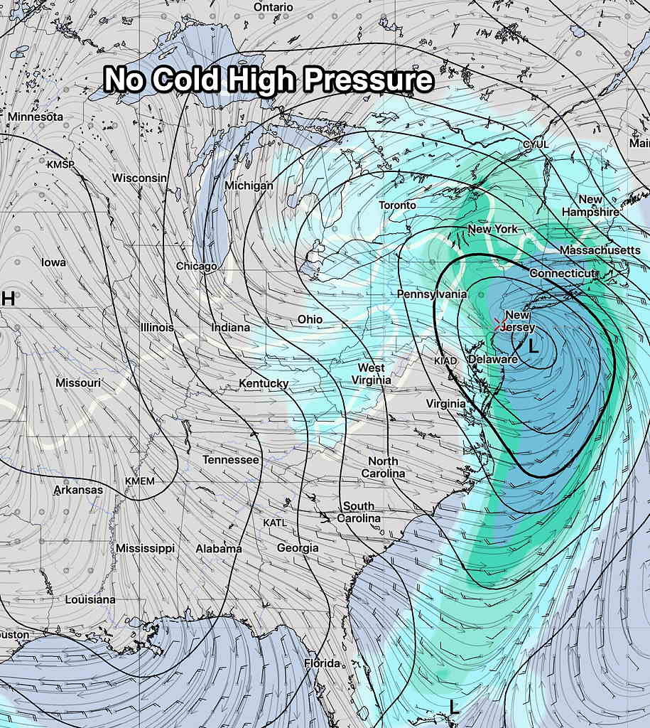
But there are changes— the models have the rain ending between 2 and 4 PM on Saturday.  There may be some clearing skies very late in the afternoon. (Previously, the rain was expected to end later.)  It will be mild on Saturday, with high temps near 57º!

Sunday will be sunny in the morning, with cloudiness moving in during the mid afternoon as an upper air disturbance rolls through.  It will be mild for January, with high temps near 49º.

HEAVY RAIN FOR SATURDAY

The models have been consistent in their forecast of heavy rain for Saturday.  The latest GFS model cranks out almost 1.8 inches of rain  right over us during the daytime hours, starting daybreak and ending early evening.  Mild with high temps in the 50s!

Here’s the latest PRATE (precipitation rate) forecast from the GFS—

GFS Forecast PRATE forecast GIF for Saturday. Click for larger image.

(If a picture is worth a thousand words, a .GIF file is worth a bit more!)

Sunday looks to be sunny, but some upper air disturbance may bring some clouds in the afternoon.

Things still look quiet, snow-wise.  There’s a possibility next weekend, but the models aren’t all-in on this.


WEEKEND WEATHER OUTLOOK

High pressure dominates the east coast today.  Despite the very cold temperatures yesterday and today, a moderating trend will develop by the end of the week.  This high pressure system over us will move off the coast, but it will be blocking any storms from affecting us through Friday.

This Saturday, a coastal low pressure  system is expected to develop around Delaware Bay Friday night and move slowly northeastward through the day Saturday as an upper air low catches up with the surface low. The models are in remarkable agreement about this system right now.

Ordinarily, this would be a snowstorm for us but not this time.  What’s lacking, unsurprisingly for this winter, is a cold high pressure system to the immediate northwest.

GFS ensemble Precip rate  forecast for 7 PM Saturday.  White line is 32º surface temp line.

So Saturday will be rainy for most of the day, with QPF values near 1.00 inches water.

As the upper low moves into position, some cold air may be enough to provide some snow flurries late Saturday night, but temperatures are expected to remain above freezing.

Windy for Sunday!