MEMORIAL DAY WEEKEND WEATHER FORECAST

As discussed in yesterday’s Weekend Outlook, our weather this weekend will be influenced by an strong upper air high pressure centered over Georgia and Alabama. Areas of vorticity will rotate into our area around this upper level high.

The weekend’s weather will depend on the timing of these impulses and the models have been consistent in having the these disturbances affect us during the night time hours of both Saturday and Sunday.

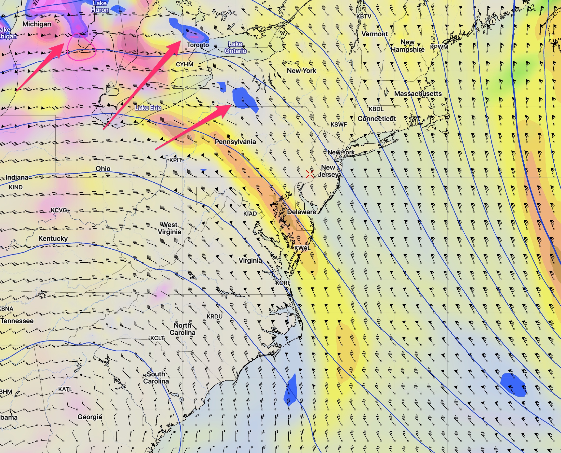
[su_note note_color=”#d9f2da”]It should be noted that at the time of this post, none of the models are predicting the showers in the northwest corner of Pennsylvania that are occurring now. The confidence level of this forecast is a bit below average.[/su_note]

WRF Model Depiction of Areas of Vorticity around 18,000 feet 1 PM Saturday with their direction of movement (red arrows)

Saturday will have a mix of sun and clouds.  High 78-80.  Cloudiness will be more prominent north and west of the city, less at the shore.  (The models differ in the amount of cloudiness.)  A south-southeasterly flow of moisture ahead of these disturbances will cause the cloudiness to thicken later in the day on Saturday.

The vorticity will drag a warm front over our area Saturday night. Light showers possible Saturday night; most of the rain far north and west of Philadelphia.

Sunday:   After some early morning clouds, Sunday will become mostly sunny and very warm.  High 88-90.

However, another upper air disturbance approaches from the northwest  with increasing  cloudiness on Sunday afternoon.  It will drag a cool front through our area Sunday night.

Showers develop late in the day or the evening Sunday, again mostly far north and west of the city.  (The models differ in the amount of precipitation- the GFS keeps us dry, the NAM has showers.)

A northwesterly flow of drier, somewhat cooler air in store for Monday.

Monday: After some early clouds, Monday will become mostly sunny and pleasant. High 84-86.

[su_note note_color=”#d9f2da”]Friday Afternoon’s GFS has much more cloudiness on Monday than the NAM. Will need to update over the weekend.[/su_note]

MEMORIAL DAY WEEKEND WEATHER OUTLOOK

A strong cold front will move through Thursday evening.  Heavy thunderstorms, especially in the far northwest suburbs (Allentown) are possible from late this afternoon and especially between 8 and 11 PM Thursday evening.   Winds will be gusty to 40 mph.

High pressure builds in behind the front for Friday.  Friday will be sunny, windy and cool.  High 73-75

A unusually strong upper air high pressure system will center itself over Alabama and Georgia this weekend.  Around this upper air high pressure system, areas of disturbance, rotation, (“vorticity”) or eddy currents will rotate around this upper high, bringing us breaks in an otherwise fair weather pattern.

Upper Air Forecast (500 mb  approx 18,000 Ft) for Saturday showing areas of negative vorticity (blue).

Saturday will be sunny and  warm.  High 88-90. 78-80. An area of vorticity will  approach Saturday night. Showers are possible, but the upper air confluence of flow will cause much of the precipitation to fall apart as it gets to our immediate area.

Sunday:  Skies will clear by Sunday morning. Sunday will be sunny and very warm with highs 88-90.   Clouds increase mid-afternoon as another, stronger area of vorticity and a weak cold front approaches Sunday late afternoon.  There’s a chance of showers late afternoon Sunday, especially west of the Philadelphia area.   Some showers will make it into Philadelphia by Sunday night.

[su_highlight]Currently, the greatest uncertainty in this forecast is the extent and timing of the showers Sunday afternoon and evening.[/su_highlight]

Monday: The front moves off the coast and skies clear during the morning, later at the shore.  Delayed clearing possible southern shore areas.   Sunny.  Light winds.  High 83-85.

I’ll be updating Friday night, as usual.