This post will be a ongoing collection of observations and thoughts about the upcoming weekend weather.
Wed PM – Tonight’s NAM shows no thunderstorms for Thursday and highs near 82. Tonight’s NAM has the rain tapering early Sunday morning.
Wed AM – Very warm on Thursday. Looking towards the weekend, it looks like an easterly flow will keep temperatures not as warm as previously expected. It appears that most of the periods of rain will occur during the nighttime hours, although it may linger into Sunday morning.
Tues PM – Tonight’s NAM shows a change of forecast -The warm front that moves through Wednesday returns as a backdoor cold front Thursday night. Friday not as warm as previously thought.
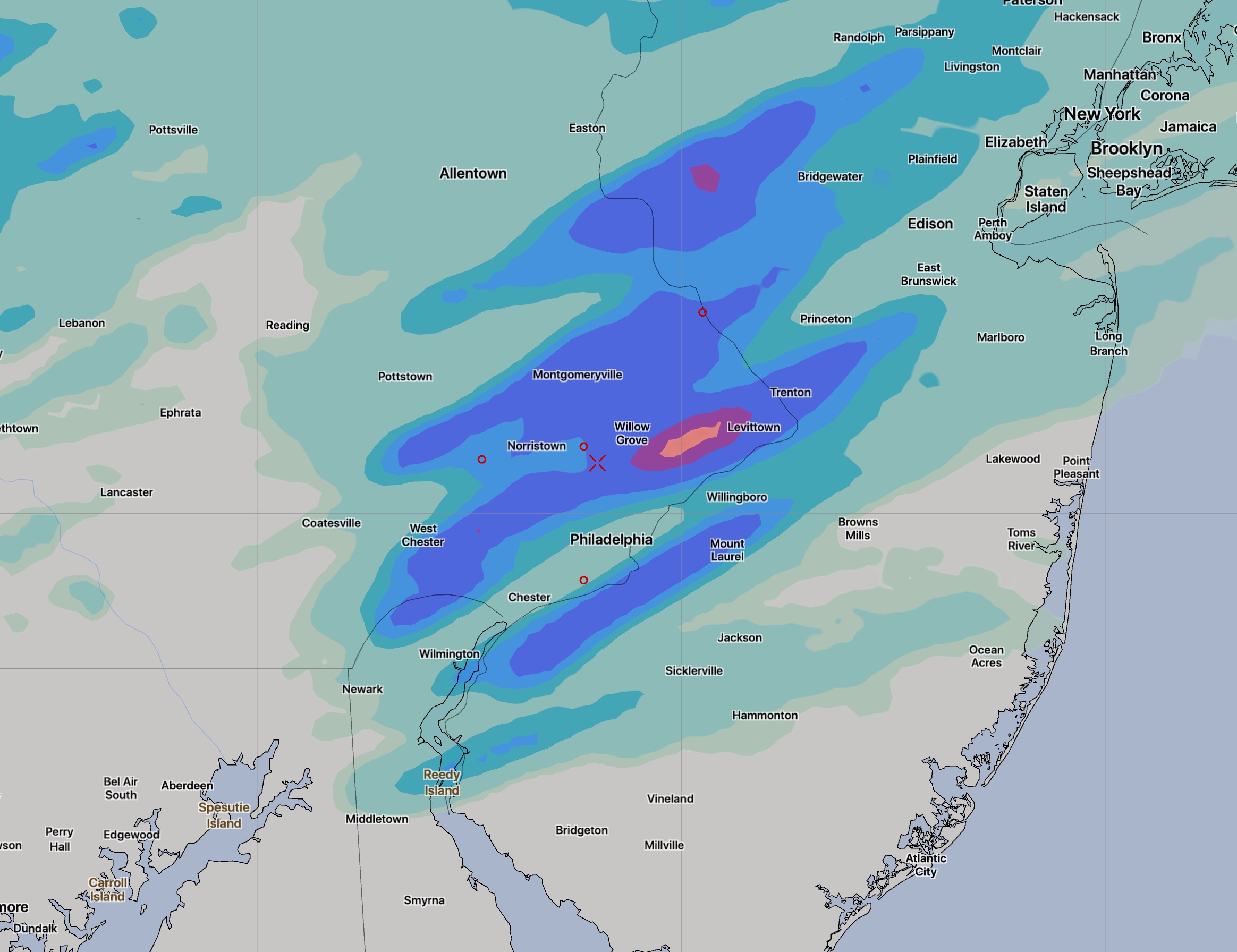
Tues AM -A warm front will slowly move north of our area on Wednesday, opening up a flow of moist, warm air from the southwest. Weak impulses embedded in this southwesterly flow will give us a chance of showers Thursday through Sunday morning. The main low pressure system is expected to move over our area on Saturday night.
So, there’s a chance of showers almost every day, according to the EKDMOS. We are getting into the season where the normal “background probability” is about 20-25%, but this is looking higher.
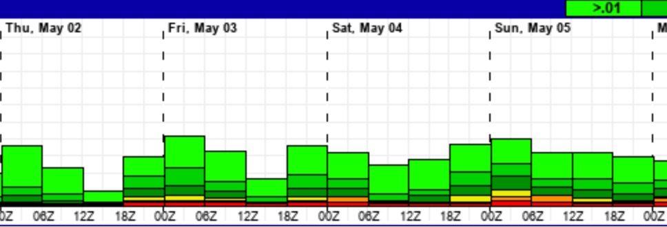
Temperatures may reach into the mid to upper 80s on Thursday. Reviewing the FV3-GFS, we may be lucky and the showers occur mostly during the evening and night time hours.