WINTER WEATHER UPDATE SAT 5PM

This afternoon’s NAM model just became available. This is the “off hour” model run that does not include new weather balloon upper air (radiosonde)  data.

Here are the changes—Temperatures are warmer and precipitation ends earlier, about 4 AM Monday. Precipitation starts about 4 PM Sunday, probably as snow or a mix.Temperatures at the surface are above freezing, so the first amounts won’t accumulate very much.

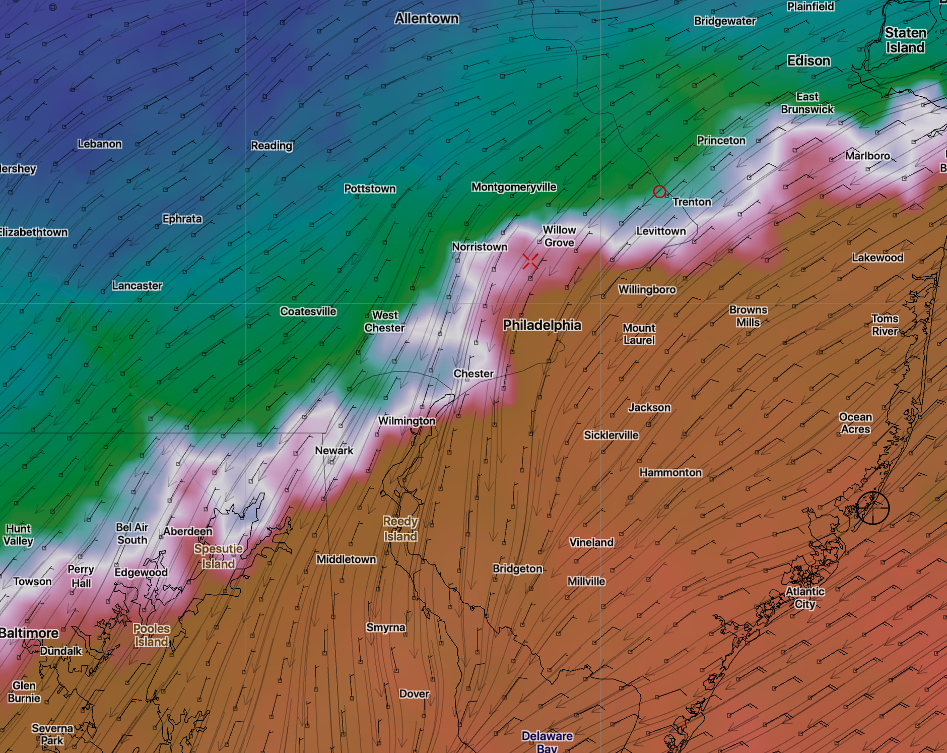
Temperatures at critical levels of the atmosphere become too warm for snow about 8:00 PM in Philadelphia and move north.

8:00 PM Critical Temperatures

The warm air aloft moves north to a position shown below by midnight. This is the northern extent of the sleet/rain line.

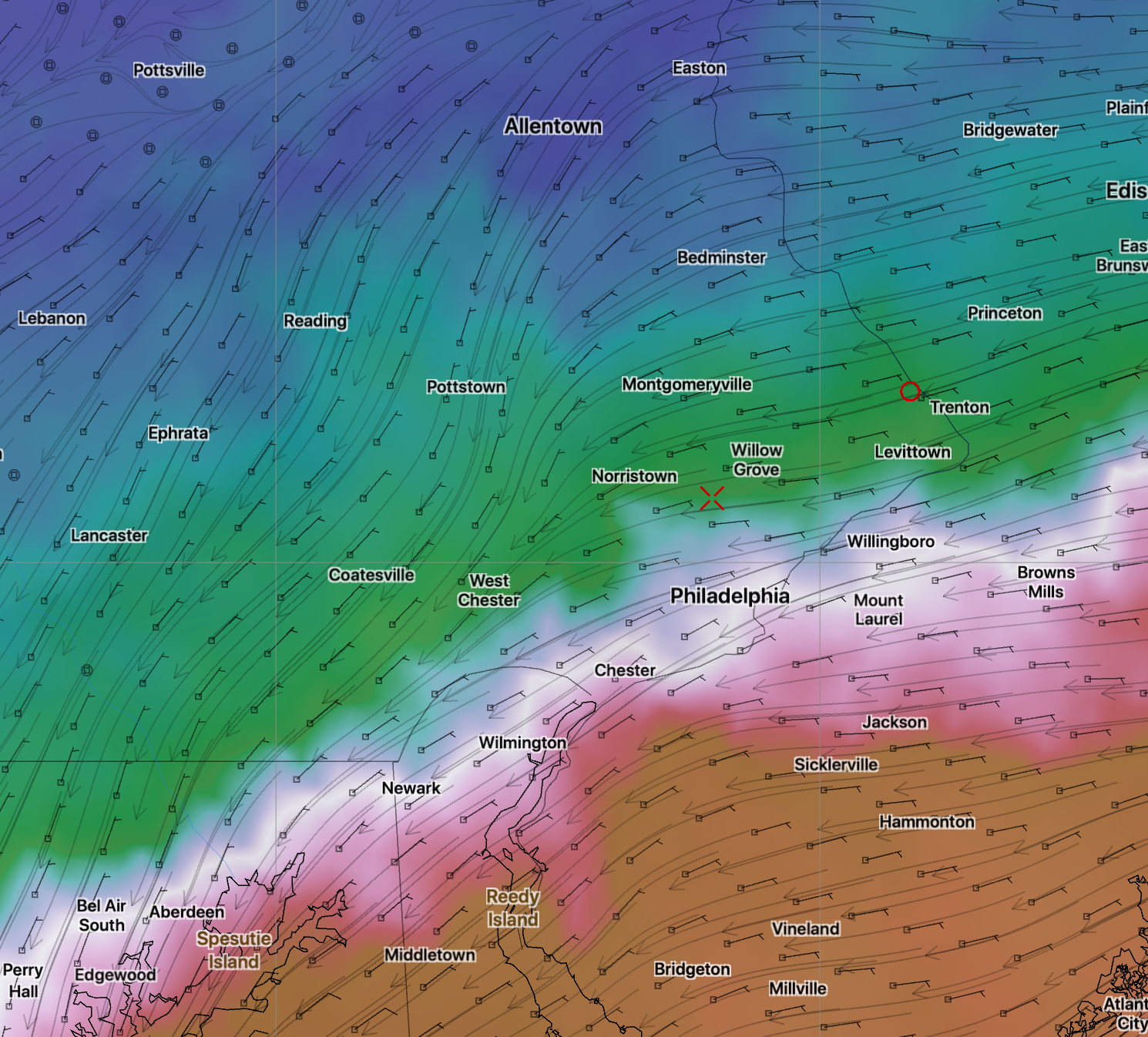
Areas  north and west of the white line below are all-snow for the storm: 

Midnight Sunday critical temp- Maximum northward movement- white line is transition line

By 2 AM, cold air line moves back through Philadelphia:

Sunday 2 AM critical temp

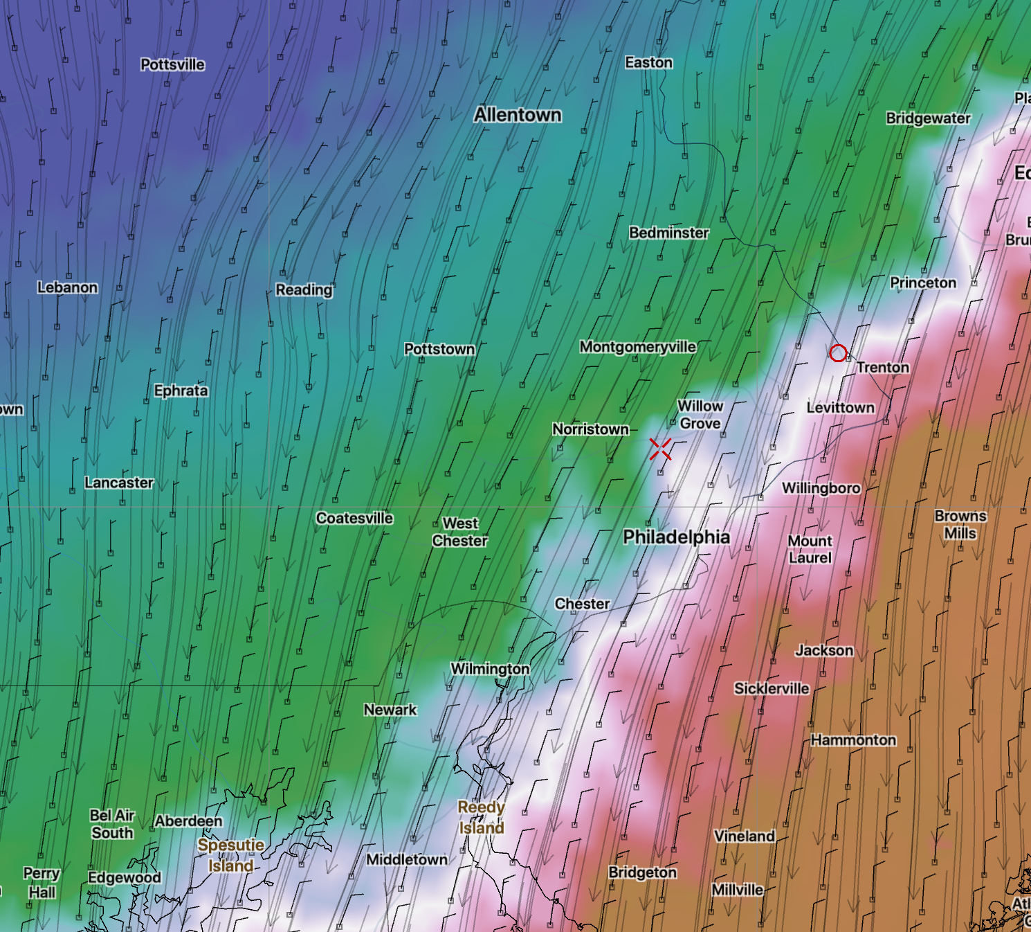
[su_note note_color=”#d9f2da”]So this means that between 8:30 PM and 2 AM, areas below the white line in the middle graphic are a mix of sleet and rain instead of snow.

This will seriously limit the snow accumulations in the immediate Philadelphia area. Combine this with marginally freezing surface temperatures in the 32-33 degree range means limited snow.[/su_note]

This is an off-hour run.  We really will need to wait until Sunday morning’s model runs for the final call.


WINTER WEATHER UPDATE -SAT 11 AM

I’ve been reviewing the latest NAM and GFS data.  Here’s the latest on the expected storm for Sunday afternoon into Sunday night.  Total QPF values 0.50 GFS and 0.74 NAM

Basic scenario: snow to sleet and rain in the city, then back to snow. Details below:

Precipitation starts as wet snow in the afternoon, about 2-4 PM.  Initially, surface temperatures are above freezing in areas near the city, preventing accumulation.  Temperatures  then drop due to dynamic cooling and there’s some snow accumulation in the city.  However…

During the early evening, the snow in the city will mix with and change to sleet and rain.  By 9 PM, it will be mostly rain and some sleet in the city.  The northern extent of this changeover is depicted in the following map at 10 PM:

Northernmost extent of changeover to sleet at 10 PM Sunday night is depicted as white line.

North of this white line, snow continues throughout the storm.

South of this white line (10PM), the sleet and rain will gradually change back to snow about 12-1 AM  and will continue as snow until morning.

North, the QPF values are less, but the temperatures are colder; calculations for the snow totals become a bit complicated.

North of this white line, final accumulations will be 4-8 inches.

South of this white line, the final accumulations will be 2-5 from the city northward.  These are preliminary estimates.

This is a complex storm. We won’t have a final handle on the thermal profiles  and final QPF until tomorrow morning’s model runs.