WEEKEND WEATHER FORECAST

Low pressure will move up from the south and intensify somewhat as a coastal low on Saturday.  As mentioned in my post earlier this week, this would ordinarily be a snowstorm here, but the lack of cold air will make this a rainstorm.

Saturday will be rainy through most of the day, tapering late afternoon and ending early evening. High temperatures 46-48.  It will be somewhat windy.

Things dry out for Sunday.

Sunday will be mostly sunny, windy and cooler.  High temperatures 44-46.   (Average highs now are 39.)

[su_box title=”Forecast Update Saturday 11 PM” box_color=”#defcdc” title_color=”#000000″]Sunday forecast looks to be cloudy in the morning with sun breaking out in the afternoon. Temperatures chill down for Monday (Highs in the 30s) with a brief warm up Tuesday (High near 50); Temperatures chill down again Wednesday night into the weekend. [/su_box]

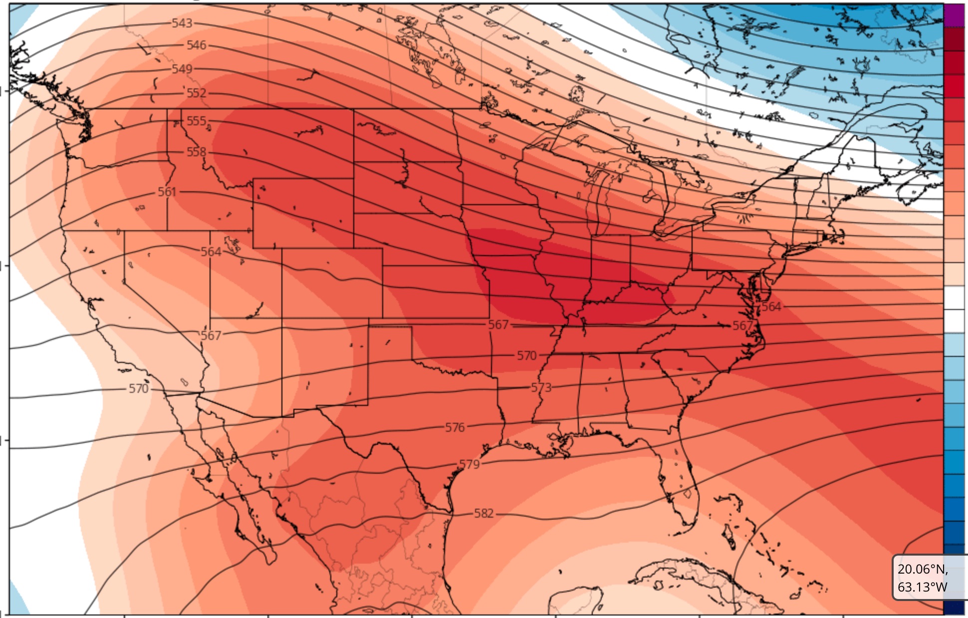
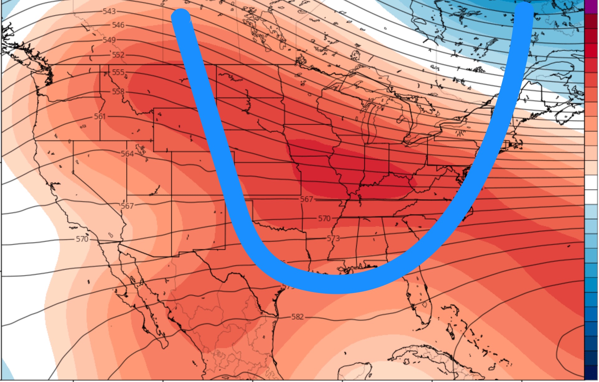
[su_note note_color=”#d9f2da”]The medium range models are showing some winter-like cold air moving in Wednesday night into Thursday and lasting into the weekend. This dip in the jet flow will primarily affect the eastern and northeastern sections of the US.

After another warmup, the overall weather pattern is expected to gradually change into a much colder pattern during the third and fourth week of January as a mass of colder air moves down from Canada into the central US.  [/su_note]

WEATHER OUTLOOK

Two more rain storms forecast for this week –one Thursday (possibly missing us, staying to the south) and on Saturday.   The Saturday storm may be a nor’easter, but the lack of cold air makes this an atypical nor’easter for January.  It looks like rain!

The current weather pattern is quite anomalous for January.  There’s little evidence of deep intrusions of cold air into the  continental US for the first two to three weeks of January!

There will be short duration cold air intrusions  into the Northeastern US which will alternate with mild air and wet flows from the southwest.

The current climate model forecast captures this nicely:

CFS Forecast for the first week in January (areas in red/orange are above average upper air heights associated with above normal temperatures.)

What we need for winter to return is for the height contours (shown in black) to take the following configuration, (shown in blue.)

Blue line drawn shows typical configuration for cold air intrusion in January

Obviously, there  would have to be giant changes in the current weather pattern to support my early December climate forecast of significant cold weather and significant precipitation.  I’m not very confident about that forecast at this time.

So enjoy the relatively mild weather!

The current long range climate models show colder intrusions around the third to fourth week in January, a time when we usually get the “January Thaw”.