I was interviewed yesterday by Mónica Zorrilla at BillyPenn.com who had questions about about why Philadelphia Center City often gets lower snowfall totals. She also had some other questions about weather and climate. Read the article here.

I was interviewed yesterday by Mónica Zorrilla at BillyPenn.com who had questions about about why Philadelphia Center City often gets lower snowfall totals. She also had some other questions about weather and climate. Read the article here.
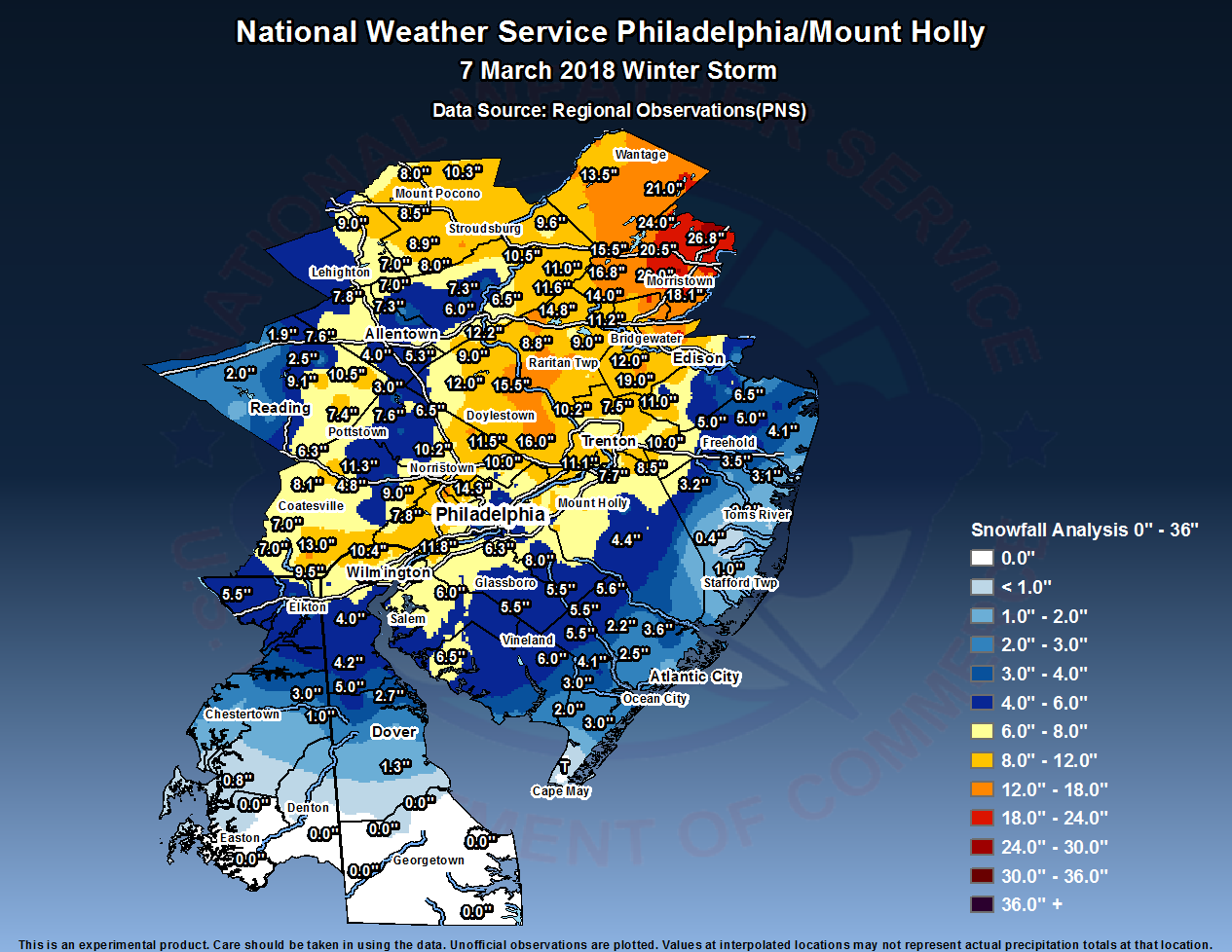
An interesting snowstorm, with some aspects forecast correctly and others not.
On the plus side—
Interestingly, the Kuchera algorithm NAM snow totals and axis from last night was probably the most accurate!
What was off on the forecast—
I’m ready for spring!
Well, the snow happened. Current short range forecasts (HRRR model ) show it ending in the Philadelphia and immediate surrounding areas between 4 and 6 PM. An additional 4 inches of snow is possible in some areas near PHL from 2 PM until ending.
Here’s a doppler radar summary depiction of storm total QPF that has already fallen with this storm. (Water value in inches.) It shows the precipitation maxima locations, which with this storm is not the same as the snowfall total maxima locations– areas with the highest QPF in this storm likely had much of the early precip as rain.

There’s still more snow to go.
[su_note note_color=”#ebf2d9″]One thing that the forecasts got wrong (luckily) was the winds and wind gust forecast. The winds have been extremely light, avoiding the power line issues. Hopefully it stays that way. Current GFS LAMPS forecast has only light winds with no gusts tonight. That said, wind forecasts are often the least accurate part of a forecast. [/su_note]