Updated Sun 10/02 11:12 PM —Tonight’s early models are showing the remnants of Ida have become a closed upper low that will meander near our area through late Tuesday. Monday may see a reduction of the rain from Philadelphia and westward, but rain rotates back in on Tuesday. The ECMWF is showing several inches of rain possible in some areas on Tuesday. I’ll be updating this interesting setup tomorrow
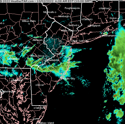
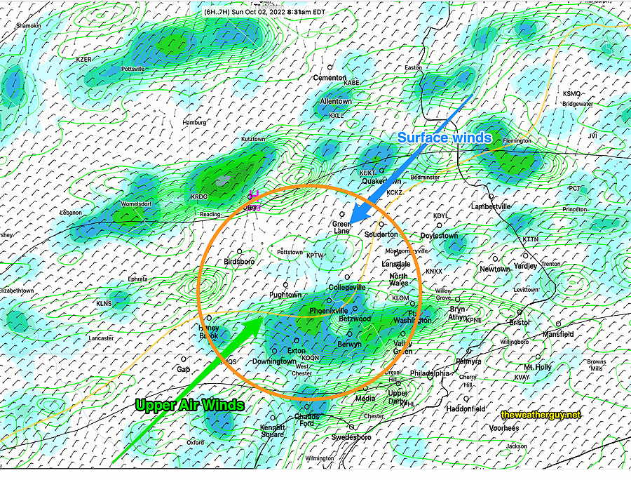
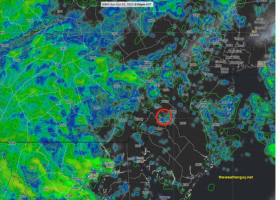
Update Sun 10/02 @ 8:42 AM — Fascinating convergence zone has developed over us—
Radar at 7 AM shows area of converging winds (Click on image for a larger view.)
06z HRRR forecast for 8:30 AM shows surface winds. I’ve added the notations of the direction of the upper air winds Also visible is the wavy light orange “500-1000 thickness line” showing a small scale ‘wave‘ over our area. This convergence and wave are causing the rain. This feature is forecast to move slowly eastward over much of Philadelphia for the afternoon. (Click on image for a larger view.)
Unfortunately, the Eagles game looks like it will be played in the rain (and wind.)
Updated Sat 10/01 10:41 PM — Tonight’s models are now forecasting that even Sunday morning will have some light drizzle or rain. Rain increases in coverage and intensity during the afternoon. It looks like a wet day at the Linc.
Update Sat 10/01 @ 4:07 PM — Today’s models suggest a dry period before noontime on Sunday, but additional rain will fill in between noon and 2 PM as upper disturbances rotate in around the upper low. The HRDPS captures this —
Forecast Review— We had the break in the rain mid to late morning, but the HRRR was overly optimistic forecasting breaks in the clouds.
Update Sat 10/01 @ 9:41 AM —We had some much needed rain last night. Here’s estimated accumulations according to the MRMS—
MRMS 24 hour estimated rainfall through 9 AM today. Orange contours are in millimeters 25.4 mm =1 inch (Click on image for a larger view.)
The models have the showers tapering off this morning. The latest HRRR even shows some breaks of sun around noon in a few areas—
12z HRRR shows some breaks of sun in a few areas around noon. A few scattered showers, little additional rain during the day. Rain returns about 9 PM.
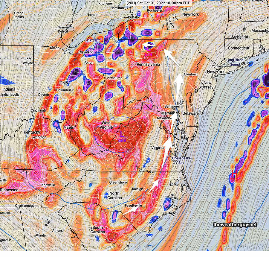
The rest of the weekend will be influenced by the upper atmospheric remnant of Ida, currently in West Virginia
Areas of vorticity (eddy currents) will be rotating around the main mid-atmospheric low. These vorticities trigger the showers as the rotate through. Timing them can be difficult.
Mid atmosphere (500 mb level) GFS forecast of absolute vorticity rotating around mid-level low pressure near West Virginia. Like a spinning top, this upper low will wobble and have precessional motion that will be difficult to accurately forecast.
The next wave of significant showers rotates through here about 10 PM tonight. That break in the action Sunday afternoon as previously forecast, is looking less likely.
Updated Fri 9/30 10:42 PM —Tonight’s NAM-NEST and HRRR have some gusty winds (40mph) and thunderstorms possible about 5-7 AM Saturday morning. Then, just occasional scattered showers and dark clouds, windy.
Update Fri 09/30 @ 6:45 PM — Incredibly, the latest ECMWF still has a break in the rain for Sunday afternoon.
ECMWF precip forecast for 2 PM Sunday (Click on image for a larger view.)
Previously Posted Fri 5:49 PM —
The remnants of what was Hurricane Ida will affect our weather over the weekend. The main remnant of the storm will reside as a mid level low pressure circulation over West Virginia while a surface low spins up far off and east of the New Jersey coast.
Friday’s 12z GFS forecast shows rain away from the city at 2 PM Saturday. (Click on image for a larger view.)
The reason for the track of the Ian westward and the weekend near-stationery low pressure is a blocked weather pattern. This will break down only slowly, so unsettled weather will be with us through Monday.
Saturday
After moderate to heavy rain later Friday night, scattered showers and on and off rain will be with us Saturday. Low dark clouds and somewhat windy conditions will make indoor activities the preferred choice.
High temperature 59.9º sd 3.5º NBM model Blue Bell, PA
Sunday
The upper low in West Virginia will throw more clouds and rain towards us, so much of the same.
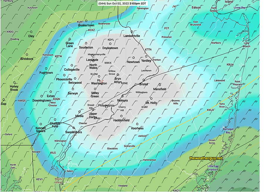
Several models that were showing a break in the rain Sunday afternoon have moved away from that forecast this afternoon. The NAM-NEST still shows relatively little rain in the city at 3 PM. The NBM shows more widespread on and off light rain in the afternoon.
NAM-Nest forecast for 3 PM Sunday (clouds- black) rain a1 hour accumulated (green contours) and simulated radar. (Click on image for a larger view.)
High temperature 58.4º sd 3.0º NBM model, Blue Bell, PA