
This coverage of Hurricane Ian focuses on possible effects of the storm on the Philadelphia area. Always base your decisions on the official NWS forecasts and the National Hurricane Center Advisories and warnings.
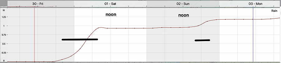
Update Fri 09/30 @ 10:56 AM — Latest ECMWF meteogram shows the bulk of the rain will fall late Friday night and some Sunday evening. Little accumulating rain for much of the weekend. But dark low clouds and windy!
Update Fri 09/30 @ 8:38 AM — Current upper air/water vapor image—

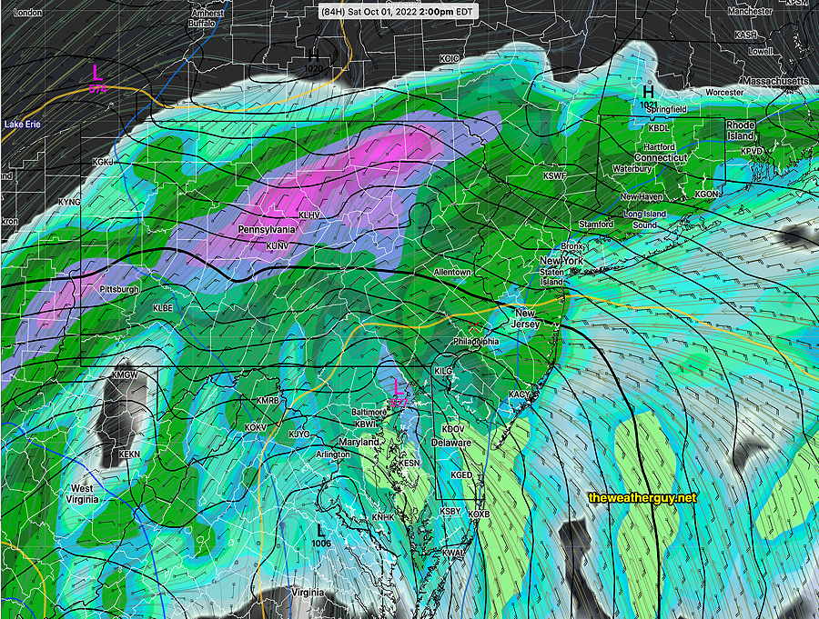
The latest GFS has the rain starting Friday evening. Most of the rain will fall before 8 AM Saturday morning, which is a significant change in the forecast. Mostly light showers for much of the day with low dark clouds.
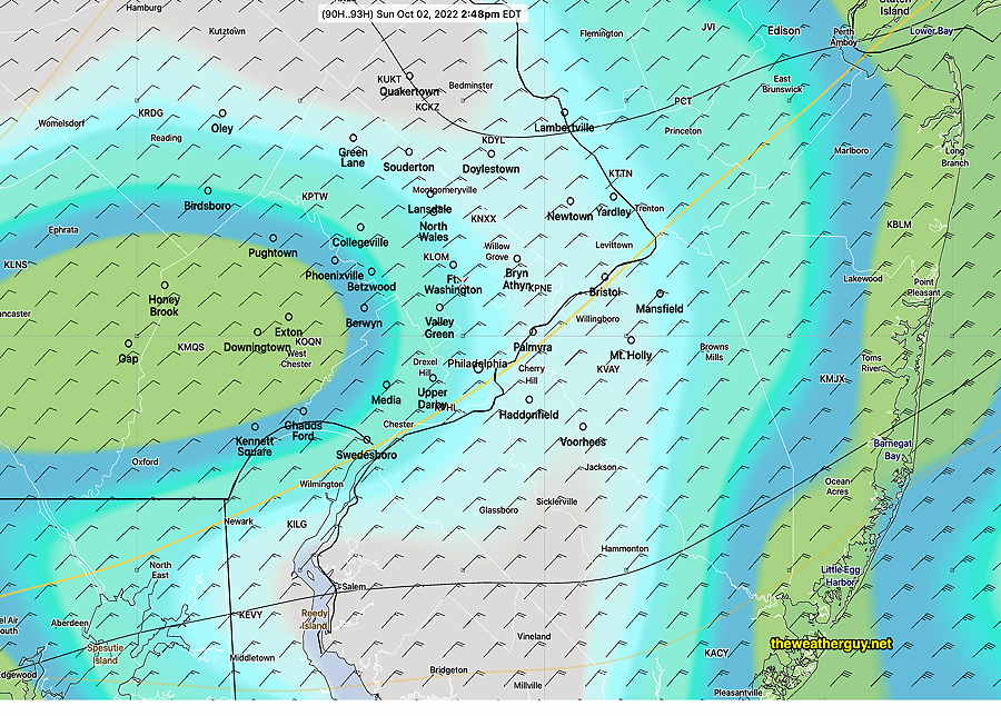
The latest GFS maintains a similar situation for Sunday with dark low clouds but with a break in the action—
See my regular Weekend Weather forecast later this afternoon or evening.
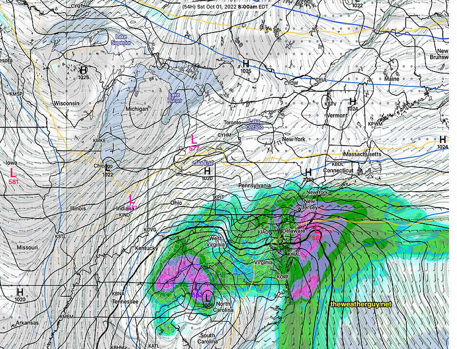
Update Thu 09/29 @ 8:09 PM — This afternoon’s models are converging on somewhat similar forecast for the weekend—
- Thickening clouds Friday. Rain moves in Friday evening
- Rain on Saturday, with occasional breaks in the rain. Cloudy and windy.
- Cloudy with showers Sunday morning. A possible break in the rain or reduction in the rain Sunday afternoon for the Eagles game. Cloudy cool and windy. Gusts to 35 mph.
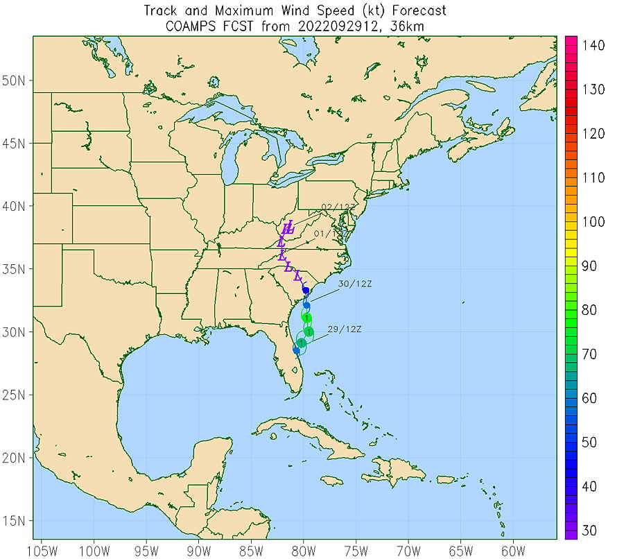
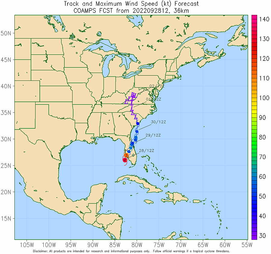
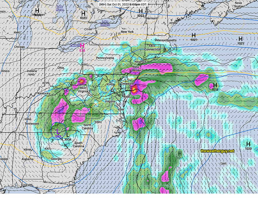
The basic track of the storm hasn’t changed appreciably. Here’s the current NAVY COAMPS model forecast—
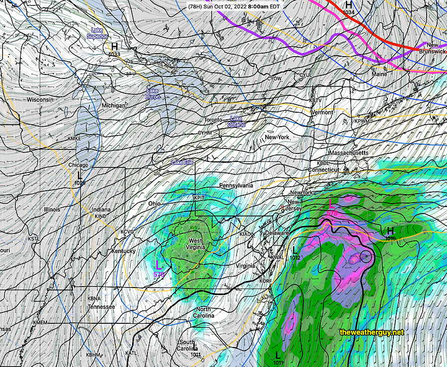
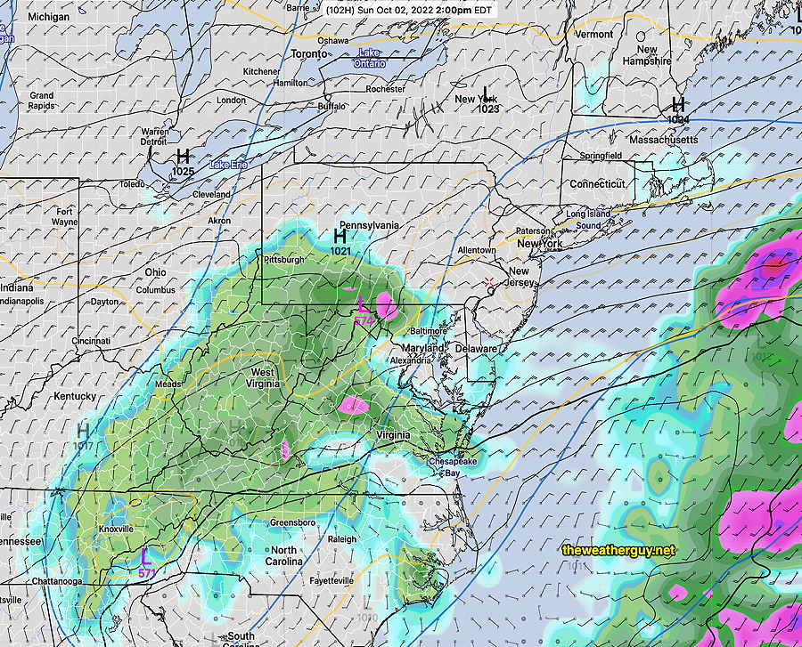
Of interest is the time Sunday afternoon time period. The latest NAM and GFS are remarkably similar in having a diminution in the rain during the afternoon hours. It won’t be dry, but the the rain should lighten.
Latest GFS forecast for Sunday afternoon—
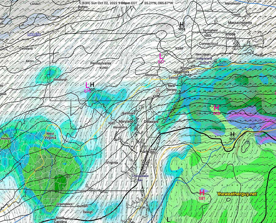
It should be noted that the ECMWF was forecasting this break in the rain for many model runs. It’s most recent run has backed away from this dry period, now forecast by the GFS.
Tropical systems are almost impossible to forecast precisely. Stay tuned.
Update Thu 09/29 @ 9:44 AM — Latest ECMWF continues with a break in the rain on Sunday afternoon. The ECMWF has been the most consistent with this Sunday forecast—
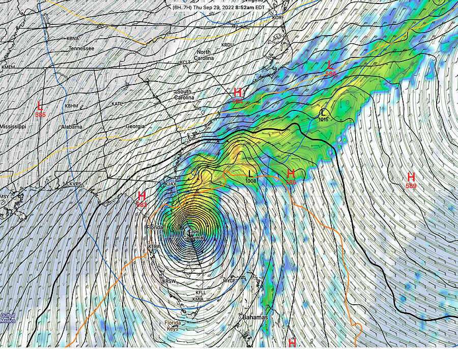
Update Thu 09/29 @ 8:18 AM — The current weather on Thursday morning in the upper atmosphere is captured best by the water vapor image (channel 09). An upper low will form where depicted below as the remnants of Hurricane Ian move inland due a blocking situation in the Atlantic—

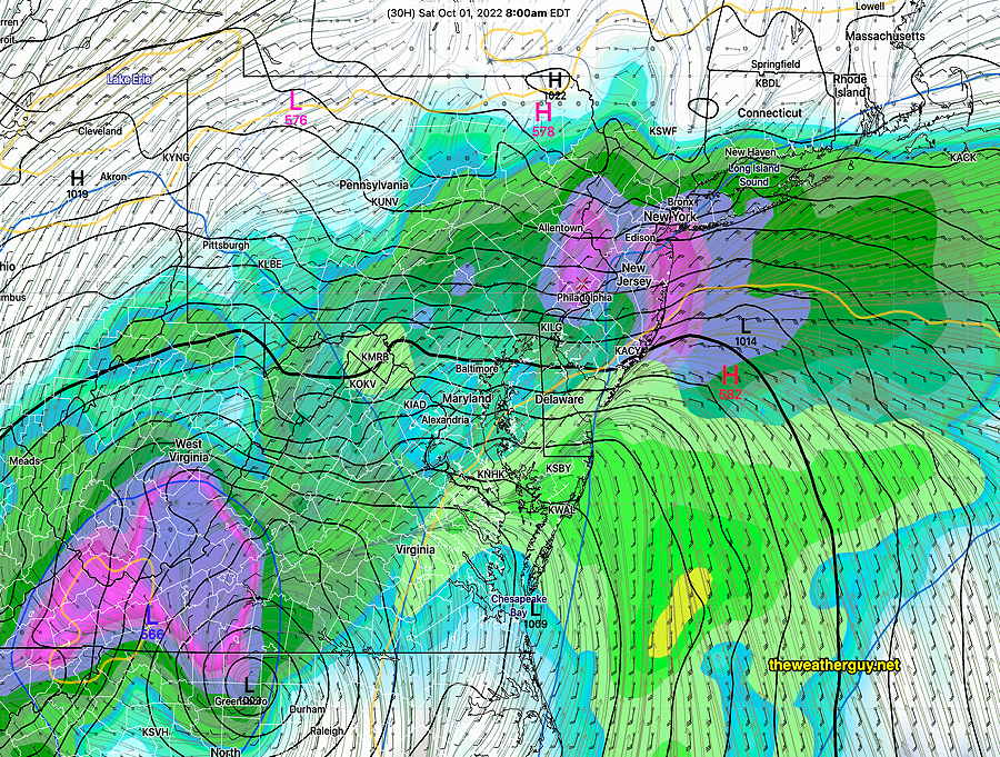
Here’s how the GFS surface map looks, as compared to current satellite—
Here’s the latest GFS forecast position Friday morning at 8 AM. Notice how little this system has moved due to blocking—
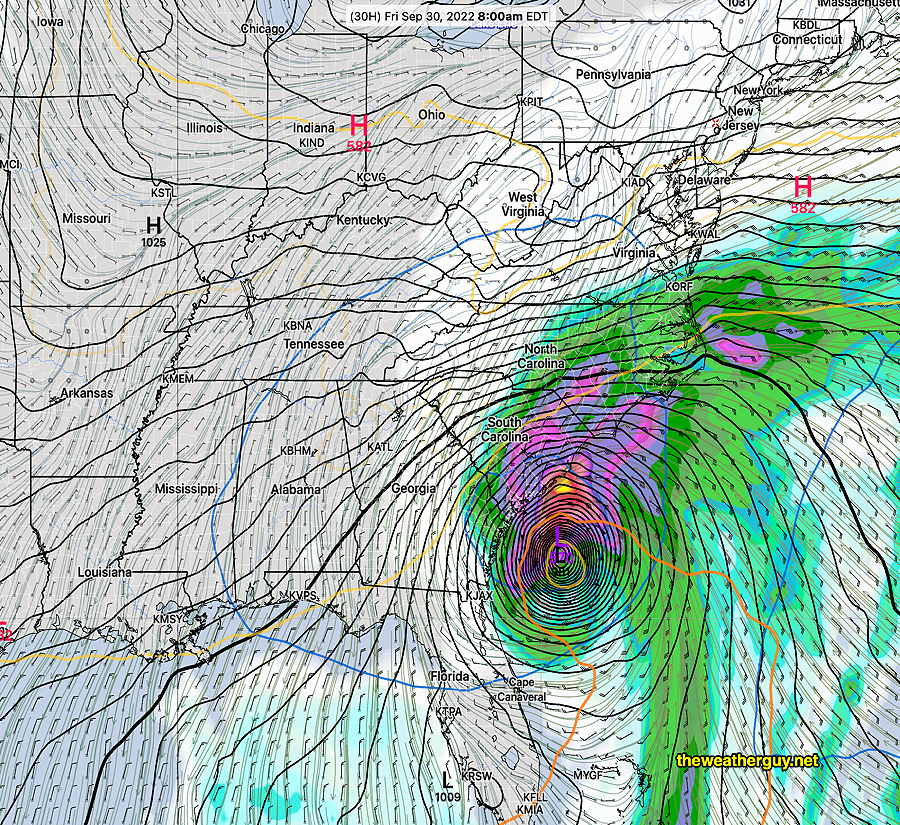
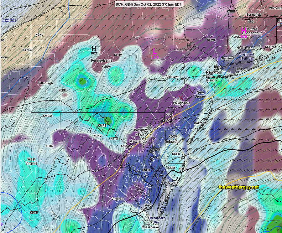
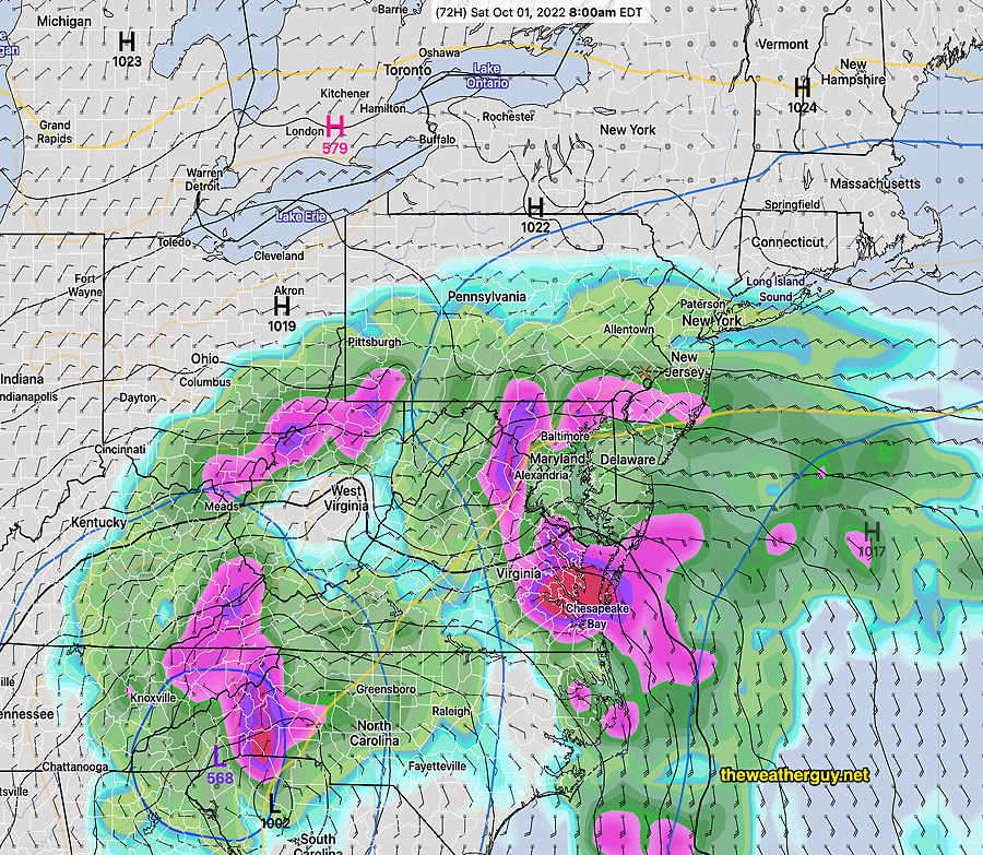
Here’s the latest GFS forecast for Saturday morning. Considerable rain moves into our area. This had not previously been predicted by the GFS, but the ECMWF has consistently predicted this—
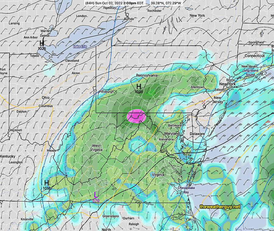
For Sunday, the upper low remains in the Ohio Valley, but a surface low develops along the coast. A complex scenario.
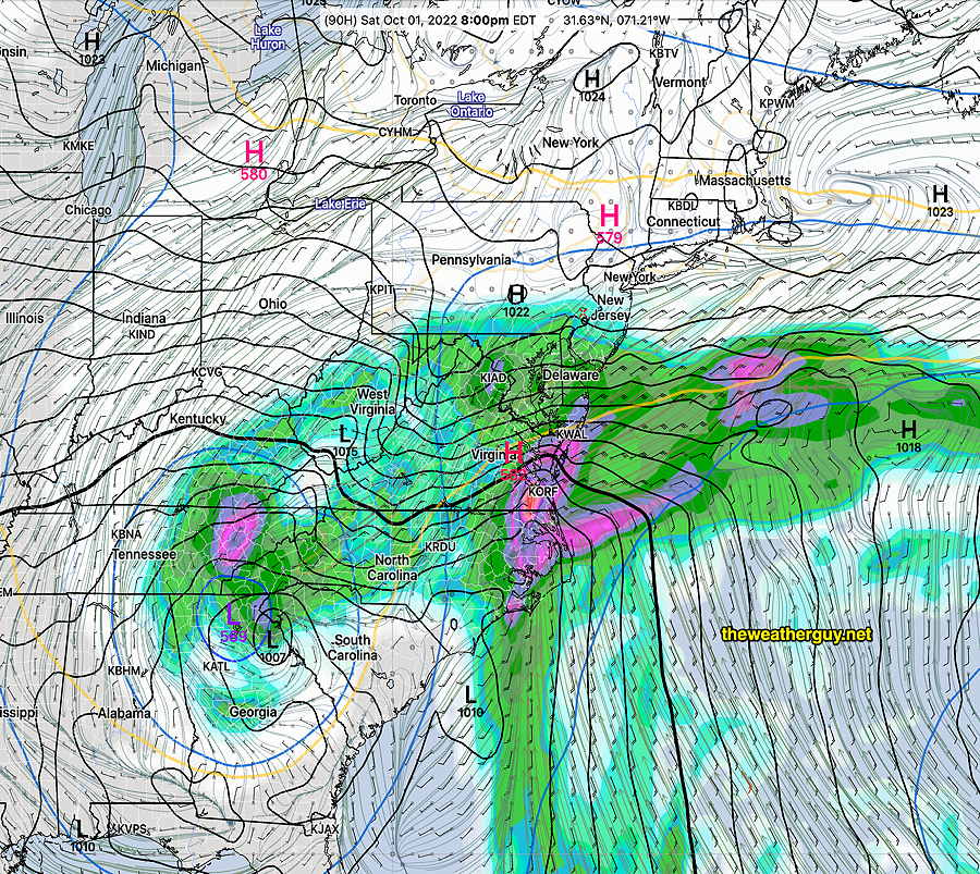
A break in the action possible at the start of the Eagles game, but the models have more showers developing during the afternoon as a result of the upper low and coastal low.—
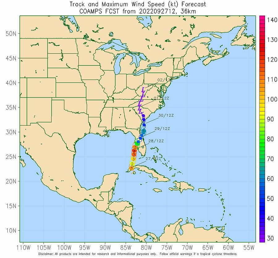
Update Wed 09/28 @ 6:20 PM — Latest COAMPS model forecast track—
Regarding our area, the latest NAM ECMWF has rain moving into our area as early as late Friday evening (ECMWF) or before daybreak Saturday.
The ECMWF has probably been the best in predicting the track of this storm.
What about Sunday and the Eagles game?
Here’s the ECMWF forecast for 2 PM Sunday, showing a break in the rain during Sunday afternoon—
Several models show this break in the action on Sunday. Expect changes in the forecast.
Update Wed 09/28 @ 7:40 AM — Catastrophic effects of Hurricane Ian in Florida are well-covered by the news.
Effects over the weekend here: Uncertain final track and effects in Philadelphia over the weekend. Models now vary with northern-most extent of the rain. The GFS has backed off of much rain here and has minimal effects by Sunday. The ECMWF, ICON and NAM have a somewhat more northern precip shield, lingering on and off through Sunday.
Update Tue 09/27 @ 6:13 PM —
The GFS and Canadian Models are showing up to 30 inches of rain possible near Tampa and central Florida from this storm.
Latest Water Vapor image of Ian—

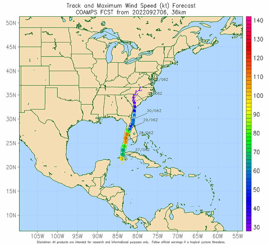
Latest COAMPS Model track and intensity
Update Tue 09/27 @ 11:37 AM —Latest COAMPS model forecast:
The ECMWF model has been more consistent and better than the GFS model regarding the basic track. The GFS had the storm moving north into the northern Gulf coast. The ECMWF has maintained an eastward shift over Tampa and central Florida.
Here is the experimental US NAVY COAMPS model which has done well with past storms—

More information later