WINTER WEATHER UDATE

Added Snow Total Forecast Graphics:

GFS Snow Depth
NAM Snow Depth Forecast
ECMWF Snow Depth

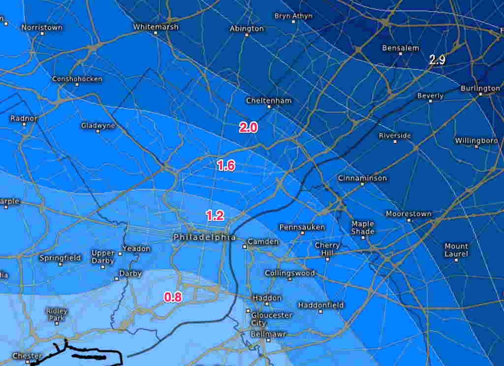
Yes, it’s snowing out and that was expected. The forecast question I’ve been trying to address— what level accumulating snow can we expect by the end of this storm?

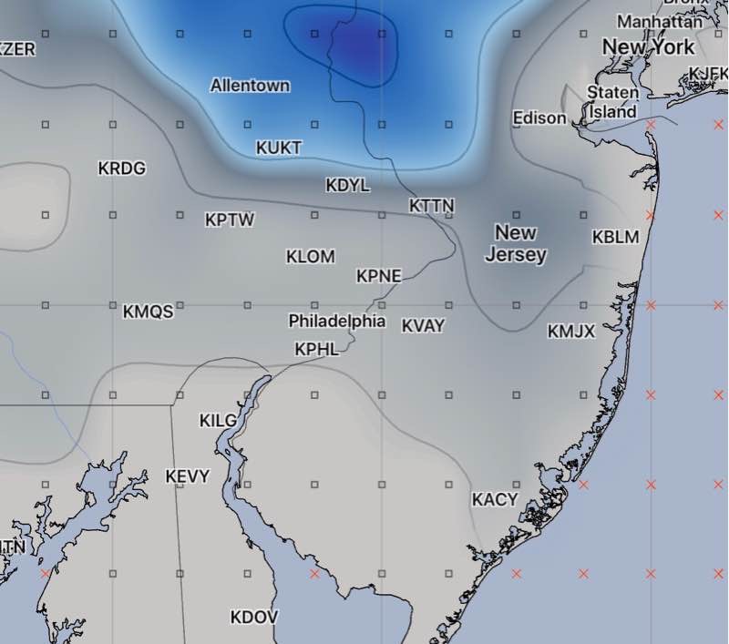
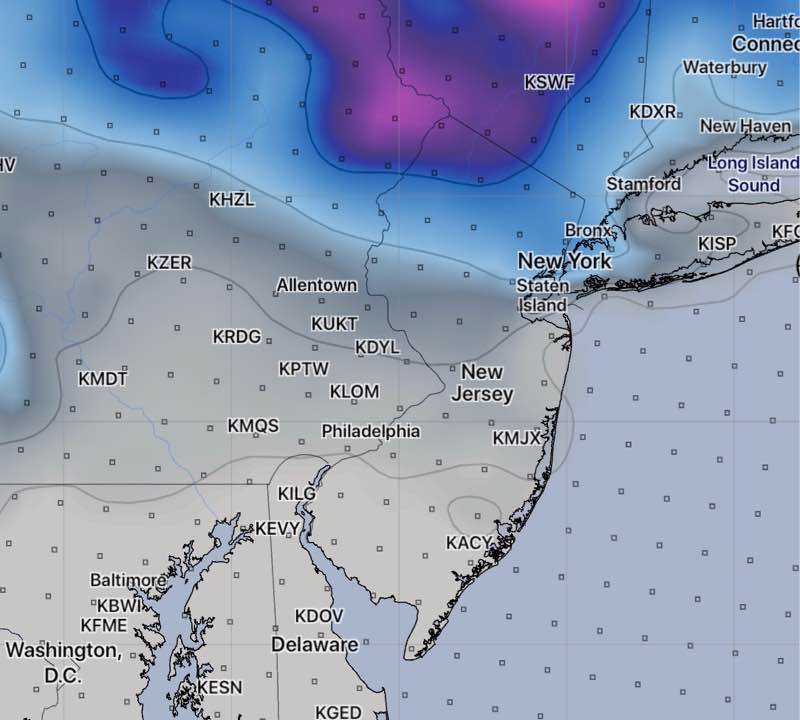
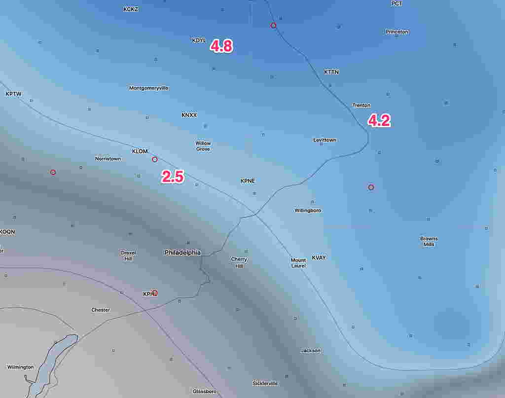
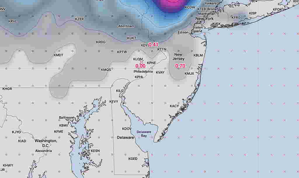
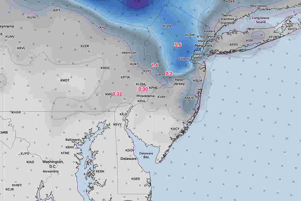
Last night’s 1 AM run of the models continue with the forecast of a coating to an inch of snow accumulation for our area.  That’s true of the NAM, GFS and high resolution Canadian.  The most recent hourly HRRR  (High Resolution Rapid Refresh) also maintains a low accumulation by the end of the storm this evening.

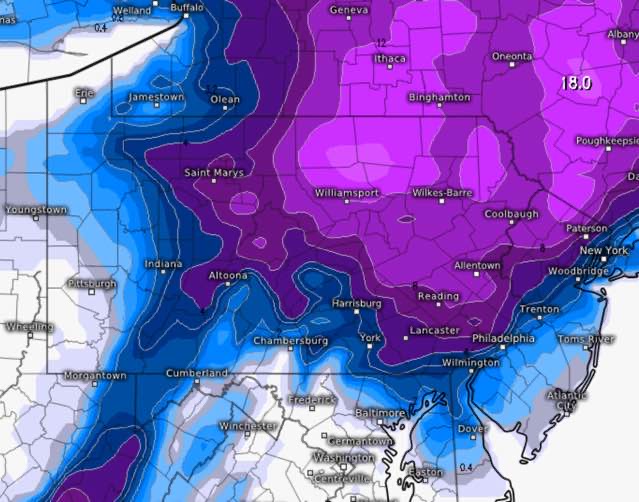
The only exception is the ECMWF, which has changed from its last run, but still gives us 2 inches with a rapid gradient increase to our north.

It sure looks like snow will accumulate and the intensity is much more than the NAM or GFS forecast QPF values.

Let’s see how it plays out.  Could all these models be wrong??  Could the Eagles lose to Miami??    Stay tuned.

The next models become available later this morning (NAM about 9:30 and the GFS about 10:38 AM) I’ll update if I can.

WINTER WEATHER UPDATE

10:55 Updated with the latest GFS snow depth forecast—

GFS model snow depth forecast

Well, this forecast has been a roller coaster regarding snow accumulations.

Tonight, I’ve reviewed the latest NAM, RAP, HRRR, SREF,  and WRF models.

Snow lovers will be disappointed.

Basically, the QPF ( quantity of water falling) has reverted to a few hundredths of an inch.  Temps remain just above freezing.  So, little or no accumulation ( a coating) now is the best guess in the immediate PHL area and adjacent counties.


Tonight’s NAM snow depth forecast for Monday.

Here’s another insight.  The new GFS model looks like it was the most consistent and accurate regarding this storm.

We will see light snow tomorrow, perhaps as early as the morning, but just a coating is the best accumulation forecast at this time.

The GFS data becomes available at 10:38 pm. I’ll update if things change.

WINTER WEATHER UPDATE

[su_note note_color=”#defcdc”]Sun 8 PM Update: Here is this afternoon’s NAM model snow forecast.  (2.5 inches for Glenside 4.8 for Doylestown.) The built in model algorithms are not always very accurate.   I’ll have a better handle about 11 this evening. The GFS has almost nothing for us.

NAM model snow depth forecast for Monday evening

[/su_note]

“The latest NAM model supports the scenario discussed as a possibility over recent days— a secondary coastal surface low is held back or regenerated along the coast due to the upper atmosphere low pressure system to the west playing catch-up with the surface system.

Once they come together and become “vertically stacked”, the coastal system will further intensify.  This setup allows the collision of cold air and wrap-around moisture to create the chance of snow Monday afternoon and evening over our area”

The above is from my Friday Update post.  Over this weekend, it wasn’t clear if this was going to happen.

The latest Canadian and ECMWF models have become available and support the changeover to snow on Monday. More importantly, they show the secondary low developing closer to the coast which may allow as much as 4 inches just outside Philadelphia.

Here’s the latest ECMWF snow totals forecast by late Monday night:

So, there’s been uncertainty about accumulation and recent trends support the possibility of more than the coating to an inch near Philadelphia.

This afternoon’s NAM supports these higher snow totals for late Monday, indeed the NAM FOUS data suggests the possibility of greater than 4 inches!  Stay tuned.

Weather… and Other Things 'Up in the Air'