SUNDAY FORECAST UPDATE

Sun 09:10 AM Update — The optimistic sunshine forecast of the NBM looks to be correct for today.

Here’s the latest German Icosahedral “ICON” model which handles one of its cloud cover parameters a bit differently,  shows the sunny area sandwiched in directly over us today—


From Saturday…

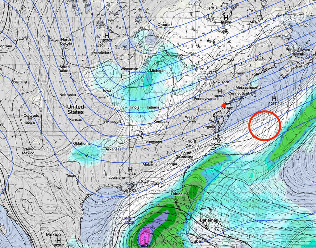
As mentioned in yesterday’s posted weekend forecast, the Philadelphia area will be sandwiched between two areas of clouds and low pressure.   Clouds fill in by the end of the day.

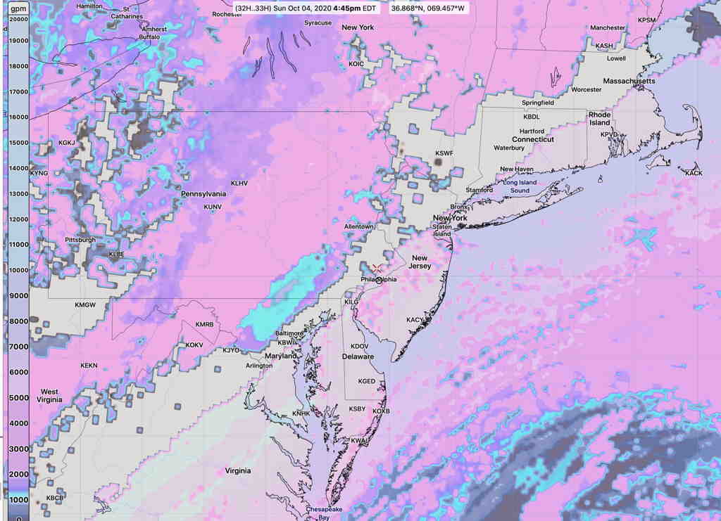
The NBM (National Blend of Models) has the most optimistic forecast, with significant sunshine and some high/mid level clouds for most of Sunday.

NBM Cloud Ceiling forecast 4:45 PM Sunday  (Click on image for a larger view.)

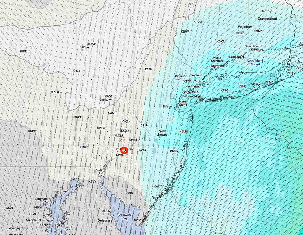
The GFS and HIRESW-FV3 (experimental) are somewhat more pessimistic with their cloudiness forecasts, significant high and mid level clouds.  The models also predict a band of clear skies; the models are consistent about this band of clear skies, but differ regarding its exact location.

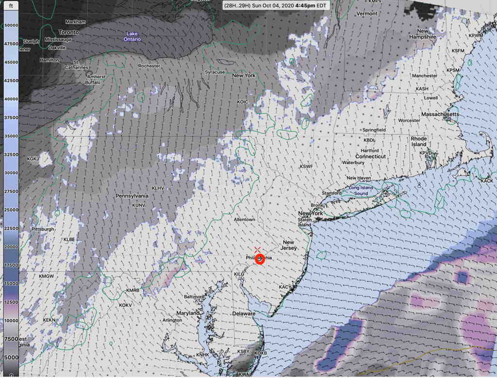
Here’s the HIRESW-FV3 cloud ceiling forecast, showing the clear sky band just west of Philadelphia—

HIRESW-FV3 (pre-release version) cloud ceiling 4:45 PM   (Click on image for a larger view.)

So,there’s a range of possibilities around the cloud cover for Sunday.  The GFS is often my preferred choice for cloud cover predictions, but but I can’t ignore the new NBM.  I guess we’ll see.

WEEKEND WEATHER FORECAST

High pressure builds in for the weekend as the upper air jet stream flow takes a dip.

For Saturday, high pressure builds in with a cool, northwesterly wind.

Saturday—

  • Sunny
  • High temp 64.5º sd 1.5º.
  • Light winds WNW  2-10 mph.

On Sunday, a frontal system in the Great Lakes area brings clouds from the west while a developing low pressure system far off the coast brings clouds in from the southeast.  We will be sandwiched in between, but the clouds will win out.

Sunday—

  • Partly sunny in the morning.
  • Increasingly cloudy by afternoon.  clouds hold off until late afternoon or evening.
  • High temp  66.9º sd 1.0º
  • Winds SSE 10-15 mph, increasing late in the day.

A few days ago, the models had this dip highly amplified, suggesting a deep coastal low formation for Monday.  The latest models have the jet dip less amplified and positively tilted, resulting in a weaker low pressure system forming late Sunday that remains considerably east of us. (red circle).

However, some models show some light rain for Monday.


GEFS forecast for Saturday afternoon.  (Click on image for a larger view.)


The new model blend (NBM v 4.0) which just became operational this past week keeps the rain in NJ.

NBM Precip forecast for Monday noon. (Click on image for a larger view.)


Last week saw the implementation of the newest version of the National Blend of Models (NBM), version 4.0.

The NBM statistically blends, weighs and combines many models and re-calculates its forecast based on updates from the short range hourly models and actual observations (“Real Time Mesoscale Analysis”) , and re-interpolates it based on the accuracy of previous 6 hour actual observations (“Unrestricted Mesoscale Analysis”).

The models included in the blend are the : GFS, GDAS, GEFS, CMC, ECMWF, FNMOC, ACCESSG, NAM, SREF, RAP, HRRR, HIRESW, WAVE, GFSMOS, NAMMOS, EKDMOS, LMP, GLMP, HWRF, HMON

I’ve been using the the NBM prelease 4.0 for high temperature forecasts over the past several months.  The NBM’s high temperature forecasts are based on a blend of the above models and includes the standard deviation (sd) which gives an idea of the spread between the various models and confidence in the the mean (average) forecast high.

Last year, the older NBM v 3.2 was highly accurate for predicting snowfall amounts and precipitation types, rain, freezing rain, sleet, snow. I expect the new NBM to be even better.

Weather… and Other Things 'Up in the Air'