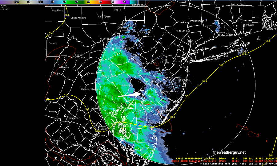
Posted Saturday 05/18/24 @ 9:17 AM — Well, it looks like I should have stayed (see my post from Friday) with the more rainy forecast of the NAEFS for today, Saturday. (The GFS and the much-touted ECMWF led most of the TV/radio forecasts astray today.)
Here’s current radar —
Radar at 9:15 AM Saturday Most of yesterday’s models had kept most this rain just to our to western suburbs today. (Click on image for a larger view.)
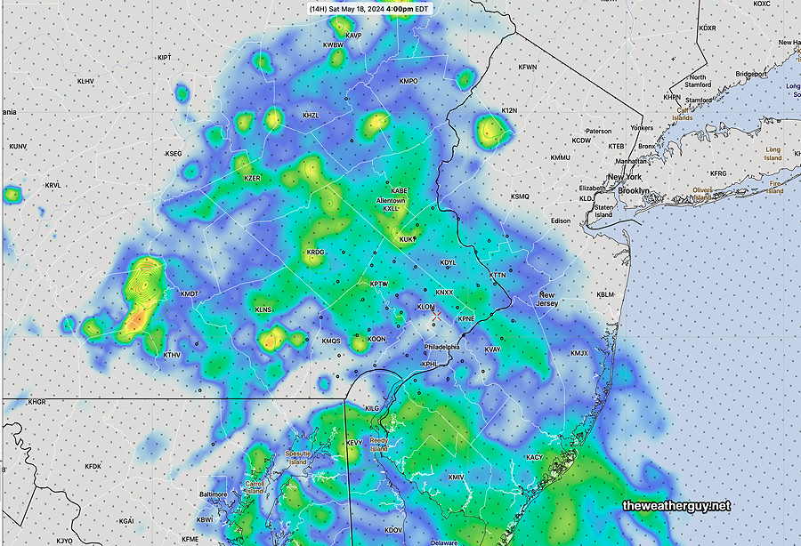
Here’s the latest experimental RRFS model simulated radar forecast for 4 PM—
Experimental RRFS simulated radar forecast for 4 PM Saturday. (Folks, I’m not sure how well the RRFS model development is going. I once looked upon the RRFS (to be released early 2025) as a major advance. I’m not so sure now and issues with the model’s ‘advanced’ FV3 core (which works in the GFS), is not working so well in the higher resolution RRFS, especially with summertime convection (thunderstorms). I’ve put so much time and effort in recent months programming to download the model that I feel compelled to use it. They are actively working to improve it. (Click on image for a larger view.)
Sunday looks dry, but there will likely be plenty of low clouds for much of the day.
Previously Posted Fri 4:44 PM —Today’s models keep the rain in central Pennsylvania, barely making it past our far western suburbs on Saturday. Sunday looks to be dry, maybe some sun.