WEEKEND WEATHER FORECAST

#weather #paweather #wx #pawx #philadelphia #phillywx

Saturday Forecast Update

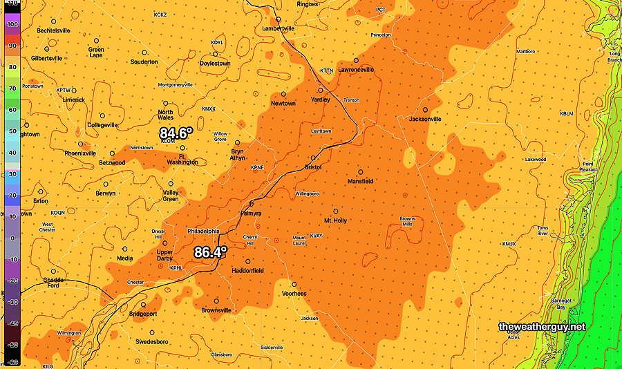
Update Sat 05/13 @ 10:58 AM — Here’s what we have at 11 AM

Current 11AM MRMS radar and RAP data. (Click on image for a larger view.)

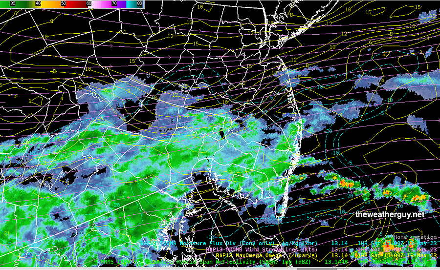
This is last night’s NBM (not previously posted)—

Last night’s 00z NBM (available at 9:30 PM EDT) showing the extent of the light showers. (Click on image for a larger view.)

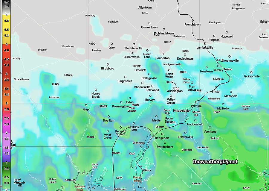
Update Sat 5/13 8:12 AM — I knew my ‘dry’ forecast was a low confidence forecast. A few sprinkles have fallen this morning. Last night’s HRRR and Canadian maintain a dry forecast as shown in last night’s graphic.

Last night’s 00z NAM-NEST also showed a dry forecast, but its 06z run shows light sprinkles from the city southward, especially in the early afternoon.

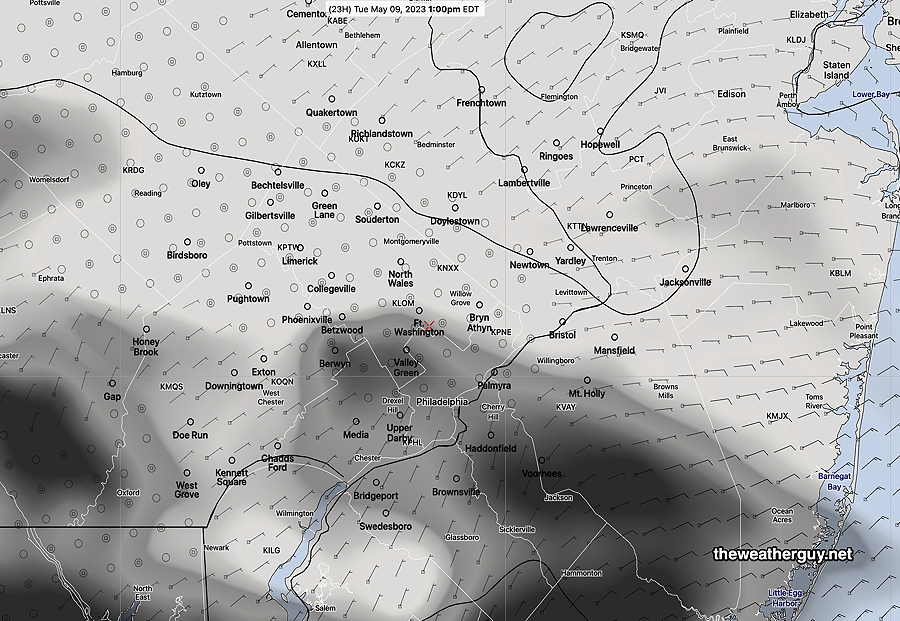
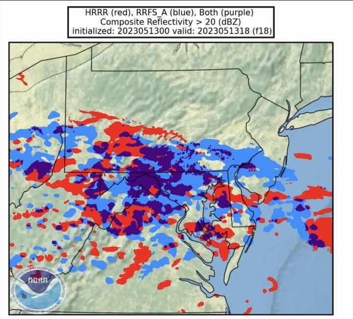
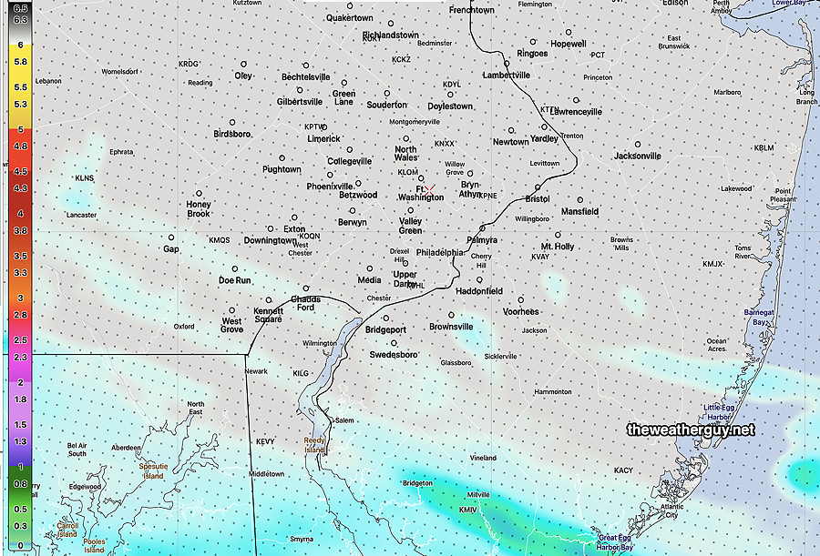
It should be noted that NOAA- NWS is working on a next generation model, called the RRFS (Rapid Refresh Forecast System), scheduled for release sometime this fall. It will actually replace several models: the NAM-NEST, HRRR, HIRESW-ARW (all three versions) .

While not ready yet for prime time, here’s its current forecast compared to the HRRR:

Pre-release beta version of the RRFS. It shows more more shower activity north of the city (blue) than the current HRRR (red) at 2 PM. (Click on image for larger view)

Anyhow, I’m going to backtrack on my ‘update’ from last night and removed the strike-out from the forecast posted below to its original form.


Saturday Forecast Update

Update Fri 05/12 @ 9:58 PM — It hasn’t been even an hour since I posted this Weekend Weather Forecast, but I’m going to remove the mention of showers in the immediate PHL area for Saturday, based on the latest HRRR just becoming available and the consistent forecast of the Canadian models.

So I’m going to call for no rain here, despite the GFS, NBM and ensemble forecasts to the contrary.

Tonight’s 00z HRRR shows most of the immediate PHL area dry on Saturday. (Click on image for a larger view.)

Previously Posted Fri 9:23 PM —

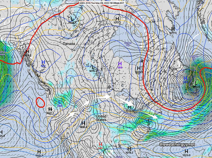
A disturbance is expected to move to our south on Saturday with the rain shield staying in Maryland and southern Delaware. As has been the case over the past few days, some models keep the immediate PHL area dry.

However, at this point there are enough models, particularly the statical ensemble models, forecasting very light scattered showers moving through Montgomery county and into New Jersey, that I need to include that possibility in Saturday’s forecast. I’m not all that sure about this aspect of the Saturday forecast because the Canadian models have consistently kept us dry.

Saturday

Cloudy with very light and scattered showers as early as 8 AM. Heaviest showers (if they occur here) early to mid afternoon.

High temperature 78.4º with a high uncertainty as expressed as a higher than normal standard deviation of 4.4° ( NBM model location Blue Bell, PA)

Sunday

Some cloudiness early morning, becoming sunny by late morning.

High temperature 72.5º sd 1.5º ( NBM model location Blue Bell, PA)


THIS WEEK’S WEATHER

#weather #paweather #wx #pawx #philadelphia #phillywx

Friday Update

Update Fri 5/12 1:01 PM — A quick mobile update. The latest NBM is insistent on showers in the PHL area on Saturday. Several models keep them to our south, only affecting southern Chester and Delaware counties. Update this evening.


Forecast Update

Update Thu 5/11 9:57 PM — Hazy sunshine through a high thin cirrus cloud layer on Friday. High 85°-87°.

NBM forecast high temps for Friday (Click on image for a larger view.)

There’s still uncertainty with the northern extent of the light rain on Saturday. Philadelphia remains on the northern edge of the rain shield. Typical rain totals range from zero to 0.3 inches, depending on the model. The Canadian models and the latest HRRR consistently keep us dry. Tonight’s Model Blend (NBM) has 0.2-0.3 inches.

I’m leaning towards the drier forecast at this time.

Tonight’s 00z HRRR shows light rain to our south, no rain for the immediate PHL area. (Click on image for a larger view.)

Thursday Forecast Update

Update Wed 5/10 10:47 PM — After today’s blue skies, Thursday will have sunshine through high cirrus clouds for much of the day, as moisture aloft moves over the upper ridge.

I’ve been keeping my eye on Saturday. The longer range global models have rain showers Saturday morning into early afternoon. The few higher resolution models whose forecasts extend that far (NAM, RGEM) keep the showers to our south, even further south than the RGEM graphic posted immediately below. I’m leaning towards the drier forecast for Saturday at this time, but with much above average uncertainty.


Wednesday Forecast

Update Wed 05/10 @ 8:22 AM — No change in the forecast for Wednesday (today) through much of Friday. Friday will have hazy sunshine through increasing high clouds (cirrus); mid-level clouds move in late afternoon Friday.

In keeping with our new pattern of dry weather, most of the showers on Saturday will be to our south, in Delaware and South Jersey. Areas from north of the city and northward may be just cloudy.

CMC-RGEM shows most of the rain to our south on Saturday (Click on image for a larger view.)

Show More

Our weather this coming week will be controlled by an upper air ridge with a disturbance moving over the top of the ridge towards us on Tuesday—

Today’s 12z NAEFS forecast for Tuesday shows the upper ridge in the middle of the country with a disturbance moving across the ridge and giving us some showers/rain on Tuesday. (Click on image for a larger view.)

This Tuesday system doesn’t look like a big rain maker. In fact, after the major rains (3-5″) of 8 days ago, it appears that we may even be entering into a much drier pattern for awhile.

Following Tuesday’s showers, high pressure builds in and fairly nice and tranquil weather is expected into at least Saturday.