Update Wed 05/03 @ 9:37 AM —The blocked pattern will slowly transform into another blocked pattern over the weekend. By the weekend, our part of the country will be under more of an upper ridge than the current upper low. Until that time we’ll continue with unsettled weather: clouds, some sun, scattered showers, and cool temperatures.
Today, Wednesday, we’ll likely have the most widespread shower activity, but both Thursday and Friday may have a few late afternoon showers in some areas.
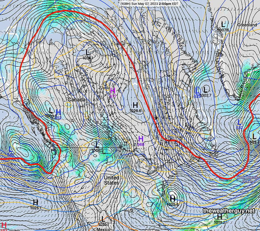
Here’s what things look like by Sunday—
NAEFS forecast for Sunday at 2 PM. The red line, (540 thickness line) captures the general configuration of the jet stream. Notice the extreme extent into northern Canada indicative of a blocked pattern. The Northeastern US will now be under more of the upper ridge. The weather should become drier and milder. (Click on image for a larger view.)
Tuesday – Continued Unsettled Weather
Update Tue 05/02 @ 8:16 AM — The upper air low has moved to north of NY State and it is expected to precess and end up over our area Wednesday and Thursday.
Disturbances continue to rotate around the upper low and one is bringing light showers this morning. Another is expected to move in this afternoon with more widespread showers.
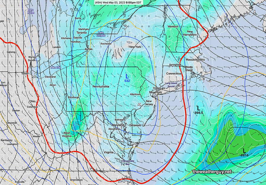
By Wednesday, the upper low is over Pennsylvania—
NAEFS for Wednesday at 5 PM. Notice the RED 540 thickness line. The 540 thickness line is usually most visible on weather maps in winter. Its appearance shows the pool of very cold air aloft associated with this upper low. This cold air aloft is resulting in instability cloudiness and showers. (Click on image for a larger view.)
Update Mon 05/01 @ 8:53 PM— The blocked pattern will remain with us through the weekend. The upper low pressure system over the Great Lakes has closed off and it will slowly move directly over Pennsylvania over the next several days. Unsettled conditions with periods of cloudiness and occasional showers expected.
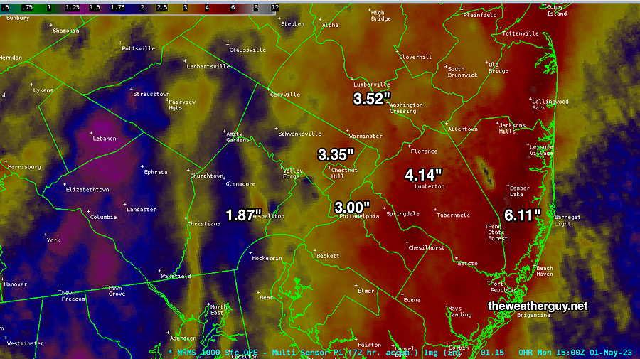
That was a lot of rain!
Woo! That was a lot of rain we got this past weekend! So how much did we get? Here’s the MRMS radar/rain gauge based measurement—
MRMS 72 hour rain total for this past weekend. (Click on image for a larger view.)
Previously Posted Mon 12:00 PM —
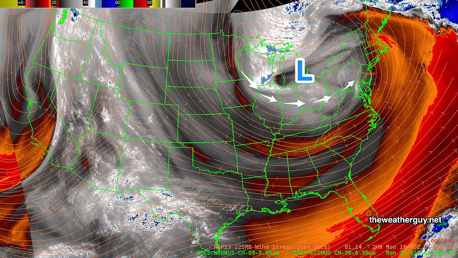
This Week’s Weather Overview
The blocked pattern will slowly loosen over the next several days. The upper low still over the Great Lakes will continue to rotate disturbances over our area, giving us periods of clouds and some showers intermixed with some sun.
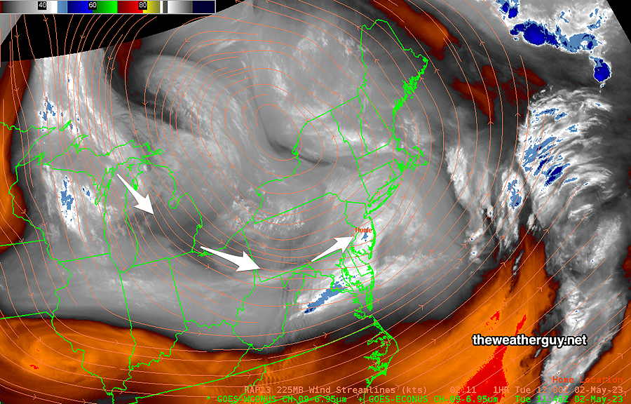
Water Vapor Satellite image Monday morning shows the low pressure system still over the Great Lakes, rotating disturbances over our area. This may continue through Thursday. (Click on image for a larger view.)