WEEKEND WEATHER FORECAST

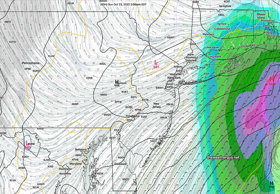
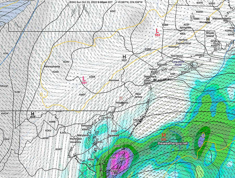
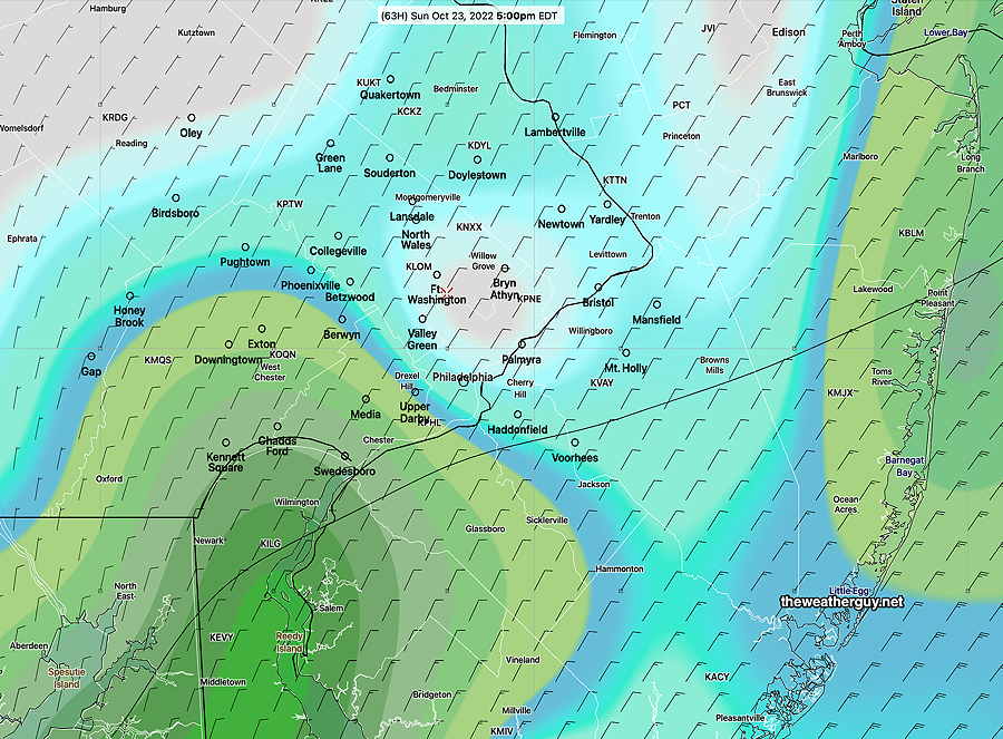
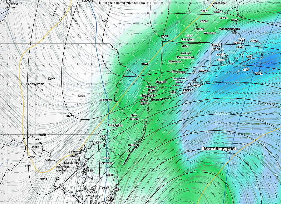
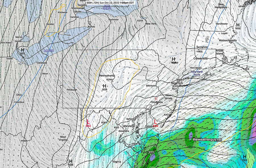
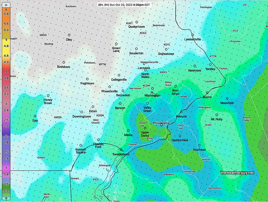
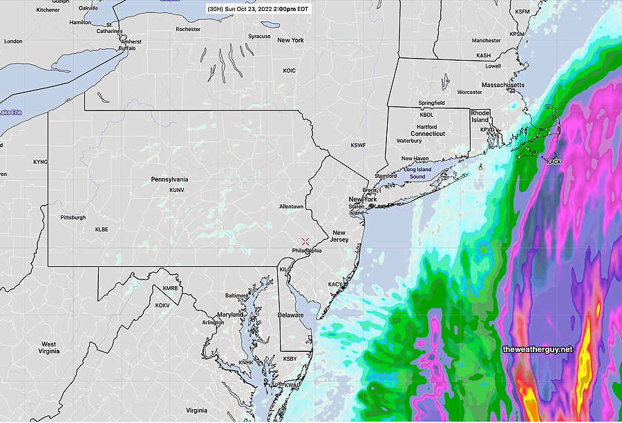
Update Sun 10/23 @ 10:23 AM — Optimism has its limits. This morning’s models are much more emphatic about some measurable rain moving in during the hours of 2-4 PM. Here’s the latest rainfall accumulation from the NAM-NEST

Today’s latest 12z NAM-NEST total accumulated rain forecast for 4 PM today (Click on image for a larger view.)

Update Sun 10/23 @ 8:17 AM — Clearly, my forecast from last night (based on the HIRESW, GFS and NAM-NEST (and the Phillies win), was clearly overly optimistic about the cloud cover and maybe the lack of rain until later today.

As mentioned previously, this rain forecast has been as difficult as many past winter snow storm forecasts.

The GFS has consistently maintained clouds but has kept the rain from moving in until after 5-7 PM. The HRRR supported this forecast, as did the ECMWF. However, the Canadian and the ensemble forecasts (GEFS NAEFS) were consistently forecasting light rain inching in about 2-5 PM.

Last night’s 06z models began are suggesting that the light rain may move in sooner than “late afternoon”, as early as 2PM with more rain tonight.

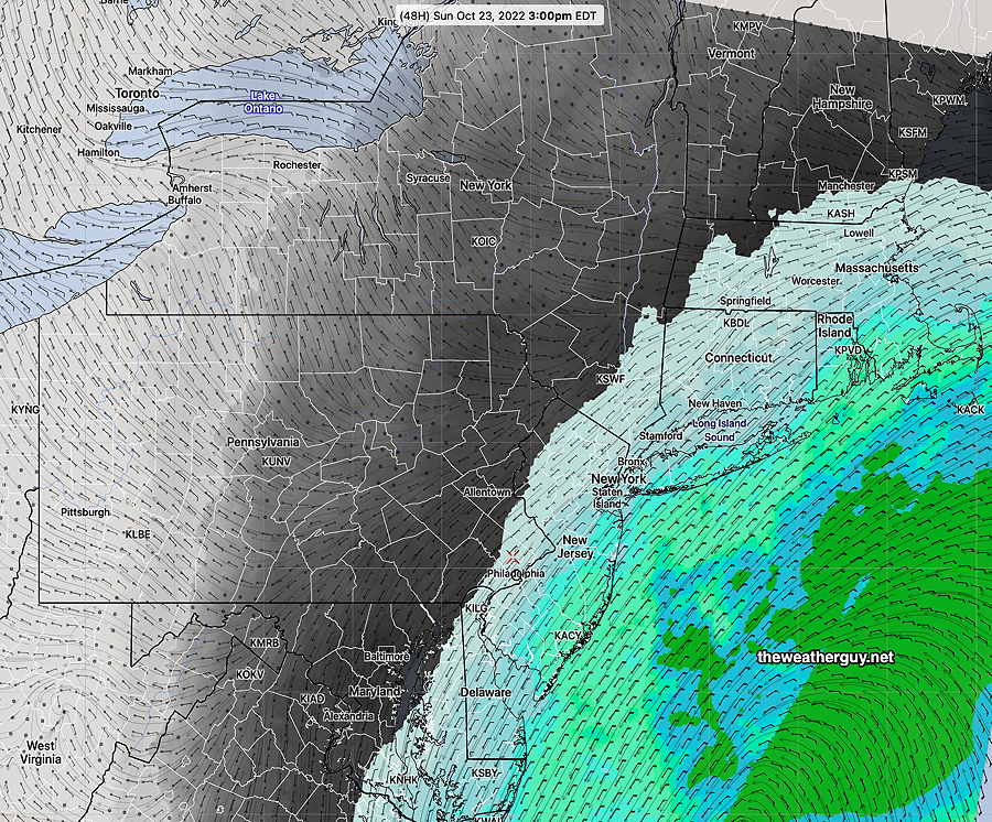
Here’s the current situation—
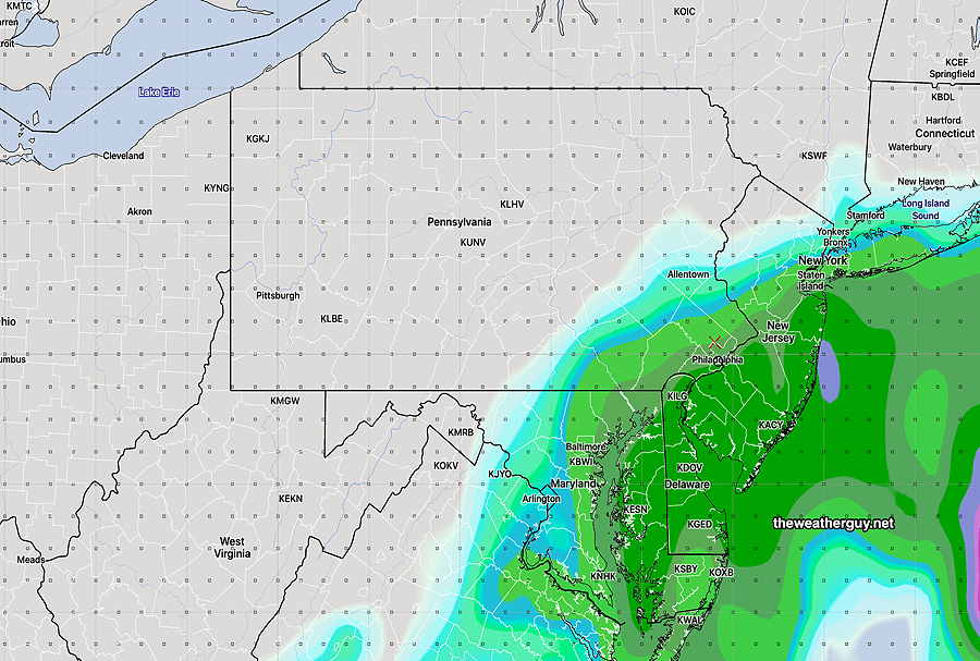
8 AM Sunday radar, jet stream streamlines (orange contours) and isentropic surface energy (yellow contours) Strong isentropic energy gradient over our area may impede showers from moving westward towards Philadelphia until late afternoon. (moisture moves along isentropic surfaces, not across them) (Click on image for a larger view.)

Here’s the current NBM

07z NBM shows very light rain just moving in about 3-4 PM today. (Click on image for a larger view.)
Sunday- Some brightening skies possible noontime. Breezy. Some light sprinkles possible as early as 2-4 PM in the city. More rain expected by evening.

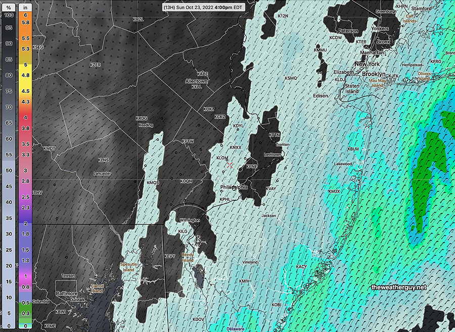
Little to no Rain for Sunday afternoon

Updated Sat 10/22 11:24 PM —

Sunday- Some sun in the morning. A mix of sun and clouds early afternoon. Breezy. Some light sprinkles possible, especially late afternoon.

Saturday afternoon’s HRRR continues with the rain from the coastal storm not reaching into Philadelphia. A few light sprinkles possible. —

Saturday’s 19z HRRR shows 30 hour accumulated rainfall. Little to no rain into Philadelphia. (Click on image for a larger view.)

Little or no Rain for Sunday afternoon

Update Sat 10/22 @ 10:18 AM — The trend for the rain associated with the coastal storm to move east of us continues. This trend, first forecast by the GFS, is now supported by several models, including this morning’s HRRR and NAM-NEST.

Sunday- Cloudy and breezy. Some light sprinkles possible, especially late afternoon.
10-22-22 NAM-NEST 12z forecast for 2 PM Sunday showing 30 hour Accumulated rain. Just light sprinkles possible in our area. (Click on image for a larger view.)

Forecast for Phillies Game Sunday

Update Fri 10/21 @ 6:25 PM — Just as I posted this forecast, the latest GFS model came in. It keeps the rain to our east on Sunday, off the coast. This scenario reminds me of several storms last winter with the GFS having an eastern track and it turned out to be correct. So expect cloudy, breezy conditions but little to no rain for Sunday afternoon.


Previously Posted Fri 6:07 PM —

High pressure will give us another beautiful day on Saturday. It will move off the northeast Saturday night.

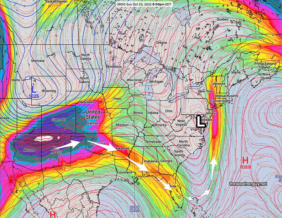
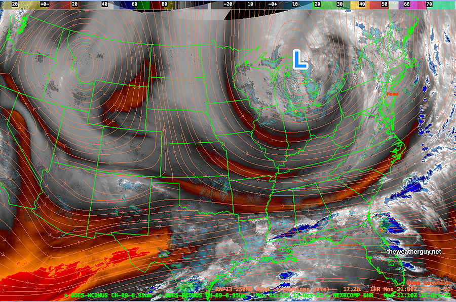
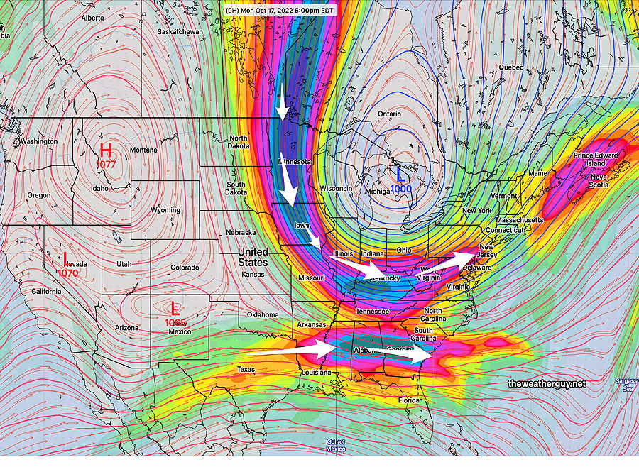
Impulses to our west are expected spawn a coastal low in the southeastern US coastline as a result of a sharp trough in the jet stream—

Water Vapor image Friday afternoon shows jet stream flow and upper atmospheric disturbances. Two areas of energy in the jet flow (1) and (2) will dive to the south following the jet flow. This will spawn a coastal low off the southeast coastline. This low will move up the coast on Sunday. (Click on image for a larger view.)

Sunday’s forecast depends upon a system that hasn’t formed yet and there are differences in the forecast track and speed of the expected secondary low.

Saturday

Sunny skies and warming temperatures.

High temperature 67.7º sd 0.8º NBM model (for Blue Bell, PA)

Sunday

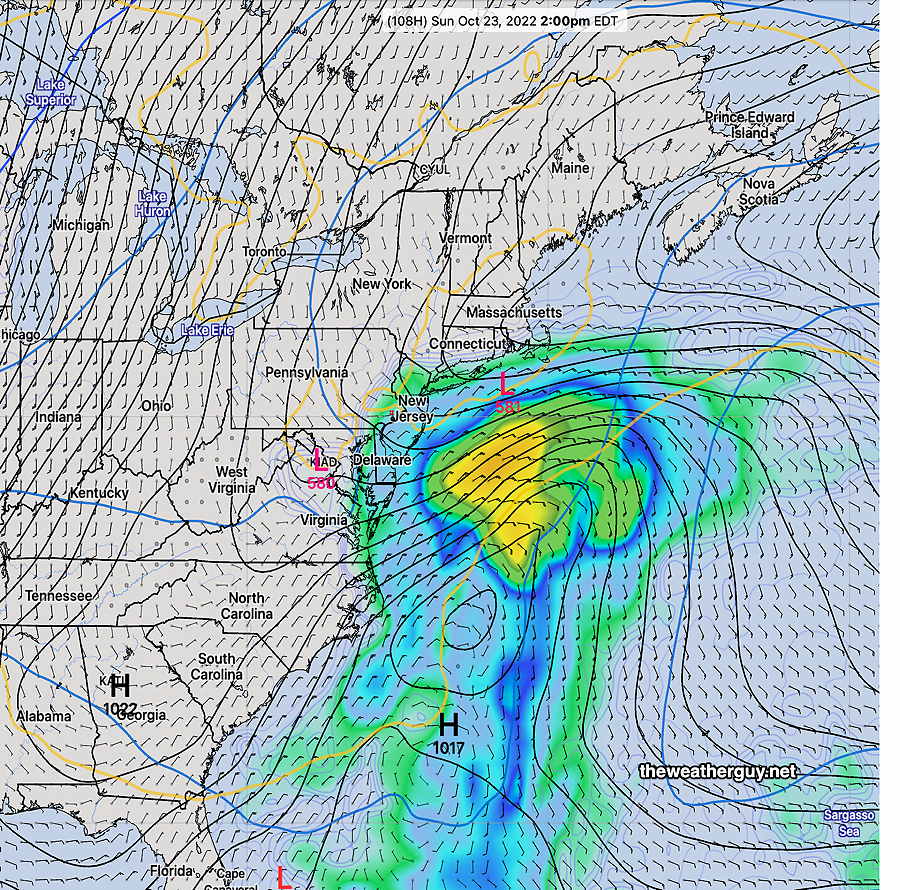
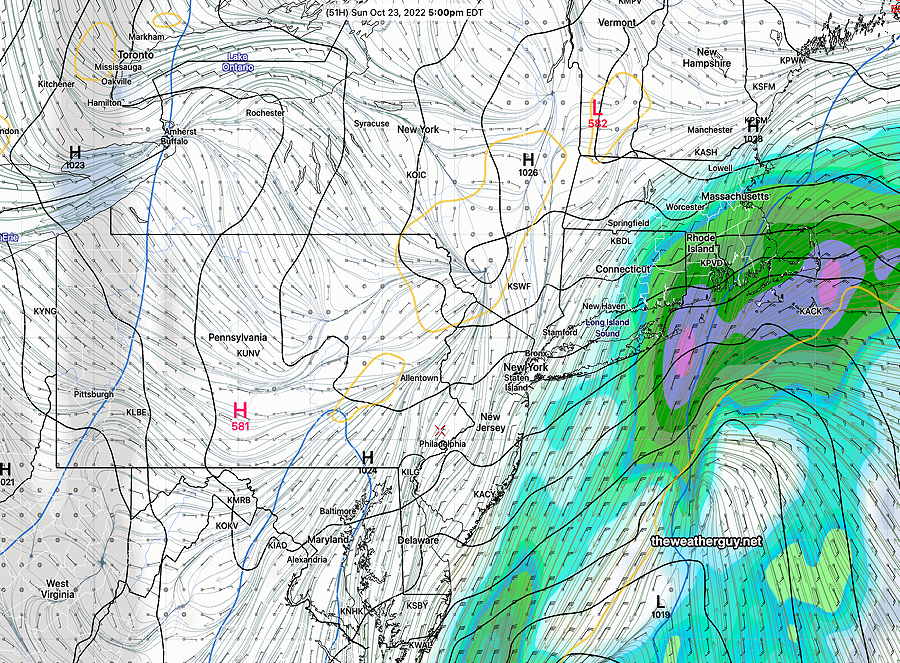
Significant differences exist in the forecast track of the coastal low expected to form. For several model runs, the GFS has shown an eastern track for the storm with the rain missing us. Other models are not on-board with this. The latest NAM has rain moving in 2-4 PM. The latest ECMWF has the rain later in the afternoon or towards evening.

The ECMWF is trending towards the GFS with most of the precipitation off the coast—

ECMWF rain forecast for 5 PM Sunday. It has the bulk of the rain off the coast with rain just entering Philadelphia about 5 PM. (Click on image for a larger view.)
Friday’s NBM 19z forecast for Sunday at 3 PM. Light rain or drizzle moves in about 1 hour earlier. Remains light. (Click on image for a larger view.)

Cloudy and increasingly breezy/windy. Currently, the models are forecasting very light rain or drizzle to move in about 3-5 PM (NAM, NBM, HIRESW-FV3) or after 5 PM (ECMWF). The GFS has the rain missing us entirely Too early to be sure. Stay tuned.


THIS WEEK’S WEATHER

Rain for the Phillies on Sunday? Probably not.

Update Fri 10/21 @ 9:56 AM — As is often the case with coastal low pressure systems, the forecast speed and track varies from model to model. The general trend has been for a slower progression (except for the GFS) keeping any rain at bay until very late afternoon.

The latest GFS is an outlier with the system moving faster but further east. (still missing us!) A known bias of the current version 16 of the GFS is too fast movement of coastal systems.

Current GFS forecast for 2 PM Sunday—

GFS has the rain missing us and moving east. (Click on image for a larger view.)

The latest NAM at 5 PM Sunday—

The latest ECMWF has the rain moving in late in the afternoon and very light in the city—

Friday’s 06z ECMWF forecast for 5 PM Suunday (Click on image for a larger view.)

Interestingly, the GEFS based on the GFS still has rain moving in during the afternoon, although quite light—

So..what’s going to happen? I’m going with the ECMWF-GEFS blended forecast right now. This is very similar to the NBM (model Blend). Very light rain moves in during the mid to late afternoon Sunday. It will be cloudy and somewhat windy. Not an ideal baseball weather backdrop, but it won’t affect the Phillies!


Updated Thu 10/20 10:50 PM — Tonight’s NAM is slower with the rain moving in on Sunday. The rain moves in late afternoon to early evening. The NBM has some very light rain earlier.


Update Thu 10/20 @ 5:38 PM — Many of this afternoon’s models have trended towards a slower northward movement of the coastal system on Sunday and things are looking somewhat more optimistic for a relatively dry (or much less wet) Sunday afternoon.

The latest NAM shows most of the rain still to our south at 1 PM—

Thursday’s 18z NAM shows rain still to our south at 1 PM Sunday. (Click on image for a larger view.)

The model blend (NBM) which incorporates many models but tends to lag 6-12 hours with changes, still shows some light rain here in the afternoon—

Thursday’s 19z NBM model shows very light rain here at 1 PM. The NBM tends to lag and may not be showing the slowing system. (Click on image for a larger view.)

The afternoon GFS will be available shortly I’ll do a quick update later after 10:45 PM when this evening’s NAM becomes available.


Update Thu 10/20 @ 9:49 AM —Increasingly nice weather through Saturday as high pressure builds in over us. Warming temperatures and sunny skies.

Unfortunately, the Phillies may have to play in the rain on Sunday, as all models have joined in the forecast of rain developing Sunday from a coastal low. The ECMWF has joined the NAEFS from yesterday with an upper low and sharp trough along the coast—

Thursday’s 06z ECMWF with upper air low and 250 mb jet stream winds and contours. This upper low will draw the coastal low closer to the coast and affect us on Sunday. (Click on image for a larger view.)

ECMWF accumuated rain forecast —

Today’s 06z ECMWF forecast for Sunday at 2 PM. (accumulated rain) (Click on image for a larger view.)

Update Wed 10/19 @ 9:32 PM — The latest GFS continues with rain for Sunday, as does several other models. (The hold-out is the German ICON model which has a slower system that stays to our east.)

The latest GFS—

Today’s 18z GFS shows a coastal system with rain by late morning. The above is the 2 PM forecast. (Click on image for a larger view.)

Possible change in Sunday’s weather forecast

The weekend forecast had been looking dandy. But the latest NAEFS shows a coastal low affecting our are with rain on Sunday. I’ll look closer at this later today.

Latest NAEFS forecast for Sunday 2 PM. Coastal low may bring some rain. (Click on image for a larger view.)

Updated Wed 10/19 8:16 AM —The Washington Post has a good article today on long range winter forecasts.

Update Tue 10/18 @ 5:07 PM — Continued chilly weather at night. Here’s the latest NBM minimum temperatures for Tuesday night into daybreak Wednesday—

Today’s 19z NBM model minimum temps for Tuesday night. The ± refers to one standard deviation. Fairly high spread for this evening’s temp forecast. (Click on image for a larger view.)

Milder temperatures for the weekend. The weekend looks real good!


Previously Posted Mon 5:53 PM —

It’s been well-advertised that a strong cold front is moving through today and considerably colder weather will be with us for the next few days.

A strong upper air low is over Canada and is gradually moving eastward, allowing colder air to move in tonight through Thursday.

Water Vapor showing upper air flow (with superimposed RAP model jet level streamlines) (Click on image for a larger view.)

Here’s the ECMWF model showing the current situation in the jet flow—

ECMWF forecast for the current upper air flow. Strong jet streaks will bring cold air down into the Northeast (Click on image for a larger view.)

We’ll fall into the 30’s Tuesday night into Wednesday mornng. There’s a wide range of uncertainty (high standard deviation) regarding exact low temperatures—

Latest NBM model with low temperatures expected early Wednesday morning. High standard deviation of almost ±3º. (Click on image for a larger view.)

It will be windy, especially Wednesday and Thursday—

Following the showers and thunderstorms moving through this evening (Monday), no storms on the horizon through the weekend.