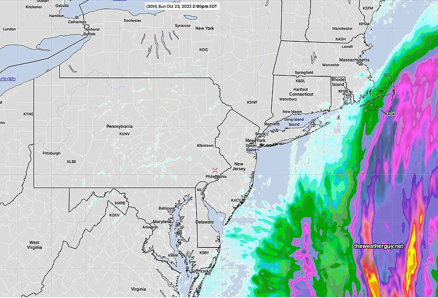
Update Sun 10/23 @ 10:23 AM — Optimism has its limits. This morning’s models are much more emphatic about some measurable rain moving in during the hours of 2-4 PM. Here’s the latest rainfall accumulation from the NAM-NEST—
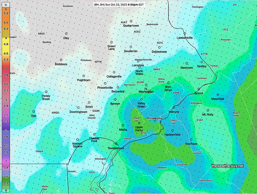
Update Sun 10/23 @ 8:17 AM — Clearly, my forecast from last night (based on the HIRESW, GFS and NAM-NEST (and the Phillies win), was clearly overly optimistic about the cloud cover and maybe the lack of rain until later today.
As mentioned previously, this rain forecast has been as difficult as many past winter snow storm forecasts.
The GFS has consistently maintained clouds but has kept the rain from moving in until after 5-7 PM. The HRRR supported this forecast, as did the ECMWF. However, the Canadian and the ensemble forecasts (GEFS NAEFS) were consistently forecasting light rain inching in about 2-5 PM.
Last night’s 06z models began are suggesting that the light rain may move in sooner than “late afternoon”, as early as 2PM with more rain tonight.
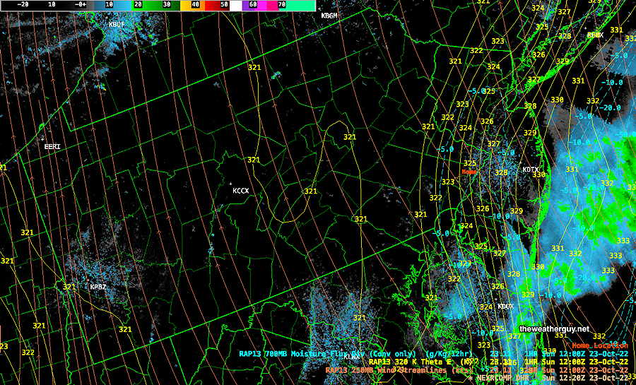
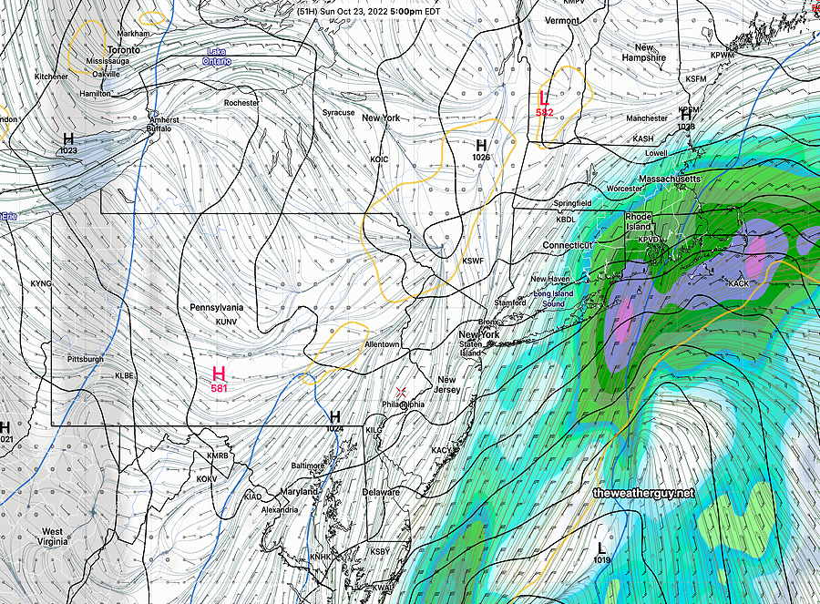
Here’s the current situation—
Here’s the current NBM—
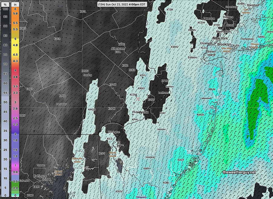
Little to no Rain for Sunday afternoon
Updated Sat 10/22 11:24 PM —
Saturday afternoon’s HRRR continues with the rain from the coastal storm not reaching into Philadelphia. A few light sprinkles possible. —
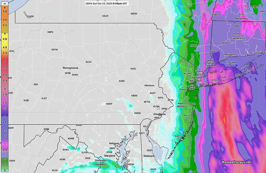
Little or no Rain for Sunday afternoon
Update Sat 10/22 @ 10:18 AM — The trend for the rain associated with the coastal storm to move east of us continues. This trend, first forecast by the GFS, is now supported by several models, including this morning’s HRRR and NAM-NEST.
Forecast for Phillies Game Sunday
Update Fri 10/21 @ 6:25 PM — Just as I posted this forecast, the latest GFS model came in. It keeps the rain to our east on Sunday, off the coast. This scenario reminds me of several storms last winter with the GFS having an eastern track and it turned out to be correct. So expect cloudy, breezy conditions but little to no rain for Sunday afternoon.
Previously Posted Fri 6:07 PM —
High pressure will give us another beautiful day on Saturday. It will move off the northeast Saturday night.
Impulses to our west are expected spawn a coastal low in the southeastern US coastline as a result of a sharp trough in the jet stream—
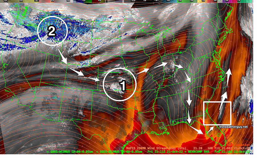
Sunday’s forecast depends upon a system that hasn’t formed yet and there are differences in the forecast track and speed of the expected secondary low.
Saturday
Sunny skies and warming temperatures.
High temperature 67.7º sd 0.8º NBM model (for Blue Bell, PA)
Sunday
Significant differences exist in the forecast track of the coastal low expected to form. For several model runs, the GFS has shown an eastern track for the storm with the rain missing us. Other models are not on-board with this. The latest NAM has rain moving in 2-4 PM. The latest ECMWF has the rain later in the afternoon or towards evening.
The ECMWF is trending towards the GFS with most of the precipitation off the coast—
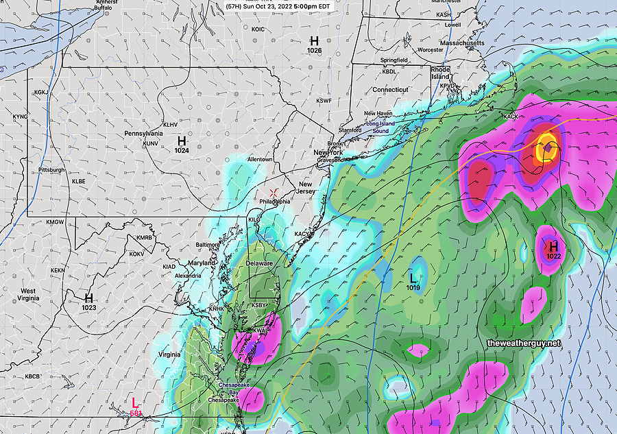
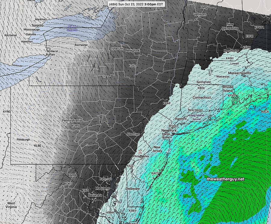
Cloudy and increasingly breezy/windy. Currently, the models are forecasting very light rain or drizzle to move in about 3-5 PM (NAM, NBM, HIRESW-FV3) or after 5 PM (ECMWF). The GFS has the rain missing us entirely Too early to be sure. Stay tuned.
