
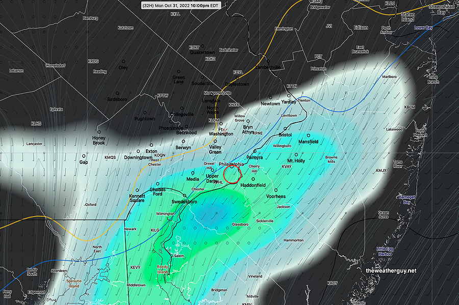
Update Sun 10/30 @ 8:19 PM — I guess I need to say that my previous forecast update below is tilted perhaps towards too much optimism. Here’s the latest Canadian High Resolution model—

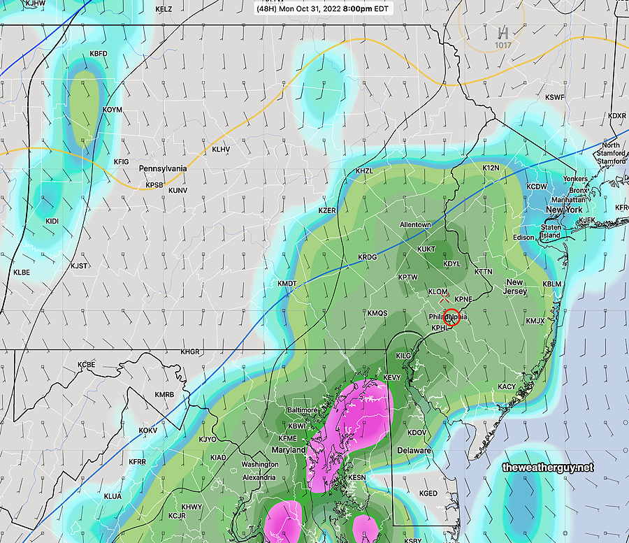
Update Sun 10/30 @ 8:04 PM — This afternoon’s models have clustered towards the following forecast for Monday evening— with the exception of the ECMWF, rain won’t arrive in Philadelphia until after 10 PM. Some suburbs to our west may see some very light showers as early as 7-8 PM. If the GFS is correct, some light rain moves into Philadelphia just as the Phillies are wrapping up (well, maybe the 7th inning) for a game 3 win. Somewhat heavier rain moves in later Monday night into Tuesday morning.
Comparing GFS 16.2 and new GFS 16.3 (today’s 18z model run)
GFS version 16.2—
New GFS v 16.3—

Update Sun 10/30 @ 9:27 AM — Another beautiful day expected for today, Sunday. But there’s a lingering question about the chances for rain Monday evening for the Trick-or-Treaters and the Phillies World Series Game.
The ECMWF has consistently shown rain between 7 and 11 PM for Monday evening. This forecast is supported, in part, by the Canadian High Resolution model and the German ICON model.
The ECMWF 3 hour accumulated rain forecast for Monday evening—
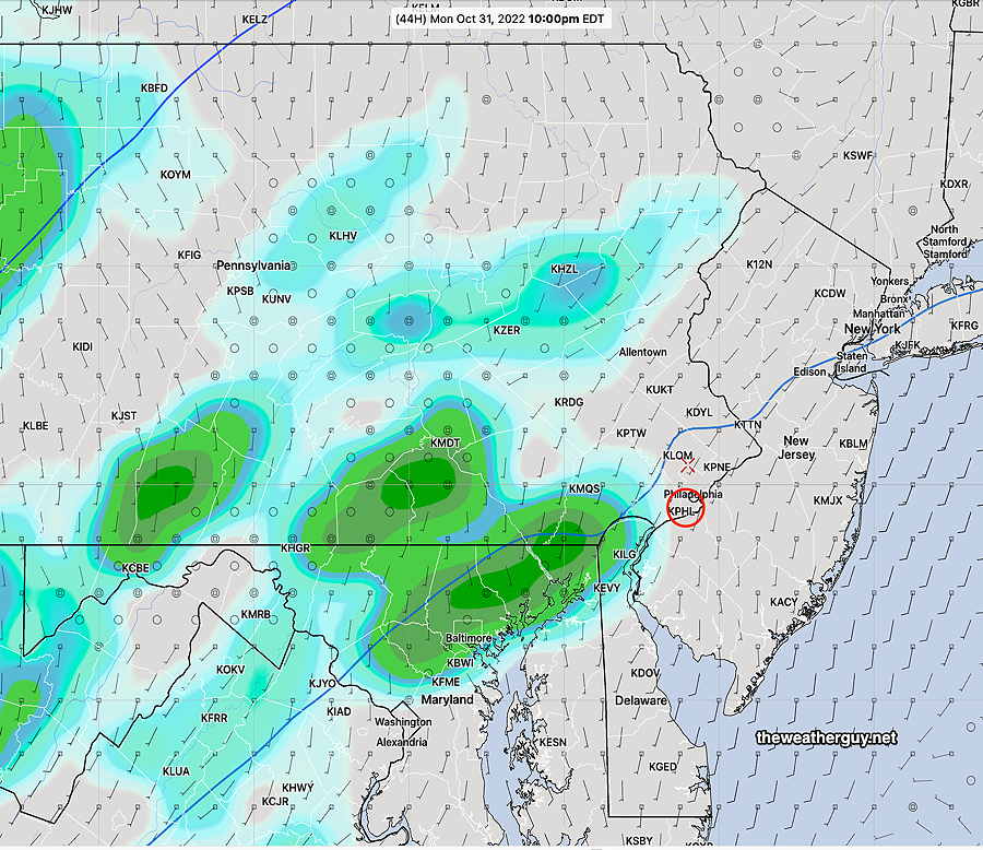
The US models have consistently shown rain moving in later, about 10-11 PM.
Here’s the latest GFS (new version 16.3)—
Unfortunately, I am now leaning towards some light rain during the Phillies game, possibly about 9-10PM. Rainfall may be as little as 0.03″ but the ECMWF shows 0.20″- 0.40″.
Updated Fri 10/28 10:27 PM — Saturday- Sunny. High 60°
Sunday mostly sunny. Some clouds may move in during Sunday afternoon in our southern and western suburbs. High 62°.
Most models have Halloween mostly dry. The exception is the ECMWF which has significant showers during the evening.
Previously Posted Fri 9:51 AM —
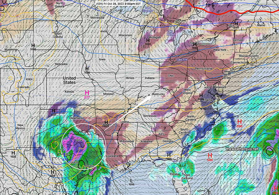
High pressure will slowly move off to the northeast while a storm shears off to our wesst late Sunday into Monday. (The storm brewing near Texas could be the Phillies?!)
Mostly sunny skies expected for Saturday and some clouds and sun are forecast for Sunday.
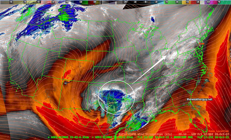
Current Water Vapor (jet stream level) —
Here’s the new GFS (v. 16.3) model forecast for Friday afternoon at 2 PM. It shows some mid-level cloudiness moving in from the west—
Let’s see how the new GFS does with the today’s cloud forecast.
Halloween evening is looking much better than it had previously.