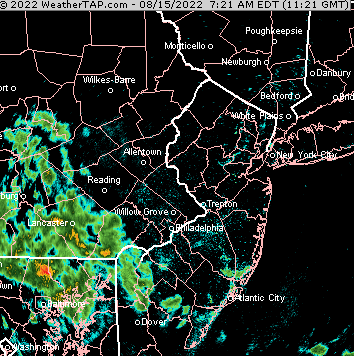
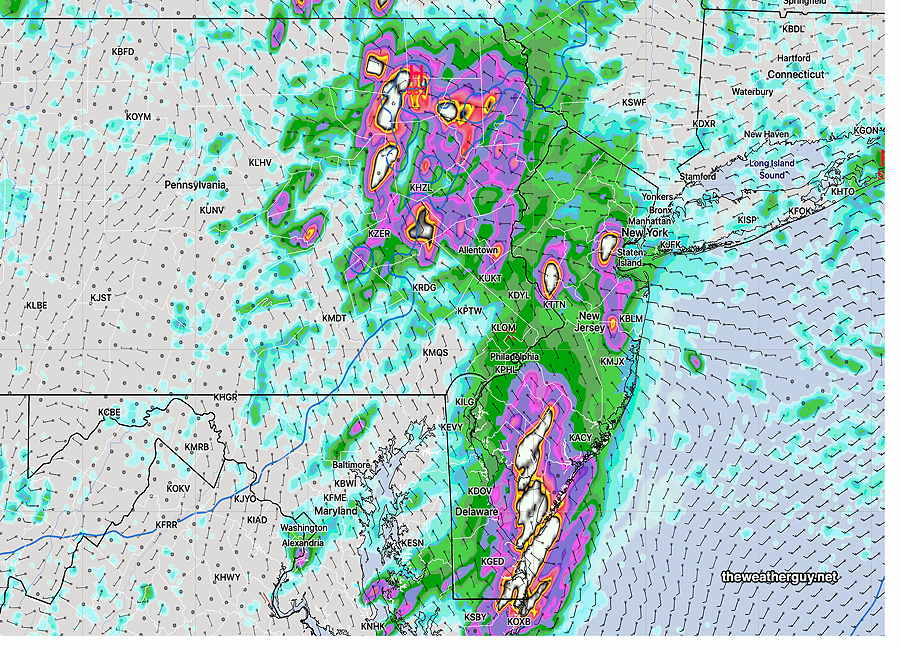
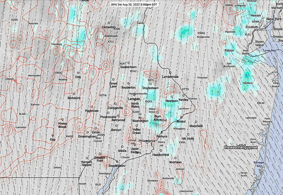
Update Sun 08/21 @ 8:41 PM — We had some break out showers Sunday afternoon that went through Citizen’s Bank Park. These had very limited coverage as they moved northward.
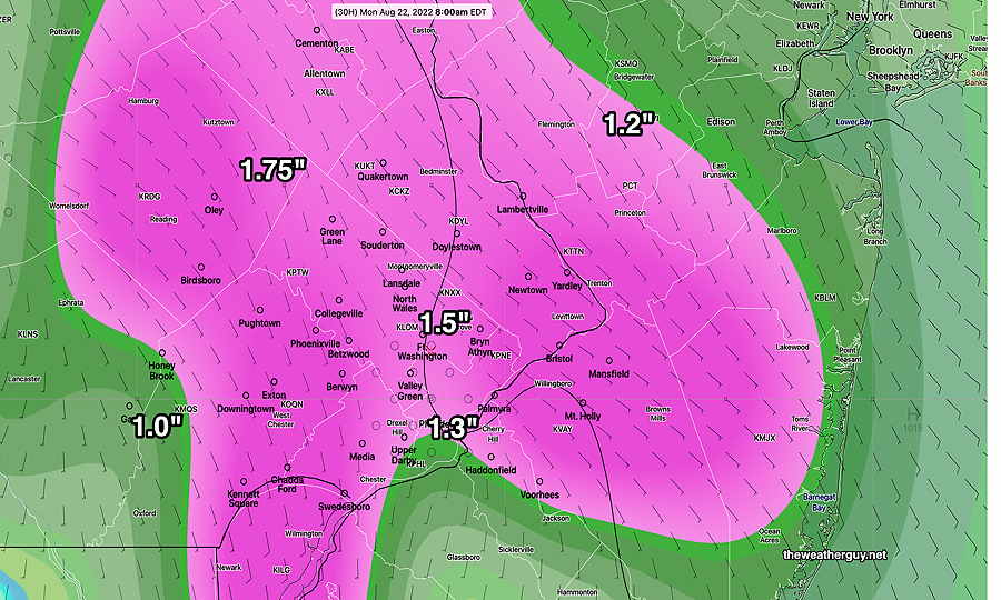
So…Are we really going to get about an inch of rain by Monday evening?
The latest RAP and GFS were in the 0.8- 1.0 inch range.
The NAM-NEST had the heavy rain splitting into two areas: far north of Philadelphia and far south of Philadelphia. The immediate PHL area was just getting about 0.4 inches—
Show More
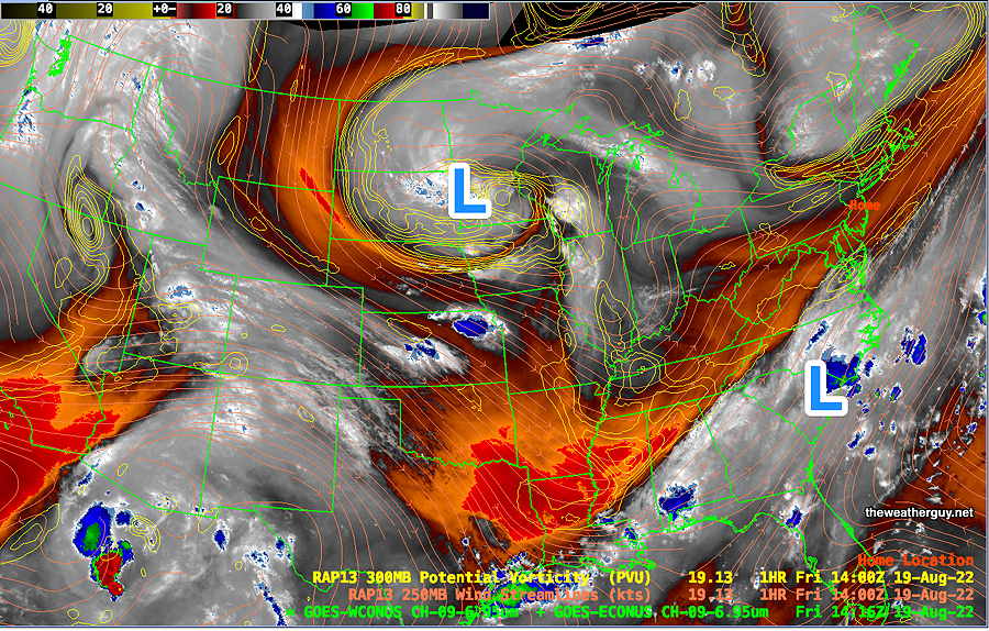
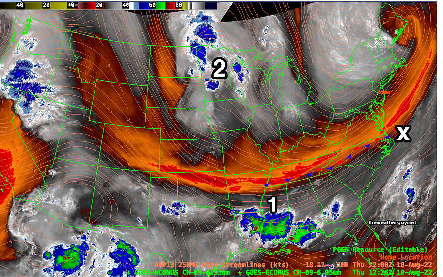
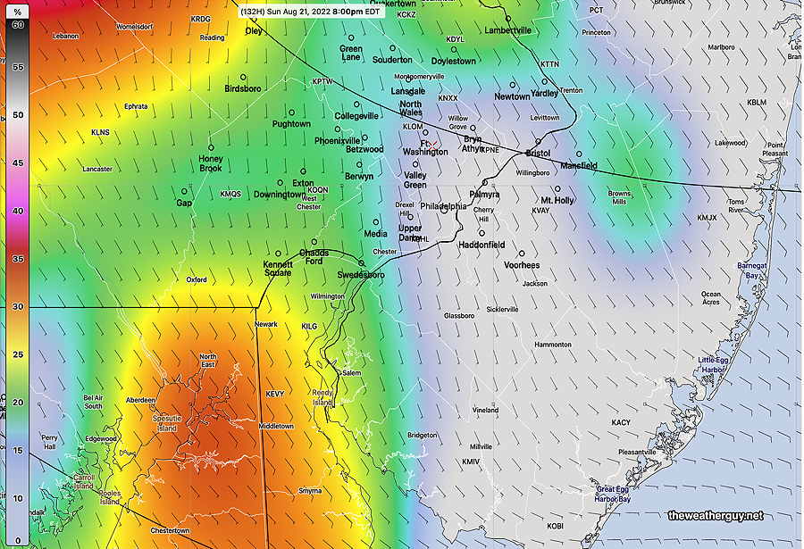
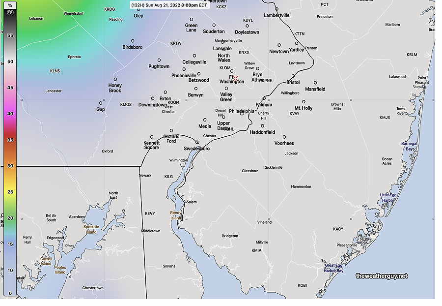
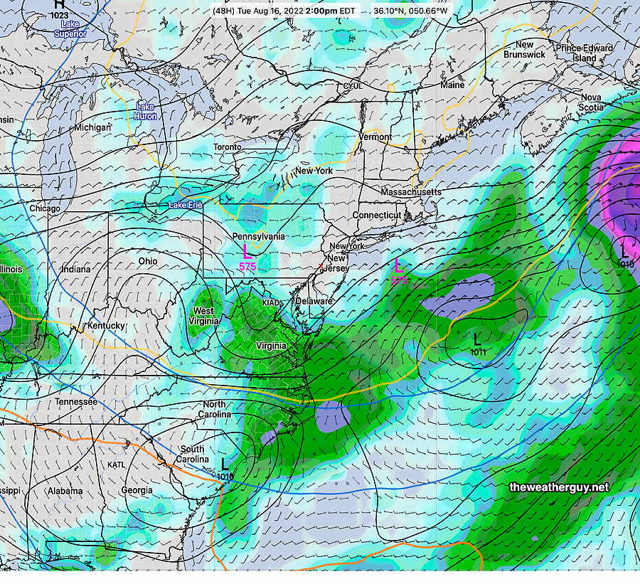
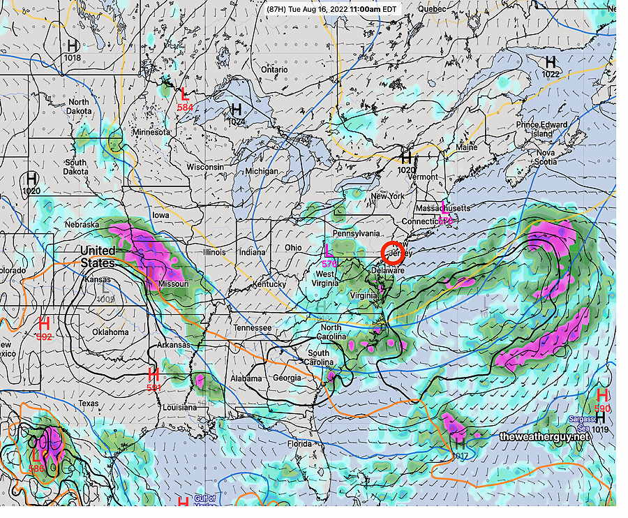
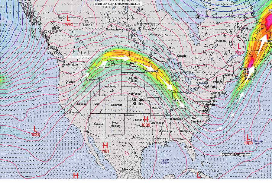
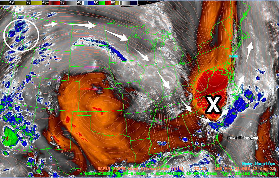
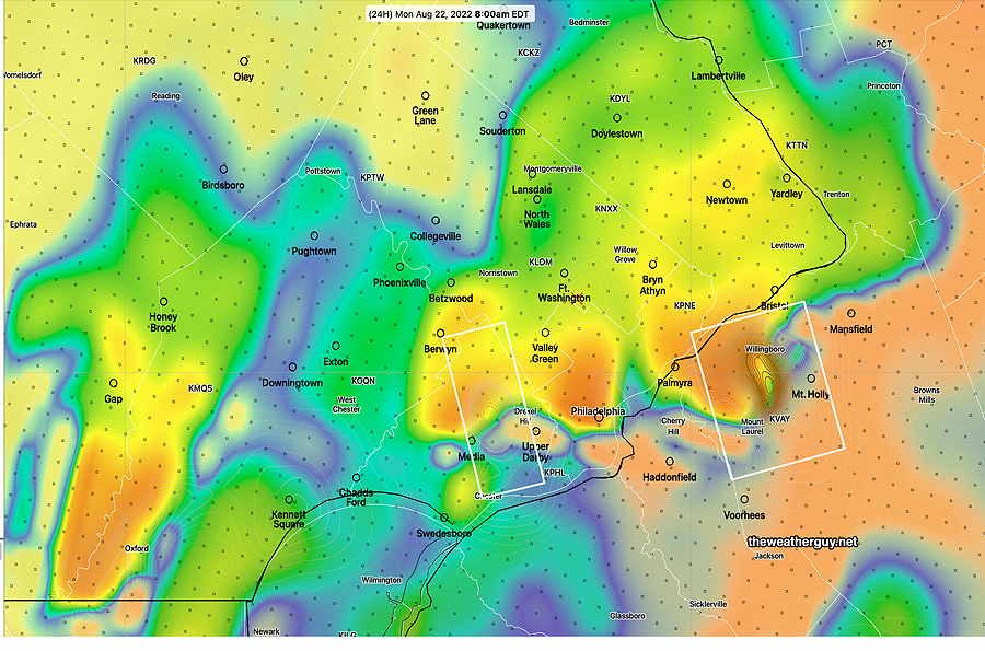
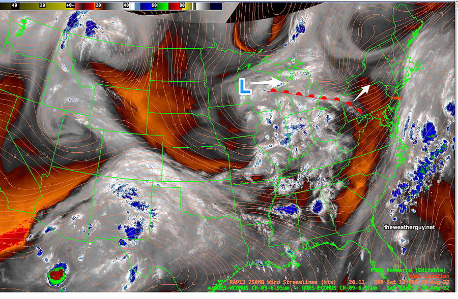
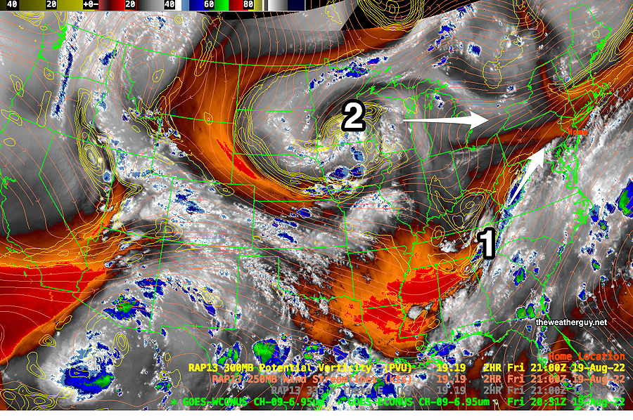
I’m going to stick with the current “about 0.75-1.25 inches” forecast. And I’m going to avoid my usual temptation to update my forecast later with tonight’s models…the rain event is too close and errors from model spin up time may move the forecast in the wrong direction. Models are very complex mathematical constructs that incorporate starting conditions and observations, in a process called “initialization”, to accurately simulate and blend (and not conflict) with its past simulation so that it maximally captures ‘reality’ at the start. Short range models can take 3 or more hours to spin-up. The new models being developed by NOAA have a built in ‘cold start’, followed by an intentional 6 hour spin up! Most current models do not ‘cold start’ but still have a spin up time to ‘mesh’ past runs into equilibrium with new observations. The 00z models from last night all have new upper air measurements that need to blend into equilibrium with the previous run. Thus, spin up time is needed. If heavy rain is falling in our area at the start of initialization, it can throw off the first few hours of the precipitation forecasts of the new model run until equilibrium is reached. Am I still skeptical about this amount of rain during a mini-drought? Yes. (Maybe the NAM-NEST shouldn’t be ignored?) Update Sun 08/21 @ 9:40 AM — The latest ECMWF accumulated rain forecast— The latest HRRR (12z) just available shows the rain (and thunderstorms) moving in after midnight tonight (Sunday). The HRRR is predicting the possibility of some strong thunderstorms about 8 AM Monday morning. Updated Sun 8/21 9:03 AM —I expect the sun to break out later this morning. Rain waits for the evening hours, most likely after 8 PM. The GFS and NBM still crank out rainfall amounts in the 0.7-1 inch range for much of the area. The HRRR has reduced the rainfall amount to less than 0.5 inches. Updated Sat 8/20 10:19 PM — Despite several of last night’s models having forecast widely scattered afternoon showers to our immediate north, none were to be found today except in far northeastern Pennsylvania. While writing this update, today’s 18z (2pm EDT) ECMWF became available. (There’s a 7 hour delay for free ECMWF data downloads.) Incredibly, this afternoon’s ECMWF was still forecasting the afternoon showers that never materialized. Sunday— Periods of sun and periods of clouds. High temp 87.5° sd 1.5°. A few scattered showers as early as 6 PM, but the main area of rain moves in about 10-11 PM. The models are cranking out anywhere from 0.75” to 1.25” of rain through Monday. Update Sat 08/20 @ 9:32 AM — Last night’s models shows a warm front moving up to our north and west later this afternoon. This feature didn’t show on earlier models, but does show on today’s water vapor image. The latest HRRR shows very little activity, but the ECMWF and NBM show light scattered showers possible. As for the onset time for showers on Sunday, there’s still a range of model forecasts, but most wait until evening. Previously Posted Fri 5:25 PM — The delightful and low humidity weather pattern we’ve been in this past week will change over the weekend. Increasingly warm and humid air will move in from the south. A disturbance to our southwest this evening (1) will bring some light showers before daybreak Saturday morning, mostly to far western suburbs. Following some very early morning cloudiness, especially far western suburbs, it will become partly to mostly sunny, very hot and more humid than recent days. High temperature 90.1º ± 1.5º NBM model Blue Bell, PA The disturbance from the west (2 above) will move in. Sunny early, becoming increasingly cloudy in the afternoon. There is still uncertainty with the timing of any light showers, but there’s a strong signal (especially from the ECMWF and NAEFS) that some scattered shower activity may begin in the early afternoon instead of the evening. The majority of the models (and the NBM) hold off the showers until after 7 PM. More humid, but clouds will hold down the high temperatures. High temperature 85.7º ± 2.4º NBM model Blue Bell, PA
Due to spin up time, the first few forecast hours of a new model run may be less accurate.
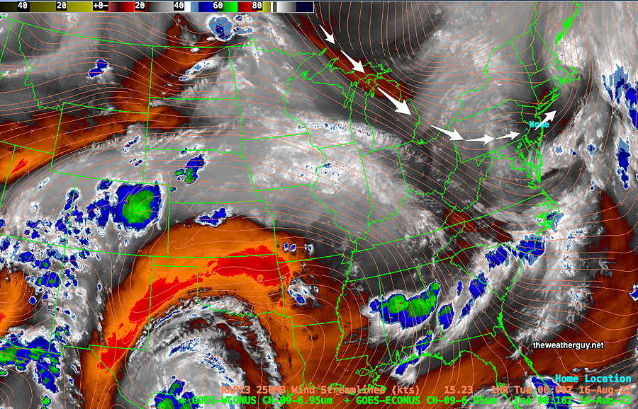
Weather pattern transition
Saturday
Sunday