WEEKEND WEATHER FORECAST

Sun 7:33 PM — Forecast Review — Overall a beautiful day and nicer weather than forecast. The clouds moved in later than had been predicted. The rain made it a bit further into Philadelphia than forecast this afternoon, but did diminish in intensity as forecast. Yesterday’s ICON and Canadian GEM did better than the GFS with forecasting the late arrival of the showers.
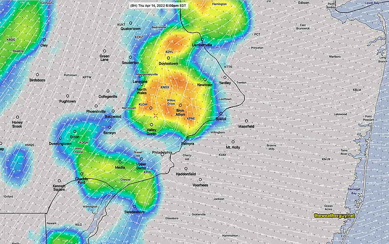
More showers expected later this evening and after midnight.

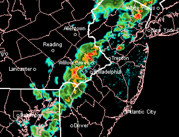
Update Sun @ 8:28 AM — Despite the early sunshine, clouds are expected to move in by late morning. Last night’s late models (06z) continue with the forecast of showers dissipating as they move into Philadelphia this afternoon.

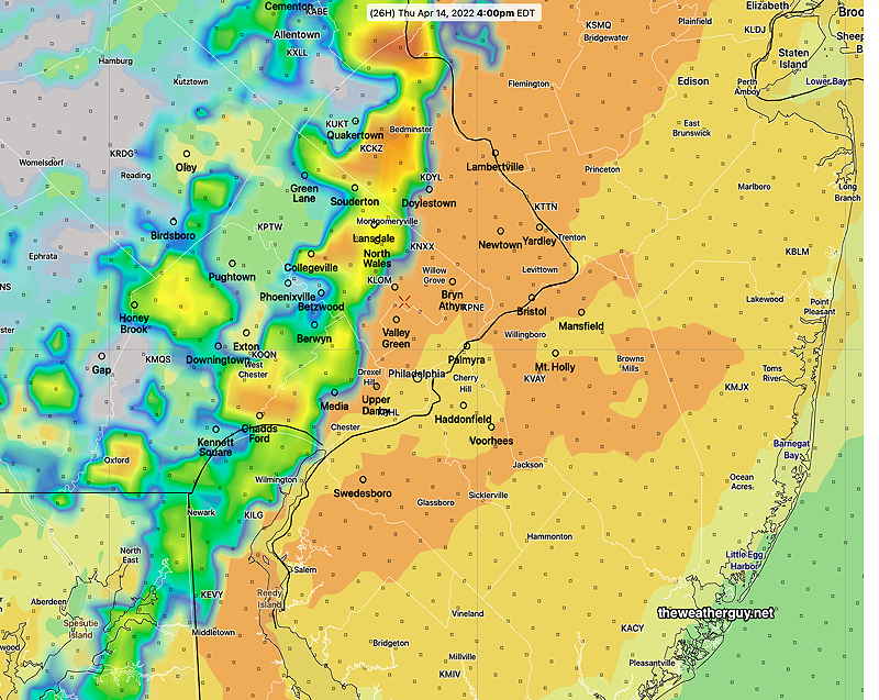
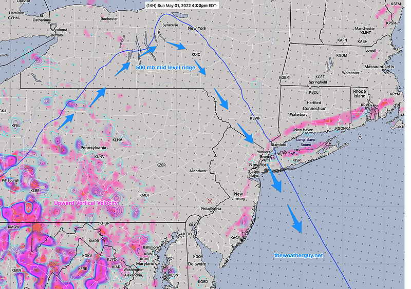
Most of the eastern area will be dry today (until this evening). Here’s last night’s high resolution HIRESW model forecast showing the eastern extent of the showers this afternoon at 4 PM; they aren’t expected to move much more eastward this afternoon—

HIRESW-ARW2P5 model forecast showing rain/radar and clouds (black) at 4 PM. This is the furthest eastward extent of the rain this afternoon. More showers after sunset throughout the area. (Click on image for a larger view.)

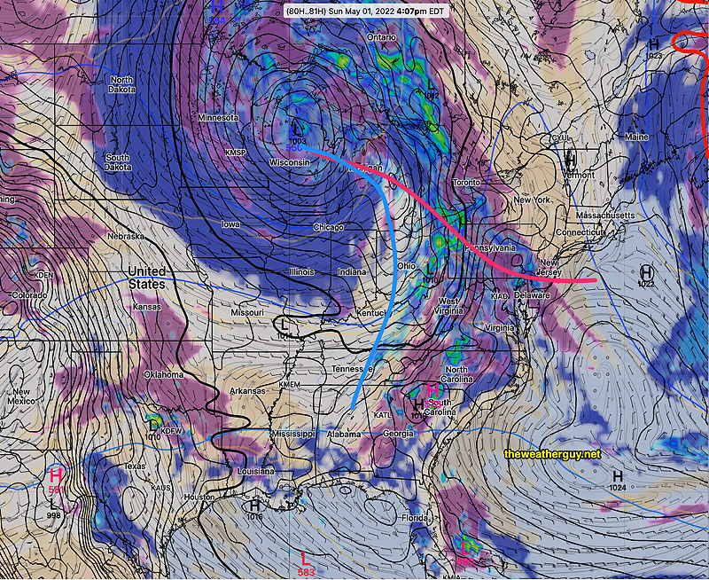
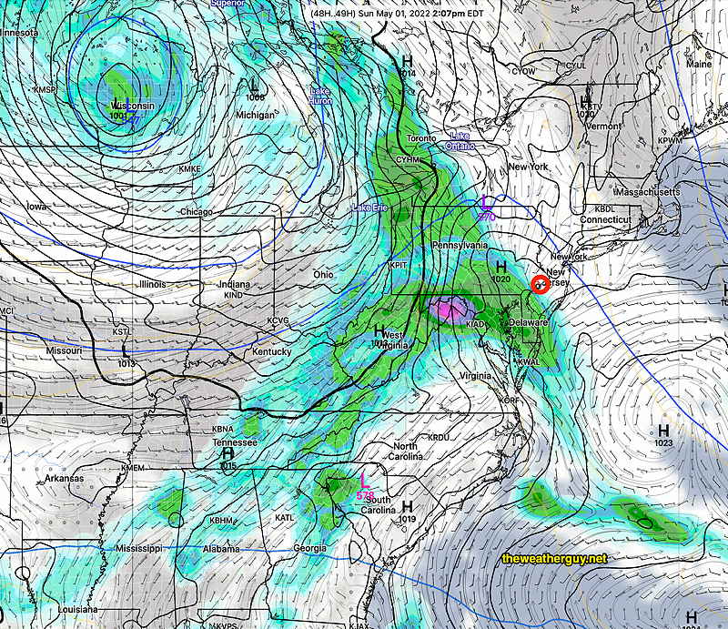
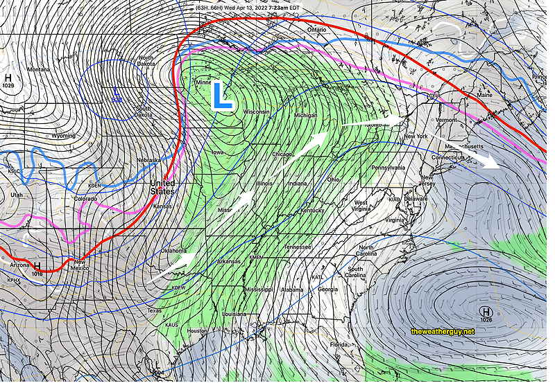
Why does the rain dissipate? The reason is a sharp mid level (500 mb) ridge that doesn’t allow vertical upward motion eastward—

HREF 06z showing the 500 mb (~18000 feet level) ridge (thin blue line) and upper wind flow (blue arrows). Due to this sharp upper ridge, the upward vertical motion (violet-pink= upward vertical velocity) is possible only on the western side of the ridge line.


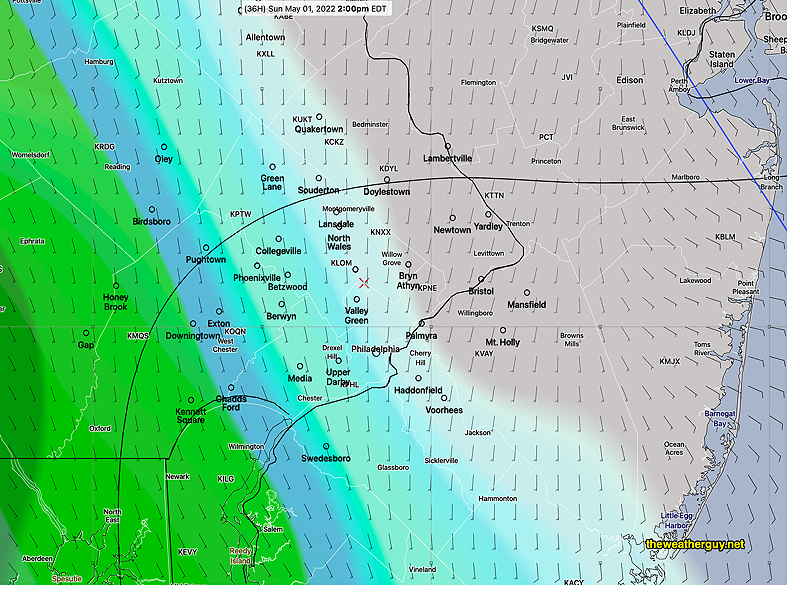
Update Sat @ 10:40 PM — Tonight’s models have the rain in far western suburbs Sunday afternoons, but struggling to move into the city during the afternoon as it hits a sharp mid-level upper air ridge. Much of the eastern area remains dry during the day. Still a lower confidence forecast.


Update Sat @ 9:15 AM — There’s still some uncertainty about the onset of showers Sunday. The GFS, GEFS, SREF and ECMWF have showers moving in from the west by 12-2 PM. The Canadian RGEM and ICON have a later onset, towards evening. I’m leaning towards the GFS group—

Saturday’s 06z GEFS shows showers moving in by 12-2 PM (Click on image for a larger view.)

Update Fri 10:13 PM— Tonight’s models suggest an even earlier start with the showers on Sunday, possibly late morning to noontime. The NBM still holds the showers off until evening. So forecast uncertainty remains for Sunday.


The forecast for the weekend has clarified since posting yesterday’s outlook. High pressure will be with us for Saturday. The timing of an approaching warm front on Sunday will occur earlier than many models had been forecasting— the warm front will bring some showers as early as Sunday afternoon. (Most models have joined the GFS and ICON with the earlier showers.)

Saturday

High pressure will influence our weather on Saturday. It will still be somewhat windy mid-day. Highs 65º ± 1.0º NBM model, Blue Bell

NBM wind /wind gust meteogram for Blue Bell, PA- Friday through Sunday (Click on image for a larger view.)

Sunday

High pressure moves off as a warm front associated with a deep low in the Great Lakes region approaches. Today’s models have joined yesterday’s GFS and ICON models—w showers move as early as 2- 4 PM, especially west and southwest of the immediate PHL area. Highs 66.3º ± 3.0º NBM, Blue Bell (large spread due to uncertainty in cloud cover.)

Thursdays’s 12z GFS shows clouds and showers moving in about 4 PM Sunday as a warm front approaches. (Click on image for a larger view.)
Friday’s 18z GFS shows rain on our doorstep as early as 1- 2 PM (Click on image for a larger view.)


WEEKEND WEATHER OUTLOOK

High pressure will be with us for most of the weekend. An approaching warm front will bring some showers late Sunday afternoon or Sunday evening.

Saturday

High pressure will influence our weather on Saturday. It will still be somewhat windy mid-day. Highs near 65º.

NBM wind /wind gust meteogram for Blue Bell, PA- Friday through Sunday (Click on image for a larger view.)

Sunday

High pressure moves off as a warm front associated with a deep low in the Great Lakes region approaches. Today’s GFS and ICON models have showers moving in about 4 PM, but today’s ECMWF, SREF and Canadian RGEM hold off the showers until Sunday evening. So there’s uncertainty with the speed of this system. Highs 69 to 70º

Today’s 12z GFS shows clouds and showers moving in about 4 PM Sunday as a warm front approaches. (Click on image for a larger view.)


THIS WEEK’S WEATHER

Weekend Weather & This Week’s Weather returns April 30th.

Thu 5:30 PM Forecast Review— We had the wind gusts and some areas had strong storms. The HRRR did pretty good forecasting the stronger storms north of Philadelphia.
NexRad radar loop about 5 PM.  Courtesy of https://weathertap.com


Update Thu @ 10:15 AM — Some changes in the forecast with the latest HRRR just available. Timing of the frontal passage today is about 5 PM ± 1.5 hours in the immediate Philadelphia area with thunderstorms, then passing into NJ.

Today’s 12z HRRR simulated radar forecast for 5 PM. Shear vectors (long white arrows) are perpendicular to storm motion vectors (short white arrows), reducing chances of severe storms. Nonetheless, strong pressure changes and other air motion will result in high winds with the front itself. (Please note: model forecasts of simulated radar should not be taken literally. The model location of a thunderstorm is a model simulation for a moment in time, not reality.) (Click on image for a larger view.)
HRRR wind gust forecast for 5 PM today. (Click on image for a larger view.)

A rapid change in pressure with the frontal passage will result in high wind gusts, as the winds shift from southwest to northwest. Depending on the model, gusts from 30-50 mph possible.

Previous model runs showed shear and helicity to be low with severe thunderstorms unlikely. Despite this, the HRRR is showing an elevated hail parameter with the storms with strong vertical motion being present.


Show More

GEFS forecast for Wednesday morning. We’ll be under the influence of an upper ridge and a warm southwesterly flow. Temperatures will move into the 70’s and perhaps approach 80 Thursday, according to the NBM. The deep low in Minnesota will move into Canada and the cold front will dissipate as the low moves more northward. (Click on image for a larger view.)

We’ll have temperatures in the 70’s by mid-week and possibly higher. The cold front that will be causing severe weather in the middle of the country is expected to weaken considerably as it approaches us Friday.

No major storms expected this week for our area. Some showers Monday night will move out by Tuesday.