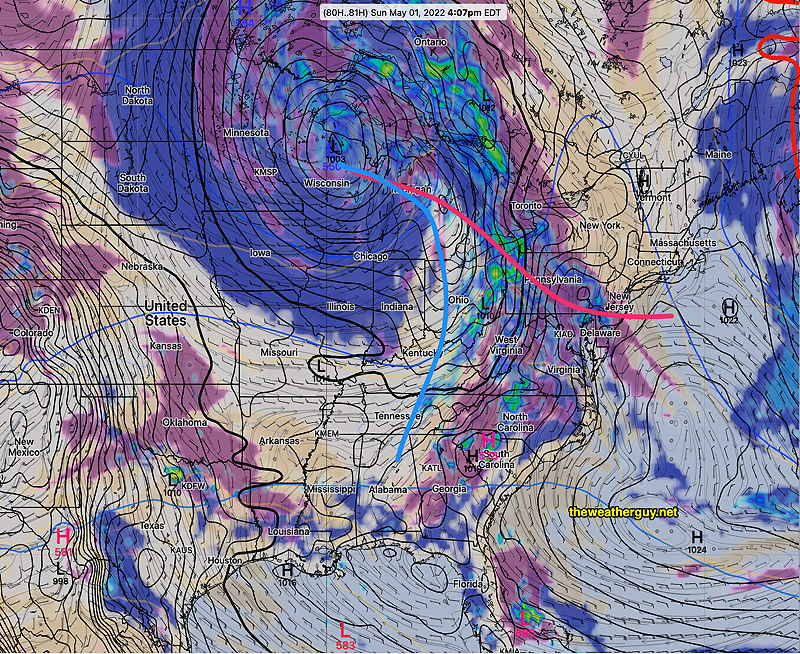
High pressure will be with us for most of the weekend. An approaching warm front will bring some showers late Sunday afternoon or Sunday evening.
Saturday
High pressure will influence our weather on Saturday. It will still be somewhat windy mid-day. Highs near 65º.
Sunday
High pressure moves off as a warm front associated with a deep low in the Great Lakes region approaches. Today’s GFS and ICON models have showers moving in about 4 PM, but today’s ECMWF, SREF and Canadian RGEM hold off the showers until Sunday evening. So there’s uncertainty with the speed of this system. Highs 69 to 70º