WEATHER OUTLOOK

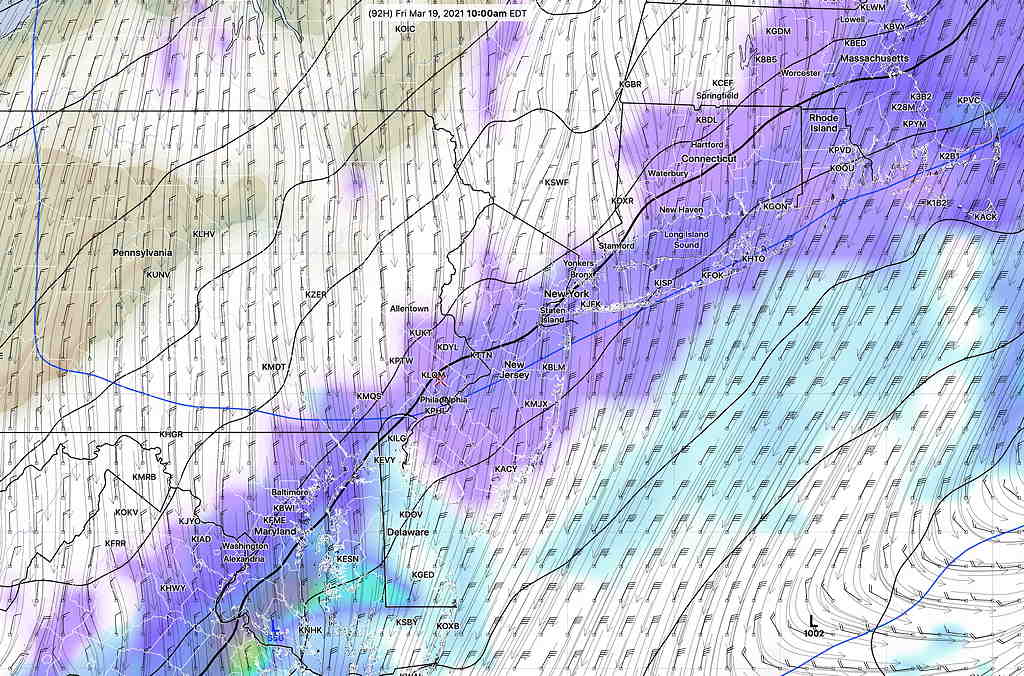
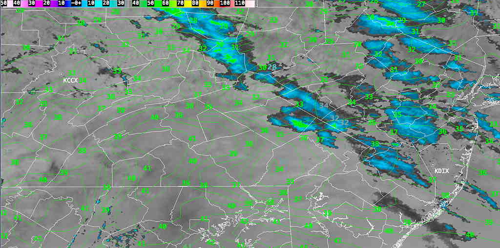
Forecast Updated Tue 11:00 AM — For many areas, the snow never made it to the ground, although the model forecast was pretty good Here’s the current situation at 11 AM—

Current Radar and RAP temperatures  (Click on image for a larger view.)


from last night…

With current average high temperatures for this week running in the low to mid 50’s, today’s cold temperatures made it difficult to remember that [astronomical] Spring starts in another week.

This week, we’ll have a few more reminders that we’re still in winter.

Tomorrow, Tuesday, may have a brief period of light snow showers/flurries in the morning, especially northwest of the city. Indeed, the model blend shows a greater than 50% chance of light snow showers far northwest of the city before a change to light rain.

This afternoon’s RAP model shows very light snow showers moving through late morning.  No accumulation expected.  (The air has been so dry, it’s unclear how much of this may evaporate before reaching the ground.)  

Rapid Refresh Model (RAP) precip type forecast for 11 AM Tuesday  (Violet is snow) (Click on image for a larger view.)


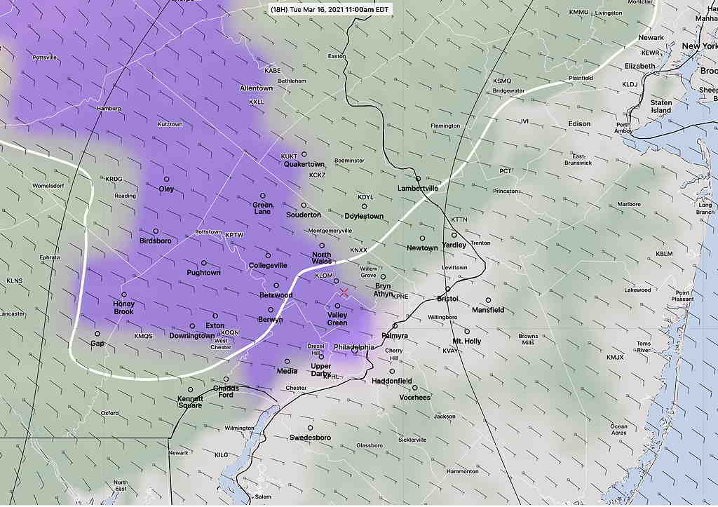
Tonight’s 00z HRRR model, just available, has a similar forecast.

The total amount of precipitation on Tuesday will be very light, possibly not enough to reduce the wildfire danger.

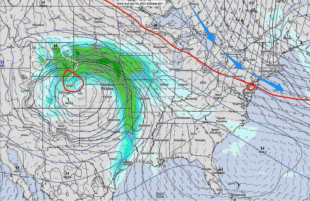
A more significant rain maker is expected on Thursday, as the low pressure system that caused the blizzard in Colorado moves eastward with possible secondary low pressure development near the coast.

The GFS model suggests enough secondary development and cold air to allow a changeover to light snow showers early Friday morning. Right now, no accumulation expected.

GFS v 16 Friday 10 AM forecast  (White is cloud cover, violet is snow)  (Click on image for a larger view.)

WEEKEND WEATHER FORECAST

Saturday morning update:

Saturday’s NBM shows even very windy  conditions for Sunday than forecast last night. (This morning’s RAP and HRRR forecast even higher wind gusts than the NBM.)  Understanding Wind barbs    (Click on image for a larger view.)


from Friday night

A weak cold front moved through Friday morning. Another front will move through before daybreak Saturday.

We’ll be in a northwesterly upper air and surface flow—

Short Range Ensemble Forecast (SREF) model showing northwesterly upper flow on Sunday at 2 PM (Click on image for a larger view.)

We’ll have sunny skies on Saturday and high temperatures 48.3º sd 2.3º (Model Blend-Blue Bell)

Sunday will continue with mostly sunny skies, but an upper air disturbance moving through may bring some partial cloudiness for part of the afternoon. The same disturbance will likely cause it to be windy. High temp 53.1º sd 3.2º (Model Blend-Blue Bell)

Winds for Saturday and Sunday:

NBM (National Blend of Models)  wind forecast Saturday and Sunday Blue Bell. Wind barbs show westerly winds changing to northwesterly with higher gusts on Sunday .  (Click on image for a larger view.)

Outlook: While it’s been mild and dry, this weekend’s change to more ‘normal’ temperatures will be a prelude for wet weather next week and colder weather next weekend.