
Outlook Updated Tue 5:58 PM — Current models do have the cold front pushing precipitation out of our area for Saturday. (There had been the possibility that the front would hang up right over us, keeping things cloudy and wet.) Sunday also looks good right now. Cooler, more seasonable temperatures for both Saturday and Sunday.
from Sunday….
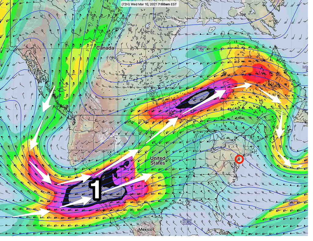
As mentioned in my previous post, a transition in our area from a jet stream trough to a jet stream ridge (warmer weather) will occur during this week.
This ridge will allow temperatures to reach into at least the 60s (and possibly near 70º) for the Philadelphia area by Wednesday.
The current Model Blend forecast high temps (Blue Bell -Wings Field, add about 1 to 2º for Philadelphia.)
Wednesday — 62º
Thursday — 66º
Friday — 66º
The uncertainty with these temps is high. The Model Blend standard deviation is 3º-5º. In these situations, the NBM can be on the low side.
For Next Weekend: Also uncertain is the eventual development and track of a deep low pressure system in center of the country from confluence of the southern and northern jet streams. We may enter a prolonged period of rain that goes into the weekend, OR we may have a cold front push far enough south to suppress the moisture to our south and give us a dry, cooler, and windy weekend.